Saint-Romain-sous-Gourdon
| Saint-Romain-sous-Gourdon | |
|---|---|
 | |
 Saint-Romain-sous-Gourdon | |
|
Location within Bourgogne-Franche-Comté region  Saint-Romain-sous-Gourdon | |
| Coordinates: 46°37′22″N 4°24′16″E / 46.6228°N 4.4044°ECoordinates: 46°37′22″N 4°24′16″E / 46.6228°N 4.4044°E | |
| Country | France |
| Region | Bourgogne-Franche-Comté |
| Department | Saône-et-Loire |
| Arrondissement | Chalon-sur-Saône |
| Canton | Mont-Saint-Vincent |
| Area1 | 18.78 km2 (7.25 sq mi) |
| Population (2006)2 | 514 |
| • Density | 27/km2 (71/sq mi) |
| Time zone | CET (UTC+1) |
| • Summer (DST) | CEST (UTC+2) |
| INSEE/Postal code | 71477 / 71230 |
| Elevation | 301–467 m (988–1,532 ft) |
|
1 French Land Register data, which excludes lakes, ponds, glaciers > 1 km² (0.386 sq mi or 247 acres) and river estuaries. 2 Population without double counting: residents of multiple communes (e.g., students and military personnel) only counted once. | |
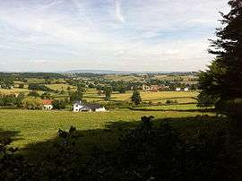
Saint-Romain-sous-Gourdon is a commune in the Saône-et-Loire department in the region of Bourgogne in eastern France.
It is 45km south west of Chalon-sur-Saône, 25km due south of Le Creusot and 6km south east of Montceau-les-Mines.
See also
References
| Wikimedia Commons has media related to Saint-Romain-sous-Gourdon. |
This article is issued from Wikipedia - version of the 10/28/2016. The text is available under the Creative Commons Attribution/Share Alike but additional terms may apply for the media files.