Saint-Hostien
| Saint-Hostien | |
|---|---|
|
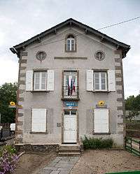
The town hall in Saint-Hostien | |
 Saint-Hostien | |
|
Location within Auvergne-Rhône-Alpes region  Saint-Hostien | |
| Coordinates: 45°04′23″N 4°02′54″E / 45.0731°N 4.0483°ECoordinates: 45°04′23″N 4°02′54″E / 45.0731°N 4.0483°E | |
| Country | France |
| Region | Auvergne-Rhône-Alpes |
| Department | Haute-Loire |
| Arrondissement | Le Puy-en-Velay |
| Canton | Saint-Julien-Chapteuil |
| Government | |
| • Mayor (2008–2014) | Gustave Alirol (Occitan Party) |
| Area1 | 13.49 km2 (5.21 sq mi) |
| Population (1999)2 | 578 |
| • Density | 43/km2 (110/sq mi) |
| Time zone | CET (UTC+1) |
| • Summer (DST) | CEST (UTC+2) |
| INSEE/Postal code | 43194 / 43260 |
| Elevation |
747–1,204 m (2,451–3,950 ft) (avg. 830 m or 2,720 ft) |
|
1 French Land Register data, which excludes lakes, ponds, glaciers > 1 km² (0.386 sq mi or 247 acres) and river estuaries. 2 Population without double counting: residents of multiple communes (e.g., students and military personnel) only counted once. | |
Saint-Hostien is a commune in the Haute-Loire department in south-central France.
See also
References
| Wikimedia Commons has media related to Saint-Hostien. |
This article is issued from Wikipedia - version of the 2/11/2016. The text is available under the Creative Commons Attribution/Share Alike but additional terms may apply for the media files.