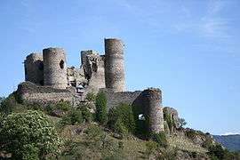
Domeyrat
| Domeyrat | ||
|---|---|---|
|
| ||
| ||
 Domeyrat | ||
|
Location within Auvergne-Rhône-Alpes region  Domeyrat | ||
| Coordinates: 45°15′00″N 3°30′09″E / 45.25°N 3.5025°ECoordinates: 45°15′00″N 3°30′09″E / 45.25°N 3.5025°E | ||
| Country | France | |
| Region | Auvergne-Rhône-Alpes | |
| Department | Haute-Loire | |
| Arrondissement | Brioude | |
| Canton | Paulhaguet | |
| Government | ||
| • Mayor (2008–) | Christian Poulet | |
| Area1 | 9.57 km2 (3.69 sq mi) | |
| Population (2005)2 | 162 | |
| • Density | 17/km2 (44/sq mi) | |
| Time zone | CET (UTC+1) | |
| • Summer (DST) | CEST (UTC+2) | |
| INSEE/Postal code | 43086 / 43230 | |
| Elevation |
472–752 m (1,549–2,467 ft) (avg. 499 m or 1,637 ft) | |
|
1 French Land Register data, which excludes lakes, ponds, glaciers > 1 km² (0.386 sq mi or 247 acres) and river estuaries. 2 Population without double counting: residents of multiple communes (e.g., students and military personnel) only counted once. | ||

Domeyrat is a commune in the Haute-Loire department in south-central France.
Geography
The Senouire flows north-northwestward through the commune and crosses the village.
See also
| Wikimedia Commons has media related to Domeyrat. |
This article is issued from Wikipedia - version of the 2/11/2015. The text is available under the Creative Commons Attribution/Share Alike but additional terms may apply for the media files.