Saint-Palais-sur-Mer
| Saint-Palais-sur-Mer | ||
|---|---|---|
|
Place du Rhâ | ||
| ||
 Saint-Palais-sur-Mer | ||
|
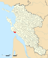
Location within Nouvelle-Aquitaine region  Saint-Palais-sur-Mer | ||
| Coordinates: 45°38′38″N 1°05′13″W / 45.6439°N 1.0869°WCoordinates: 45°38′38″N 1°05′13″W / 45.6439°N 1.0869°W | ||
| Country | France | |
| Region | Nouvelle-Aquitaine | |
| Department | Charente-Maritime | |
| Arrondissement | Rochefort | |
| Canton | La Tremblade | |
| Intercommunality | Royan Atlantique | |
| Government | ||
| • Mayor (2008–2014) | Claude Baudin | |
| Area1 | 15.69 km2 (6.06 sq mi) | |
| Population (2008)2 | 3,890 | |
| • Density | 250/km2 (640/sq mi) | |
| Time zone | CET (UTC+1) | |
| • Summer (DST) | CEST (UTC+2) | |
| INSEE/Postal code | 17380 / 17420 | |
| Elevation |
0–50 m (0–164 ft) (avg. 15 m or 49 ft) | |
|
1 French Land Register data, which excludes lakes, ponds, glaciers > 1 km² (0.386 sq mi or 247 acres) and river estuaries. 2 Population without double counting: residents of multiple communes (e.g., students and military personnel) only counted once. | ||

.svg.png)
Saint-Palais-sur-Mer is a commune in the Charente-Maritime department in southwestern France.
Population
| Historical population | ||
|---|---|---|
| Year | Pop. | ±% |
| 1793 | 748 | — |
| 1800 | 720 | −3.7% |
| 1806 | 741 | +2.9% |
| 1821 | 729 | −1.6% |
| 1831 | 760 | +4.3% |
| 1836 | 762 | +0.3% |
| 1841 | 781 | +2.5% |
| 1846 | 807 | +3.3% |
| 1851 | 802 | −0.6% |
| 1856 | 810 | +1.0% |
| 1861 | 815 | +0.6% |
| 1866 | 763 | −6.4% |
| 1872 | 798 | +4.6% |
| 1876 | 756 | −5.3% |
| 1881 | 791 | +4.6% |
| 1886 | 824 | +4.2% |
| 1891 | 797 | −3.3% |
| 1896 | 820 | +2.9% |
| 1901 | 895 | +9.1% |
| 1906 | 930 | +3.9% |
| 1911 | 1,044 | +12.3% |
| 1921 | 1,082 | +3.6% |
| 1926 | 1,164 | +7.6% |
| 1931 | 1,207 | +3.7% |
| 1936 | 1,262 | +4.6% |
| 1946 | 2,479 | +96.4% |
| 1954 | 2,252 | −9.2% |
| 1962 | 2,192 | −2.7% |
| 1968 | 2,209 | +0.8% |
| 1975 | 2,127 | −3.7% |
| 1982 | 2,370 | +11.4% |
| 1990 | 2,736 | +15.4% |
| 1999 | 3,343 | +22.2% |
| 2008 | 3,890 | +16.4% |
Gallery


 Saint-Palais-sur-Mer in Charente-Maritime
.png)
See also
References
| Wikimedia Commons has media related to Saint-Palais-sur-Mer. |
This article is issued from Wikipedia - version of the 6/25/2015. The text is available under the Creative Commons Attribution/Share Alike but additional terms may apply for the media files.