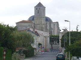
Saint-Romain-de-Benet
| Saint-Romain-de-Benet | |
|---|---|
 | |
 Saint-Romain-de-Benet | |
|
Location within Nouvelle-Aquitaine region  Saint-Romain-de-Benet | |
| Coordinates: 45°41′33″N 0°50′46″W / 45.6925°N 0.8461°WCoordinates: 45°41′33″N 0°50′46″W / 45.6925°N 0.8461°W | |
| Country | France |
| Region | Nouvelle-Aquitaine |
| Department | Charente-Maritime |
| Arrondissement | Saintes |
| Canton | Saujon |
| Intercommunality | Seudre-et-Arnoult |
| Government | |
| • Mayor (2008–2014) | Serge Roy |
| Area1 | 32.78 km2 (12.66 sq mi) |
| Population (2008)2 | 1,622 |
| • Density | 49/km2 (130/sq mi) |
| Time zone | CET (UTC+1) |
| • Summer (DST) | CEST (UTC+2) |
| INSEE/Postal code | 17393 / 17600 |
| Elevation | 3–47 m (9.8–154.2 ft) |
|
1 French Land Register data, which excludes lakes, ponds, glaciers > 1 km² (0.386 sq mi or 247 acres) and river estuaries. 2 Population without double counting: residents of multiple communes (e.g., students and military personnel) only counted once. | |
Saint-Romain-de-Benet is a commune in the Charente-Maritime department in southwestern France.
Population
| Historical population | ||
|---|---|---|
| Year | Pop. | ±% |
| 1793 | 1,295 | — |
| 1800 | 1,276 | −1.5% |
| 1806 | 1,176 | −7.8% |
| 1821 | 1,497 | +27.3% |
| 1831 | 1,584 | +5.8% |
| 1836 | 1,563 | −1.3% |
| 1841 | 1,582 | +1.2% |
| 1846 | 1,653 | +4.5% |
| 1851 | 1,649 | −0.2% |
| 1856 | 1,652 | +0.2% |
| 1861 | 1,716 | +3.9% |
| 1866 | 1,669 | −2.7% |
| 1872 | 1,636 | −2.0% |
| 1876 | 1,679 | +2.6% |
| 1881 | 1,624 | −3.3% |
| 1886 | 1,488 | −8.4% |
| 1891 | 1,416 | −4.8% |
| 1896 | 1,361 | −3.9% |
| 1901 | 1,346 | −1.1% |
| 1906 | 1,330 | −1.2% |
| 1911 | 1,379 | +3.7% |
| 1921 | 1,225 | −11.2% |
| 1926 | 1,192 | −2.7% |
| 1931 | 1,157 | −2.9% |
| 1936 | 1,134 | −2.0% |
| 1946 | 1,040 | −8.3% |
| 1954 | 1,178 | +13.3% |
| 1962 | 1,164 | −1.2% |
| 1968 | 1,130 | −2.9% |
| 1975 | 1,064 | −5.8% |
| 1982 | 1,157 | +8.7% |
| 1990 | 1,244 | +7.5% |
| 1999 | 1,374 | +10.5% |
| 2008 | 1,622 | +18.0% |
See also
References
| Wikimedia Commons has media related to Saint-Romain-de-Benet. |
This article is issued from Wikipedia - version of the 3/11/2013. The text is available under the Creative Commons Attribution/Share Alike but additional terms may apply for the media files.