Vervant, Charente-Maritime
| Vervant | |
|---|---|
|
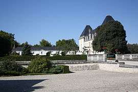
Chateau | |
 Vervant | |
|
Location within Nouvelle-Aquitaine region  Vervant | |
| Coordinates: 45°58′28″N 0°27′11″W / 45.9744°N 0.4531°WCoordinates: 45°58′28″N 0°27′11″W / 45.9744°N 0.4531°W | |
| Country | France |
| Region | Nouvelle-Aquitaine |
| Department | Charente-Maritime |
| Arrondissement | Saint-Jean-d'Angély |
| Canton | Saint-Jean-d'Angély |
| Intercommunality | Canton de Saint-Jean-d'Angély |
| Government | |
| • Mayor (2008–2014) | Pierre-Yves André |
| Area1 | 5.62 km2 (2.17 sq mi) |
| Population (2008)2 | 206 |
| • Density | 37/km2 (95/sq mi) |
| Time zone | CET (UTC+1) |
| • Summer (DST) | CEST (UTC+2) |
| INSEE/Postal code | 17467 / 17400 |
| Elevation |
18–71 m (59–233 ft) (avg. 25 m or 82 ft) |
|
1 French Land Register data, which excludes lakes, ponds, glaciers > 1 km² (0.386 sq mi or 247 acres) and river estuaries. 2 Population without double counting: residents of multiple communes (e.g., students and military personnel) only counted once. | |
Vervant is a commune in the Charente-Maritime department in southwestern France.
Geography
The village lies on the left bank of the Boutonne, which forms all of the commune's western border.
Population
| Historical population | ||
|---|---|---|
| Year | Pop. | ±% |
| 1821 | 213 | — |
| 1831 | 196 | −8.0% |
| 1836 | 184 | −6.1% |
| 1841 | 208 | +13.0% |
| 1846 | 183 | −12.0% |
| 1851 | 184 | +0.5% |
| 1856 | 199 | +8.2% |
| 1861 | 212 | +6.5% |
| 1866 | 230 | +8.5% |
| 1872 | 238 | +3.5% |
| 1876 | 214 | −10.1% |
| 1881 | 201 | −6.1% |
| 1886 | 194 | −3.5% |
| 1891 | 179 | −7.7% |
| 1896 | 183 | +2.2% |
| 1901 | 167 | −8.7% |
| 1906 | 164 | −1.8% |
| 1911 | 171 | +4.3% |
| 1921 | 155 | −9.4% |
| 1926 | 142 | −8.4% |
| 1931 | 158 | +11.3% |
| 1936 | 178 | +12.7% |
| 1946 | 158 | −11.2% |
| 1954 | 161 | +1.9% |
| 1962 | 157 | −2.5% |
| 1968 | 185 | +17.8% |
| 1975 | 153 | −17.3% |
| 1982 | 201 | +31.4% |
| 1990 | 175 | −12.9% |
| 1999 | 194 | +10.9% |
| 2008 | 206 | +6.2% |
See also
References
| Wikimedia Commons has media related to Vervant (Charente-Maritime). |
This article is issued from Wikipedia - version of the 7/20/2016. The text is available under the Creative Commons Attribution/Share Alike but additional terms may apply for the media files.