Marennes, Charente-Maritime
| Marennes | ||
|---|---|---|
 | ||
| ||
 Marennes | ||
|
Location within Nouvelle-Aquitaine region  Marennes | ||
| Coordinates: 45°49′21″N 1°06′19″W / 45.8225°N 1.1052°WCoordinates: 45°49′21″N 1°06′19″W / 45.8225°N 1.1052°W | ||
| Country | France | |
| Region | Nouvelle-Aquitaine | |
| Department | Charente-Maritime | |
| Arrondissement | Rochefort | |
| Canton | Marennes | |
| Intercommunality | Bassin de Marennes | |
| Government | ||
| • Mayor (2008–2014) | Mickaël Vallet | |
| Area1 | 20.09 km2 (7.76 sq mi) | |
| Population (2008)2 | 5,465 | |
| • Density | 270/km2 (700/sq mi) | |
| Time zone | CET (UTC+1) | |
| • Summer (DST) | CEST (UTC+2) | |
| INSEE/Postal code | 17219 / 17320 | |
| Elevation | 0–21 m (0–69 ft) | |
|
1 French Land Register data, which excludes lakes, ponds, glaciers > 1 km² (0.386 sq mi or 247 acres) and river estuaries. 2 Population without double counting: residents of multiple communes (e.g., students and military personnel) only counted once. | ||
.svg.png)
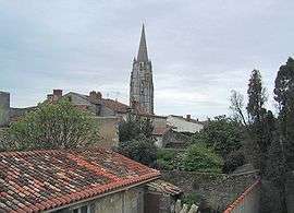
Marennes is a commune in the Charente-Maritime department in southwestern France.
For a long time it was one of the most prosperous cities of the Saintonge due to its location in the middle of the salt-water marshes at a time where salt was a valuable commodity. Marennes is a center for oyster farming.
Population
| Historical population | ||
|---|---|---|
| Year | Pop. | ±% |
| 1793 | 4,996 | — |
| 1800 | 4,633 | −7.3% |
| 1806 | 4,633 | +0.0% |
| 1821 | 4,193 | −9.5% |
| 1831 | 4,605 | +9.8% |
| 1836 | 4,542 | −1.4% |
| 1841 | 4,410 | −2.9% |
| 1846 | 4,542 | +3.0% |
| 1851 | 4,589 | +1.0% |
| 1856 | 4,508 | −1.8% |
| 1861 | 4,455 | −1.2% |
| 1866 | 4,426 | −0.7% |
| 1872 | 4,495 | +1.6% |
| 1876 | 4,565 | +1.6% |
| 1881 | 4,945 | +8.3% |
| 1886 | 4,766 | −3.6% |
| 1891 | 5,415 | +13.6% |
| 1896 | 6,293 | +16.2% |
| 1901 | 6,459 | +2.6% |
| 1906 | 6,408 | −0.8% |
| 1911 | 4,519 | −29.5% |
| 1921 | 3,900 | −13.7% |
| 1926 | 4,082 | +4.7% |
| 1931 | 4,011 | −1.7% |
| 1936 | 3,957 | −1.3% |
| 1946 | 3,806 | −3.8% |
| 1954 | 3,829 | +0.6% |
| 1962 | 4,345 | +13.5% |
| 1968 | 4,443 | +2.3% |
| 1975 | 4,214 | −5.2% |
| 1982 | 4,549 | +7.9% |
| 1990 | 4,634 | +1.9% |
| 1999 | 4,685 | +1.1% |
| 2008 | 5,465 | +16.6% |
References
External links
| Wikimedia Commons has media related to Marennes (Charente-Maritime). |
This article is issued from Wikipedia - version of the 2/12/2016. The text is available under the Creative Commons Attribution/Share Alike but additional terms may apply for the media files.