Shirley, Massachusetts
| Shirley, Massachusetts | ||
|---|---|---|
| Town | ||
|
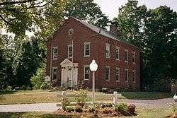
Old Shirley Municipal Building in 2008. | ||
| ||
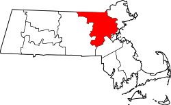
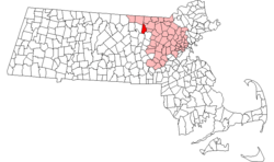 Location in Middlesex County in Massachusetts | ||
| Coordinates: 42°33′31″N 71°38′47″W / 42.55861°N 71.64639°WCoordinates: 42°33′31″N 71°38′47″W / 42.55861°N 71.64639°W | ||
| Country | United States | |
| State | Massachusetts | |
| County | Middlesex | |
| Settled | 1720 | |
| Incorporated | 1753 | |
| Government | ||
| • Type | Open town meeting | |
| Area | ||
| • Total | 15.9 sq mi (41.2 km2) | |
| • Land | 15.8 sq mi (41.0 km2) | |
| • Water | 0.1 sq mi (0.2 km2) | |
| Elevation | 279 ft (85 m) | |
| Population (2010) | ||
| • Total | 7,211[1] | |
| Time zone | Eastern (UTC-5) | |
| • Summer (DST) | Eastern (UTC-4) | |
| ZIP code | 01464 | |
| Area code(s) | 351 / 978 | |
| FIPS code | 25-61590 | |
| GNIS feature ID | 0618234 | |
| Website | http://www.shirley-ma.gov/ | |
Shirley is a town in Middlesex County, Massachusetts, United States. It is approximately fifty miles west-northwest of Boston. The population was 7,211 at the 2010 census.[1] The town has a well-preserved historic New England town center.
It is home to the Massachusetts Correctional Institution – Shirley, a medium-security state prison. (The neighboring maximum-security Souza-Baranowski Correctional Center lies just outside the town limits in the town of Lancaster.) The remains of a Shaker village have been preserved within the grounds of the prison.
History
The inhabitants at the time of European encounter were Nipmuc (or Pennacook) Indians, who called the area Catacunemaug. Once part of "The Plantation of Groton," Shirley was first settled by English pioneers about 1720.
In 1753 it separated from Groton and was incorporated, named in honor of William Shirley, governor of Massachusetts (1741–1757). A paper mill was built here around 1790 and in 1812 Shirley established the first of seven cotton mills. Other local products included iron, nails, textiles, rope, belts, suspenders, and athletic equipment. Two of the large 19th-century mill buildings have been subdivided and adapted for use by 21st-century businesses.[2]

A utopian religious community, Shirley Shaker Village, was established in Shirley in 1793. The Shakers advocated pacifism, common property, celibacy and communal living. They are renowned for their plain architecture and furniture. The Shaker movement peaked in the 1840s, but gradually dwindled, perhaps because of greater employment opportunities offered by the Industrial Revolution, or because succeeding generations grew less tolerant of the Shaker church's insistence on self-abnegation. Shirley Shaker Village closed in 1908.
A medium-security state prison was built on land surrounding the remains of the Shaker village in Shirley, and continues to operate. The town also operates a Senior Center located at 9 Parker Road.
Geography
The town has a total area of 15.9 square miles (41.2 km²), of which 15.8 square miles (41.0 km²) is land and 0.1 square mile (0.2 km²) (0.50%) is water.[3] It is bounded by the Squannacook and Nashua rivers and contains Mulpus Brook and Catecunemaug Brook. Significant wetlands are Spruce Swamp (drained by Spruce Swamp Brook) and Tophet Swamp.[4]
Demographics
| Historical population | ||
|---|---|---|
| Year | Pop. | ±% |
| 1850 | 1,158 | — |
| 1860 | 1,468 | +26.8% |
| 1870 | 1,451 | −1.2% |
| 1880 | 1,305 | −10.1% |
| 1890 | 1,191 | −8.7% |
| 1900 | 1,680 | +41.1% |
| 1910 | 2,139 | +27.3% |
| 1920 | 2,260 | +5.7% |
| 1930 | 2,427 | +7.4% |
| 1940 | 2,608 | +7.5% |
| 1950 | 4,271 | +63.8% |
| 1960 | 5,202 | +21.8% |
| 1970 | 4,909 | −5.6% |
| 1980 | 5,124 | +4.4% |
| 1990 | 6,118 | +19.4% |
| 2000 | 6,373 | +4.2% |
| 2010 | 7,211 | +13.1% |
| * = population estimate. Source: United States Census records and Population Estimates Program data.[5][6][7][8][9][10][11][12][13][14] | ||
This article describes the town of Shirley as a whole. Additional demographic detail is available which describes only the central settlement or village within the town, although that detail is included in the aggregate values reported here. See: Shirley (CDP), Massachusetts.
As of the census[15] of 2000, there were 6,373 people, 2,067 households, and 1,426 families residing in the town. The population density was 402.7 people per square mile (155.5/km²). There were 2,156 housing units at an average density of 136.2 per square mile (52.6/km²). The racial makeup of the town was 83.90% White, 6.72% Black or African American, 0.47% Native American, 2.10% Asian, 0.08% Pacific Islander, 5.12% from other races, and 1.62% from two or more races. Hispanic or Latino of any race were 6.86% of the population.
There were 2,067 households out of which 34.2% had children under the age of 18 living with them, 56.2% were married couples living together, 9.3% had a female householder with no husband present, and 31.0% were non-families. 25.4% of all households were made up of individuals and 8.7% had someone living alone who was 65 years of age or older. The average household size was 2.55 and the average family size was 3.09.
In the town the population was spread out with 21.7% under the age of 18, 7.6% from 18 to 24, 39.2% from 25 to 44, 22.3% from 45 to 64, and 9.2% who were 65 years of age or older. The median age was 37 years. For every 100 females there were 137.8 males. For every 100 females age 18 and over, there were 151.8 males.
The median income for a household in the town was $53,344, and the median income for a family was $66,250. Males had a median income of $42,078 versus $32,130 for females. The per capita income for the town was $20,556. About 1.9% of families and 3.3% of the population were below the poverty line, including 2.1% of those under age 18 and 4.4% of those age 65 or over.
Schools
- Lura A. White Elementary School[16]
- Ayer Shirley Regional Middle School[17]
- Ayer Shirley Regional High School[18]
- A new regional school system shared with the neighboring Town of Ayer officially launched in 2011
Parks
- Benjamin Hill Recreation Area[19]
- Fredonian Nature Center
- Whitley Park
Churches
- Shirley Historical Society Museum[20]
- Trinity Chapel Episcopal Church[21]
- United Church of Shirley[22]
- Holy Ghost Revival Outreach Ministries
Points of interest
- Shirley Historical Society Museum[23]
- Shirley Shaker Village
- Massachusetts Correctional Institution - Shirley, a medium/minimum security state prison.
- Shirley Senior Center
Transportation
Commuter rail service from Boston's North Station is provided by the MBTA with a stop in Shirley on its Fitchburg Line.[24] The Montachusett Regional Transit Authority (MART) supplies Councils-On-Aging service for elderly and disabled residents.[25]
Media
Newspapers
- Shirley Volunteer
- Shirley Oracle[26]
- Fitchburg Sentinel & Enterprise[27]
- Lowell Sun[28]
- Worcester Telegram & Gazette[29]
Cable
Notable people
- Michael Calvin Bacon (aka Michael Hollander), star of Saban's 1990s syndicated television series VR Troopers, grew up here. He is currently an animator for Telltale Games in San Rafael, California.
- Hermann Field, coauthor (with Stanislaw Mierzenski) of the novel Angry Harvest, basis of the movie Angry Harvest
- Oliver Holden, hymn writer
- Benton MacKaye, forester who proposed the Appalachian Trail
- Sarah Carter Edgarton Mayo, writer and editor
- Daniel Parker (general)
- William Johnson, ship captain
- Leonard Moody Parker, lawyer and legislator[30]
- Earl Tupper, founder of Tupperware company
- Jerry White, former Major League Baseball player
- General Lee Holman, Basketball player
Notes
- 1 2 http://www.shirley-ma.gov/Pages/ShirleyMA_WebDocs/about
- ↑ , Phoenix Park Online
- ↑ United States Census Bureau
- ↑ U.S. Geological Survey, Ayer, Massachusetts, 7.5 × 15 minute quadrangle, 1988.
- ↑ "TOTAL POPULATION (P1), 2010 Census Summary File 1". American FactFinder, All County Subdivisions within Massachusetts. United States Census Bureau. 2010.
- ↑ "Massachusetts by Place and County Subdivision - GCT-T1. Population Estimates". United States Census Bureau. Retrieved July 12, 2011.
- ↑ "1990 Census of Population, General Population Characteristics: Massachusetts" (PDF). US Census Bureau. December 1990. Table 76: General Characteristics of Persons, Households, and Families: 1990. 1990 CP-1-23. Retrieved July 12, 2011.
- ↑ "1980 Census of the Population, Number of Inhabitants: Massachusetts" (PDF). US Census Bureau. December 1981. Table 4. Populations of County Subdivisions: 1960 to 1980. PC80-1-A23. Retrieved July 12, 2011.
- ↑ "1950 Census of Population" (PDF). Bureau of the Census. 1952. Section 6, Pages 21-10 and 21-11, Massachusetts Table 6. Population of Counties by Minor Civil Divisions: 1930 to 1950. Retrieved July 12, 2011.
- ↑ "1920 Census of Population" (PDF). Bureau of the Census. Number of Inhabitants, by Counties and Minor Civil Divisions. Pages 21-5 through 21-7. Massachusetts Table 2. Population of Counties by Minor Civil Divisions: 1920, 1910, and 1920. Retrieved July 12, 2011.
- ↑ "1890 Census of the Population" (PDF). Department of the Interior, Census Office. Pages 179 through 182. Massachusetts Table 5. Population of States and Territories by Minor Civil Divisions: 1880 and 1890. Retrieved July 12, 2011.
- ↑ "1870 Census of the Population" (PDF). Department of the Interior, Census Office. 1872. Pages 217 through 220. Table IX. Population of Minor Civil Divisions, &c. Massachusetts. Retrieved July 12, 2011.
- ↑ "1860 Census" (PDF). Department of the Interior, Census Office. 1864. Pages 220 through 226. State of Massachusetts Table No. 3. Populations of Cities, Towns, &c. Retrieved July 12, 2011.
- ↑ "1850 Census" (PDF). Department of the Interior, Census Office. 1854. Pages 338 through 393. Populations of Cities, Towns, &c. Retrieved July 12, 2011.
- ↑ "American FactFinder". United States Census Bureau. Retrieved 2008-01-31.
- ↑ Lura A. White Elementary School. Retrieved March 24, 2014.
- ↑ . Retrieved October 29, 2014.
- ↑ . Retrieved October 29, 2014.
- ↑ Benjamin Hill Recreation Area. Retrieved March 24, 2014.
- ↑ St. Anthony's Catholic Church. Retrieved March 24, 2014.
- ↑ Trinity Chapel Episcopal Church. Retrieved March 24, 2014.
- ↑ United Church of Shirley. Retrieved March 24, 2014.
- ↑ Shirley Historical Society Museum. Retrieved March 24, 2014.
- ↑ MBTA website. mbta.com. Retrieved May 25, 2008.
- ↑ "MART: Communities served". mrta.us. Retrieved January 31, 2012.
- ↑ Shirley Oracle. Retrieved March 24, 2014.
- ↑ Sentinel & Enterprise. Retrieved March 24, 2014.
- ↑ Sun. Retrieved March 24, 2014.
- ↑ Telegram & Gazette. Retrieved March 24, 2014.
- ↑
 Wilson, James Grant; Fiske, John, eds. (1900). "Parker, Daniel". Appletons' Cyclopædia of American Biography. New York: D. Appleton.
References
- The source for Shirley's coordinates is "US Gazetteer files: 2010, 2000, and 1990". United States Census Bureau. 2011-02-12. Retrieved 2011-04-23. The 1990 Gazetteer was consulted and the value given for the zip code 01464 was used: 42.558653 N, 71.646444 W.
Further reading
- History of the Town of Shirley, Massachusetts, by Seth Chandler, published 1883, 744 pages.
- Seth Chandler (1880). "Shirley". In Samuel Adams Drake. History of Middlesex County, Massachusetts. 2. pp. 297–309.
- Joseph Crehore (1890). "Chapter XXXII: Shirley". In D. Hamilton Hurd. History of Middlesex County, Massachusetts. I. J. W. Lewis & Co. pp. 456–486.
- Seth Chandler Biography, by Alan Seaburg, Published 2011, Anne Miniver Press
Maps
See also
External links
| Wikimedia Commons has media related to Shirley, Massachusetts. |
| Wikisource has original text related to this article: |
- Town of Shirley official website
- Massachusetts official website – Town of Shirley
- Shirley, Massachusetts at DMOZ
 |
Townsend | Pepperell | Groton | |
| Lunenburg | |
Ayer | ||
| ||||
| | ||||
| Leominster | Lancaster | Harvard |