Marlborough, Massachusetts
| Marlborough, Massachusetts | ||
|---|---|---|
| City | ||
|
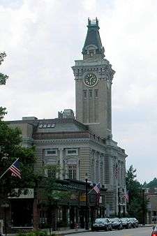
Main Street | ||
| ||
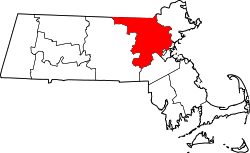
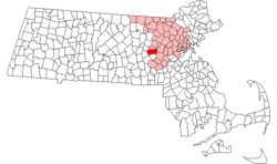 Location in Middlesex County in Massachusetts | ||
 Marlborough, Massachusetts Location in the United States | ||
| Coordinates: 42°20′45″N 71°33′10″W / 42.34583°N 71.55278°WCoordinates: 42°20′45″N 71°33′10″W / 42.34583°N 71.55278°W | ||
| Country | United States | |
| State | Massachusetts | |
| County | Middlesex | |
| Settled | 1657 | |
| Incorporated | 1660 | |
| Government | ||
| • Type | Mayor-council city | |
| • Mayor | Arthur G. Vigeant[1] (R[2]) | |
| Area | ||
| • Total | 22.2 sq mi (57.4 km2) | |
| • Land | 21.1 sq mi (54.6 km2) | |
| • Water | 1.1 sq mi (2.8 km2) | |
| Elevation | 450 ft (137 m) | |
| Population (2010) | ||
| • Total | 38,499 | |
| • Density | 1,804.0/sq mi (697.2/km2) | |
| Time zone | Eastern (UTC-5) | |
| • Summer (DST) | Eastern (UTC-4) | |
| ZIP code | 01752 | |
| Area code(s) | 508 / 774 | |
| FIPS code | 25-38715 | |
| GNIS feature ID | 0611360 | |
| Website | http://www.marlborough-ma.gov/ | |


Marlborough (often spelled Marlboro) is a city in Middlesex County, Massachusetts, United States. The population was 38,499 at the 2010 census. Marlborough became a prosperous industrial town in the 19th century and made the transition to high technology industry in the late 20th century after the construction of the Massachusetts Turnpike.
Marlborough was declared a town in 1660. It was incorporated as a city in 1890 when it changed its Municipal charter from a New England town meeting system to a Mayor–council government.
History
Christopher Allen was recorded as marshal of Marlborough in 1638 and married to Mary Wetherbee. John Howe, Jr. in 1656 was a fur trader and built a house at the intersection of two Indian trails, Nashua Trail and Connecticut path.[3] He could speak the language of the Algonquian Indians though the local tribe referred to themselves as the Pennacooks. The settlers were welcomed by the Indians because they protected them from other tribes they were at war with. In the 1650s, several families left the nearby town of Sudbury, 18 miles west of Boston, to start a new town. The village was named after Marlborough, the market town in Wiltshire, England. It was first settled in 1657 by 14 men led by Edmund Rice, John Ruddock and John Howe; in 1656 Rice and his colleagues petitioned the Massachusetts General Court to create the town of Marlborough and it was officially incorporated in 1660. Rice was elected a selectman at Marlborough in 1657. Sumner Chilton Powell wrote, in Puritan Village: The Formation of a New England Town, "Not only did Rice become the largest individual landholder in Sudbury, but he represented his new town in the Massachusetts legislature for five years and devoted at least eleven of his last fifteen years to serving as selectman and judge of small causes."[4]
The Reverend William Brimstead was the first minister of the Puritan church and Johnathan Johnson was the first blacksmith.
Marlborough was one of the seven "Praying Indian Towns" because they were converted to Christianity by the Rev. John Eliot of Roxbury. In 1674 a deed was drawn up dividing the land between the settlers and the natives. This is the only record of names of the natives.
The settlement was almost destroyed by Native Americans in 1676 during King Philip's War.
In 1711 Marlborough's territory included Northborough, Southborough, Westborough and Hudson. As population, business, and travel grew in the colonies, Marlborough became a favored rest stop on the Boston Post Road. Many travelers stopped at its inns and taverns, including George Washington, who visited the Williams Tavern (see citation below) soon after his inauguration in 1789.[5]
In 1836, Samuel Boyd, known as the "father of the city," and his brother Joseph, opened the first shoe manufacturing business - an act that would change the community forever. By 1890, with a population of 14,000, Marlborough had become a major shoe manufacturing center, producing boots for Union soldiers, as well as footwear for the civilian population. Marlborough became so well known for its shoes that its official seal was decorated with a factory, a shoe box, and a pair of boots when it was incorporated as a city in 1890.[6]
The Civil War resulted in the creation of one of the region's most unusual monuments. Legend has it that a company from Marlborough, assigned to Harpers Ferry, appropriated the bell from the firehouse where John Brown last battled for the emancipation of the slaves. The company left the bell in the hands of one Mrs. Elizabeth Snyder for 30 years, returning in 1892 to bring it back to Marlborough. The bell now hangs in a tower at the corner of Route 85 and Main Street.
Around that time, Marlborough is believed to have been the first community in the country to receive a charter for a streetcar system, edging out Baltimore by a few months. The system, designed primarily for passenger use, provided access to Milford to the south, and Concord to the north. As a growing industrialized community, Marlborough began attracting skilled craftsmen from Quebec, Ireland, Italy, and Greece.[6]
Shoe manufacturing continued in Marlborough long after the industry had fled many other New England communities. Rice & Hutchins, Inc. operated several factories in Marlborough from 1875 to 1929. Famous Frye boots were manufactured here through the 1970s, and The Rockport Company, founded in Marlborough in 1971, continues to maintain an outlet store in the city. In 1990, when Marlborough celebrated its centennial as a city, the festivities included the construction of a park in acknowledgment of the shoe industry, featuring statues by the sculptor David Kapenteopolous.
The construction of Interstates 495 and 290 and the Massachusetts Turnpike has enabled the growth of the high technology and specialized electronics industries. With its easy access to major highways and the pro-business, pro-development policies of the city government, the population of Marlborough has more than doubled in the last 25 years to over 38,000 at the time of the last census.
-

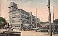
Bird's-eye view c. 1912
-

Main Street in 1906
-
Shoe factory c. 1910
-
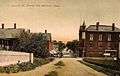
Lincoln Street c. 1908
Geography
Marlborough is located at 42°21′3″N 71°32′51″W / 42.35083°N 71.54750°W (42.350909, -71.547530).[7] According to the United States Census Bureau, the city has a total area of 22.2 square miles (57 km2), of which, 21.1 square miles (55 km2) of it is land and 1.1 square miles (2.8 km2) of it (4.87%) is water. Marlborough is drained by the Assabet River. Within city limits are three large lakes, known as Lake Williams, Millham Reservoir and Fort Meadow Reservoir. A portion of Fort Meadow Reservoir extends into nearby Hudson.
Marlborough is crossed by Interstate 495, U.S. Route 20 and Massachusetts Route 85. The eastern terminus of Interstate 290 is also in Marlborough.
Adjacent towns
Marlborough is located in eastern Massachusetts, bordered by six towns:
 |
Berlin | Hudson | Sudbury | |
| Northborough | |
|||
| ||||
| | ||||
| Southborough | Framingham |
Demographics
| Historical population | ||
|---|---|---|
| Year | Pop. | ±% |
| 1790 | 1,554 | — |
| 1800 | 1,735 | +11.6% |
| 1810 | 1,674 | −3.5% |
| 1820 | 1,952 | +16.6% |
| 1830 | 2,077 | +6.4% |
| 1840 | 2,101 | +1.2% |
| 1850 | 2,941 | +40.0% |
| 1860 | 5,911 | +101.0% |
| 1870 | 8,474 | +43.4% |
| 1880 | 10,127 | +19.5% |
| 1890 | 13,805 | +36.3% |
| 1900 | 13,609 | −1.4% |
| 1910 | 14,579 | +7.1% |
| 1920 | 15,028 | +3.1% |
| 1930 | 15,587 | +3.7% |
| 1940 | 15,154 | −2.8% |
| 1950 | 15,756 | +4.0% |
| 1960 | 18,819 | +19.4% |
| 1970 | 27,936 | +48.4% |
| 1980 | 30,617 | +9.6% |
| 1990 | 31,813 | +3.9% |
| 2000 | 36,255 | +14.0% |
| 2010 | 38,499 | +6.2% |
| 2014 | 39,612 | +2.9% |
| 2015 | 39,818 | +0.5% |
| * = population estimate. Source: United States Census records and Population Estimates Program data.[8][9][10][11][12][13][14][15][16][17][18] Source: | ||
As of the census[20] of 2000, there were 36,255 people, 14,501 households, and 9,280 families residing in the city. The population density was 1,719.4 people per square mile (663.7/km²). There were 14,903 housing units at an average density of 706.8 per square mile (272.8/km²). The racial makeup of the city was 87.70% White, 2.17% African American, 0.20% Native American, 3.76% Asian, 0.04% Pacific Islander, 3.27% from other races, and 2.86% from two or more races. Hispanic or Latino of any race were 6.06% of the population.
There were 14,501 households out of which 30.4% had children under the age of 18 living with them, 51.5% were married couples living together, 9.0% had a female householder with no husband present, and 36.0% were non-families. 28.4% of all households were made up of individuals and 8.3% had someone living alone who was 65 years of age or older. The average household size was 2.47 and the average family size was 3.07.
In the city the population was spread out with 23.3% under the age of 18, 7.0% from 18 to 24, 36.7% from 25 to 44, 21.5% from 45 to 64, and 11.6% who were 65 years of age or older. The median age was 36 years. For every 100 females there were 97.2 males. For every 100 females age 18 and over, there were 94.8 males.
The median income for a household in the city was $56,879, and the median income for a family was $70,385. Males had a median income of $49,133 versus $32,457 for females. The per capita income for the city was $28,723. About 4.7% of families and 6.8% of the population were below the poverty line, including 8.9% of those under age 18 and 10.3% of those age 65 or over.
Economy
Marlborough is home to numerous businesses, stores and restaurants.
Companies from a wide variety of industries with a significant presence in Marlborough include TJX, Raytheon, Hewlett-Packard, AMD, Navilyst Medical, Netezza, Boston Scientific, Sunovion (formerly Sepracor), AT&T, Apple Inc., Egenera, Evergreen Solar, Fidelity Investments, Quest Diagnostics, Lucent Technologies, VCE, and the many other businesses large and small that provide the strong business community in the city.
Marlborough Regional Chamber of Commerce
The Marlborough Regional Chamber of Commerce is the local chamber of commerce for Marlborough and five other surrounding towns in MetroWest Massachusetts. The chamber represents the business needs of over 650 businesses and thousands of employees in the area and is headquartered in the city.
The Chamber of Commerce's role has included working with the MetroWest Regional Transit Authority to improve transportation options and to obtain recognition for Marlborough's Downtown Village as a cultural district.[21]
Education
Public schools
- Advanced Math and Science Academy Charter School
- Assabet Valley Regional Technical High School
- Marlborough High School
- 1LT Charles W. Whitcomb School Formerly 4-7 School, Marlborough Middle School, and Marlborough Intermediate Elementary School
- Raymond C. Richer Elementary School
- Francis J.Kane Elementary School
- Sgt. Charles J. Jaworek Elementary School
- Early Childhood Center
See also Marlborough Public Schools
Charter schools
Advanced Math & Science Academy grades ( 6-12 )
Parochial schools
Private schools
- Hillside School (5-9)
- Wayside Academy (9-12)
- Massachusetts International Academy
After school programs
Transportation
Marlborough is located near the intersection of Routes 495, 290, 20 and the Massachusetts Turnpike.[22] It is connected to neighboring towns and cities by MWRTA.[22]
Major highways
Marlborough is served by Two Interstate, one U.S Highway and one state highways:
| Route number | Type | Local name | Direction |
|---|---|---|---|
| |
Interstate | Interstate 495 (Massachusetts) | north/south |
| |
Interstate | Interstate 290 (Massachusetts) | east/west |
| |
United States highway | Boston Post Rd., East/West Main St. Lakeside Ave and Granger Blvd. |
east/west |
| |
State route | Washington St., Bolton St. and Maple St. |
north/south |
Mass-transit
Bus
- The MetroWest Regional Transit Authority (MWRTA) operates a regional bus service which provides fixed route public bus lines servicing multiple communities in the MetroWest region, including the towns of Ashland, Framingham, Holliston, Hopkinton, Milford, Marlborough, Sudbury, Sherborn, Natick and Weston.[23]
- MWRTA Routes 7 connect Marlborough with Framingham which is well connected to Boston and other parts of the state via rail and bus.[24]
- MWRTA Route 7C (Inner City Marlborough) line runs roughly east-west through Marlborough. This route runs through the downtown Marlborough and connects multiple Shopping Complexes/Malls, residential localities and Marlborough Hospital.[25] Transfers can be made between routes 7 and 7C at the Marlborough City Hall stop.[24][26]
- The City of Marlborough announced that Peter Pan Bus service will begin offering service to Boston twice daily for $6.00 starting October 19, 2015[27]
Private services
- A number of private Taxi/Limousine services have been listed as being operated in Marlborough e.g. Marlborough City Taxi, American Way, Etc.[28]
Media
Newspapers
The MetroWest Daily News, a daily newspaper covering Marlborough and surrounding communities in the MetroWest region
The Marlborough Enterprise, the city's weekly newspaper
Marlborough Patch (online daily)
Television
Channel 8 (Comcast), Channel 34 (Verizon): WMCT-TV Your Community Station (Marlborough Cable Trust).
Channel 96 (Comcast), Channel 33 (Verizon): Marlborough Access, Public Access Television (Marlborough Cable Trust).
Channel 98: Marlborough Public Schools' student run station
Radio
Internet
- The Marlborough Historical Society
- Marlborough Virtual Town Hall
- Unofficial Marlborough Massachusetts web site with discussion forum
Points of interest
- Brigham Cemetery
- Callahan State Park
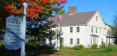
- Capt. Peter Rice House
- John Brown Bell
- Maplewood Cemetery
- Marlboro Airport
- Marlborough Center Historic District
- New England Sports Center
- Robin Hill Cemetery
- Rocklawn Cemetery
- Solomon Pond Mall
- Weeks Cemetery
- Wilson Cemetery
Notable residents

- Horatio Alger, Jr., author, graduated from high school in Marlborough in 1847 (The city's annual Horatio Alger Street Fair was renamed the Harvest Fair in 2007.)
- Asa Brigham, politician and businessman
- Carl C. Brigham, psychologist and creator of the SAT Tests
- Joey Graceffa, actor, author, singer, and YouTube personality
- John Buckley, baseball pitcher
- Mike Burns, Olympian and World Cup soccer player
- Rich Busa, marathon runner
- Bobby Butler, NHL hockey player
- Marcia Cross, actress best known for her role in Desperate Housewives; graduated from Marlborough High School in 1980
- Aaron Dalbec, guitarist in bands including Converge and Bane
- Crystal Eastman, lawyer, journalist and activist
- Charles "Duke" Farrell, catcher of the World Series–winning Boston Americans team of 1903
- Evan Fonseca, stand-up comedian, actor, and writer who appeared in The Fighter and Ted
- Philo C. Fuller, former US Congressman
- Gilman Bigelow Howe, genealogist and author
- James Simon Kunen, author of The Strawberry Statement: Notes of a College Revolutionary
- Gregory Maguire, author of Wicked: The Life and Times of the Wicked Witch of the West
- John J. Mitchell, former U.S. Congressman
- Robert J. Murray, Under Secretary of the Navy
- Roy Nutt, businessman and computer pioneer
- George Pyne II, American football player
- Ken Reynolds, Major League Baseball player
- Edmund Rice, co-founder and early resident
- Franklin Pierce Rice, printer, publisher and antiquarian
- Henry Rice, Massachusetts state legislator and subject of Gilbert Stuart portrait
- John Rock, gynecologist and obstetrician, co-credited with developing the first effective oral contraceptive, the Pill[29]
- Lucy Goodale Thurston, missionary
- John Patrick Treacy, Roman Catholic Bishop of the Diocese of La Crosse
- Bobb Trimble, musician
- Paul Warnke, diplomat
- Hayden Voss, star of Big Brother season 16
- Katya Zamolodchikova, drag queen, RuPaul's Drag Race season 7 contestant.
Sister cities and towns
Cities
Towns
 - Marlborough, Wiltshire, England, United Kingdom from 1657
See also
References
- ↑ "Office of the Mayor". City of Marlborough, MA. Retrieved 17 September 2015.
- ↑ Laidler, John (4 October 2012). "Mayors, other area notables take sides in Senate race". The Boston Globe. Retrieved 17 September 2015.
Marlborough Mayor Arthur G. Vigeant, on the other hand, said he is backing the incumbent senator, Scott Brown, because the fellow Republican from Wrentham 'has been available for us in Marlborough. . . I think he’s done a good job.'
- ↑ "Marlborough Massachusetts Genealogy". USGenWeb. Archived from the original on 2006-10-16. Retrieved 2007-03-01.
- ↑ "Who was Edmund Rice?". The Edmund Rice (1638) Association, Inc. Retrieved 2007-05-14.
- ↑ "Marlborough Massachusetts History - Williams Tavern". History RootsWeb. Retrieved 2010-02-10.
- 1 2 History of Marlborough
- ↑ "US Gazetteer files: 2010, 2000, and 1990". United States Census Bureau. 2011-02-12. Retrieved 2011-04-23.
- ↑ "TOTAL POPULATION (P1), 2010 Census Summary File 1". American FactFinder, All County Subdivisions within Massachusetts. United States Census Bureau. 2010.
- ↑ "Massachusetts by Place and County Subdivision - GCT-T1. Population Estimates". United States Census Bureau. Retrieved July 12, 2011.
- ↑ "1990 Census of Population, General Population Characteristics: Massachusetts" (PDF). US Census Bureau. December 1990. Table 76: General Characteristics of Persons, Households, and Families: 1990. 1990 CP-1-23. Retrieved July 12, 2011.
- ↑ "1980 Census of the Population, Number of Inhabitants: Massachusetts" (PDF). US Census Bureau. December 1981. Table 4. Populations of County Subdivisions: 1960 to 1980. PC80-1-A23. Retrieved July 12, 2011.
- ↑ "1950 Census of Population" (PDF). Bureau of the Census. 1952. Section 6, Pages 21-10 and 21-11, Massachusetts Table 6. Population of Counties by Minor Civil Divisions: 1930 to 1950. Retrieved July 12, 2011.
- ↑ "1920 Census of Population" (PDF). Bureau of the Census. Number of Inhabitants, by Counties and Minor Civil Divisions. Pages 21-5 through 21-7. Massachusetts Table 2. Population of Counties by Minor Civil Divisions: 1920, 1910, and 1920. Retrieved July 12, 2011.
- ↑ "1890 Census of the Population" (PDF). Department of the Interior, Census Office. Pages 179 through 182. Massachusetts Table 5. Population of States and Territories by Minor Civil Divisions: 1880 and 1890. Retrieved July 12, 2011.
- ↑ "1870 Census of the Population" (PDF). Department of the Interior, Census Office. 1872. Pages 217 through 220. Table IX. Population of Minor Civil Divisions, &c. Massachusetts. Retrieved July 12, 2011.
- ↑ "1860 Census" (PDF). Department of the Interior, Census Office. 1864. Pages 220 through 226. State of Massachusetts Table No. 3. Populations of Cities, Towns, &c. Retrieved July 12, 2011.
- ↑ "1850 Census" (PDF). Department of the Interior, Census Office. 1854. Pages 338 through 393. Populations of Cities, Towns, &c. Retrieved July 12, 2011.
- ↑ "1950 Census of Population" (PDF). 1: Number of Inhabitants. Bureau of the Census. 1952. Section 6, Pages 21-7 through 21-09, Massachusetts Table 4. Population of Urban Places of 10,000 or more from Earliest Census to 1920. Retrieved July 12, 2011.
- ↑ "Census of Population and Housing". Census.gov. Retrieved June 4, 2015.
- ↑ "American FactFinder". United States Census Bureau. Retrieved 2008-01-31.
- ↑ "Marlborough's downtown recognized as a cultural district". Marlborough Economic Development Corporation. 2012-10-12. Retrieved 2014-06-16.
- 1 2 "City of Marlborough Official Website, Transportation". City of Marlborough. Retrieved 2012-01-12.
- ↑ "MWRTA Official Website". MWRTA. Retrieved 2012-01-12.
- 1 2 "MWRTA Route 7 Details". MWRTA. Retrieved 2012-01-12.
- ↑ "MWRTA Route 7C Details". Retrieved 2012-01-12.
- ↑ "Rates and Transfers Details". Retrieved 2012-01-12.
- ↑ "City of Marlborough facebook". City of Marlborough. Retrieved 2015-10-05.
- ↑ "Yahoo Local listing of taxi services in Marlborough". Retrieved 2012-01-12.
- ↑ "John Rock: Pioneer in the Development of Oral Contraceptives", Marc A. Shampo, PhD and Robert A. Kyle, MD
Further reading
- 1871 Atlas of Massachusetts. by Wall & Gray.Map of Massachusetts. Map of Middlesex County.
- History of the Town of Marlborough, Middlesex County, Massachusetts. by Charles Hudson, and Joseph Allen. Published 1862, 544 pages.
- History of Middlesex County, Massachusetts, Volume 1 (A-H), Volume 2 (L-W) compiled by Samuel Adams Drake, published 1879 and 1880. 572 and 505 pages. Marlborough Section in Volume 2 page 137 by R.A.Griffin and E.L.Bigelow.
External links
| Wikimedia Commons has media related to Marlborough, Massachusetts. |
- City of Marlborough, Massachusetts
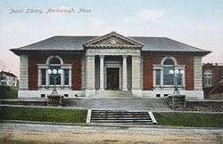
- Marlborough Public Library
- Marlborough Historical Society
- Marlborough Airport
- Marlborough Regional Chamber of Commerce
Boston (capital) | |
| Topics |
|
| Society | |
| Regions | |
| Counties | |
| Cities |
|