Sudbury, Massachusetts
| Sudbury, Massachusetts | ||
|---|---|---|
| Town | ||
|
| ||
| ||
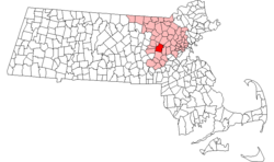 Location in Middlesex County in Massachusetts | ||
| Coordinates: 42°23′N 71°25′W / 42.383°N 71.417°WCoordinates: 42°23′N 71°25′W / 42.383°N 71.417°W | ||
| Country | United States | |
| State | Massachusetts | |
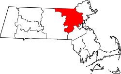
| County | Middlesex | |
| Settled | 1638 | |
| Incorporated | 1639 | |
| Government | ||
| • Type | Open town meeting | |
| Area | ||
| • Total | 24.6 sq mi (63.8 km2) | |
| • Land | 24.4 sq mi (63.1 km2) | |
| • Water | 0.3 sq mi (0.7 km2) | |
| Elevation | 190 ft (58 m) | |
| Population (2010) | ||
| • Total | 17,659 | |
| • Density | 720/sq mi (280/km2) | |
| Time zone | Eastern (UTC-5) | |
| • Summer (DST) | Eastern (UTC-4) | |
| ZIP code | 01776 | |
| Area code(s) | 351 / 978 | |
| FIPS code | 25-68260 | |
| GNIS feature ID | 0618237 | |
| Website | sudbury.ma.us | |


Sudbury is a town in Middlesex County, Massachusetts, United States. At the 2010 census, it had a population of 17,659.[1] The town, located in Boston's MetroWest, has a rich colonial history.
History
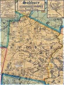
The town was incorporated in 1639. At that time, the boundaries of Sudbury included (by 1653) all what is now of Wayland (which split off in 1780), and parts of Framingham, Marlborough, Stow and Maynard.[2] The Sudbury Center Historic District has changed little since 1800.
Sudbury also contributed the most militia during King Philip's War and was the site of a native raid. Ephraim Curtis was a successful leader of the militia of West Sudbury and would lend his name to the town's junior high school.[3][4]:24–75 Sudbury militia participated in the Battle of Lexington and Concord, in 1775, where Sudbury members sniped on British Red Coats returning to Boston.
One of Sudbury's historic landmarks, the Wayside Inn, claims to be the country's oldest operating inn, built and run by the Howe family for many generations. Henry Wadsworth Longfellow wrote Tales of a Wayside Inn, a book of poems published in 1863. In the book, the poem The Landlord's Tale was the source of the immortal phrase "listen my children and you shall hear, of the midnight ride of Paul Revere." Henry Ford bought the inn in 1923, restored it and donated it to a charitable foundation which continues to run it as an operating inn to this day. Ford also built a boys' school on the property, as well as a grist mill, and the Martha–Mary Chapel. He brought in the Redstone Schoolhouse from Sterling, which was reputed to be the school in Sarah Josepha Hale's nursery rhyme Mary Had a Little Lamb.[5][6] However, Giuseppi Cavicchio's refusal to sell his water rights scuttled Henry Ford's plans to build an auto parts factory at the site of Charles O. Parmenter's mill in South Sudbury.[7]
In August 1925, a Sudbury farm was the scene of a riot between local members of the Ku Klux Klan and Irish-American youths from the area. Five people were wounded by gunshots, and the State Police arrested over 100 Klansmen. Massachusetts officials cracked down on the group's meetings thereafter, and the Klan died out in the area.[7]
The American Powder Mills complex extending upstream along the Assabet River manufactured gunpowder from 1835 to 1940.[8] In the post-war period, Sudbury experienced rapid growth in population and industry. Defense contractor Raytheon became a major employer after opening a large research facility in Sudbury in 1958. Another major employer in that period was Sperry Rand. In the 1970s, the town was home to many of the engineers working in the minicomputer revolution at Digital Equipment Corporation in nearby Maynard. Sudbury was also one of the largest carnation-growing towns, with many greenhouse operations.
Residentially, Sudbury's 1-acre (4,000 m2) zoning bylaws helped the town maintain a more rural character through the 1970s and 1980s, when developments of single-family Colonials and large Capes established it as an affluent location. Commercial growth was restricted to the town's main thoroughfare, US Route 20, and significant tracts of open space—including much wetland—were preserved in the northern half of town. As subdivisions of large homes continued to be constructed well into the 1990s, Sudbury became one of the wealthiest towns in Massachusetts.
Contrary to local legend, the town's ZIP code of 01776 was not specially assigned in recognition of the town's historical connections to the Revolutionary War, according to the Sudbury Historical Society.
Geography
According to the United States Census Bureau, the town has a total area of 24.6 square miles (64 km2), of which 24.4 square miles (63 km2) is land and 0.3 square miles (0.78 km2), or 1.06%, is water. The highest point in Sudbury is on the north slope of Nobscot Hill, and the highest summit is Tippling Rock,[9] which commands a great view of the west of Boston and the tops of the Hancock and Prudential buildings in downtown.
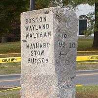
Sudbury is bordered by Wayland (the Sudbury River) on the east; Framingham on the south; Hudson, Maynard, Marlborough, and Stow on the west; Concord on the northeast; and Acton on the north. A larger town, Sudbury also shares a common corner with Lincoln, with which it shares a regional high school, Lincoln-Sudbury High School. Sudbury is 20 miles (32 km) west of Boston, 26 miles (42 km) east of Worcester, and 194 miles (312 km) from New York City.
The area of original town of Sudbury in 1650 included most of the area within the present towns of Wayland and Maynard and all of the area within the present town of Sudbury.[10]
Adjacent towns
Sudbury is located in eastern Massachusetts, bordered by several towns:
 |
Maynard & Stow | Acton | Concord | |
| Hudson | |
Wayland | ||
| ||||
| | ||||
| Marlborough | Framingham |
Demographics
| Historical population | ||
|---|---|---|
| Year | Pop. | ±% |
| 1790 | 1,290 | — |
| 1800 | 1,303 | +1.0% |
| 1810 | 1,287 | −1.2% |
| 1820 | 1,417 | +10.1% |
| 1830 | 1,423 | +0.4% |
| 1840 | 1,422 | −0.1% |
| 1850 | 1,578 | +11.0% |
| 1860 | 1,691 | +7.2% |
| 1870 | 2,091 | +23.7% |
| 1880 | 1,178 | −43.7% |
| 1890 | 1,197 | +1.6% |
| 1900 | 1,150 | −3.9% |
| 1910 | 1,120 | −2.6% |
| 1920 | 1,121 | +0.1% |
| 1930 | 1,182 | +5.4% |
| 1940 | 1,754 | +48.4% |
| 1950 | 2,596 | +48.0% |
| 1960 | 7,447 | +186.9% |
| 1970 | 13,506 | +81.4% |
| 1980 | 14,027 | +3.9% |
| 1990 | 14,358 | +2.4% |
| 2000 | 16,841 | +17.3% |
| 2010 | 17,659 | +4.9% |
| * population 1850–2010 Source: United States Census records and Population Estimates Program data.[11][12][13][14][15][16][17][18][19][20] * population 1790–1840 Source: Map Of Massachusetts[21] | ||
As of the census[22] of 2000, there were 16,841 people, 5,504 households, and 4,749 families residing in the town. The population density was 691.1 people per square mile (266.8/km²). There were 5,590 housing units at an average density of 229.4 per square mile (88.6/km²). The racial makeup of the town was 94.23% Caucasian, 0.80% African American, 0.03% Native American, 3.72% Asian, 0.03% Pacific Islander, 0.23% from other races, and 0.96% from two or more races. Hispanic or Latino of any race were 1.24% of the population. An update in the town's census[23] recorded the population at 18,192 as of 6/10/2015.
There were 5,504 households out of which 51.1% had children under the age of 18 living with them, 78.5% were married couples living together, 6.2% had a female householder with no husband present, and 13.7% were non-families. 11.0% of all households were made up of individuals and 5.5% had someone living alone who was 65 years of age or older. The average household size was 3.02 and the average family size was 3.28.
In the town the population was spread out with 32.5% under the age of 18, 3.2% from 18 to 24, 27.3% from 25 to 44, 27.2% from 45 to 64, and 9.8% who were 65 years of age or older. The median age was 39 years. For every 100 females there were 95.4 males. For every 100 females age 18 and over, there were 92.3 males.
The median income for a household in the town is $151,041, and the median income for a family is $222,008. Males had a median income of $148,593 versus $47,500 for females. The per capita income for the town was $75,865. About 2.1% of families and 2.8% of the population were below the poverty line, including 3.9% of those under age 18 and 4.8% of those age 65 or over.
The median home price is $759,405.[24]
Sudbury was ranked in 2005 as the best town in Massachusetts in which to raise a family.[25]
Education
Sudbury students in kindergarten through eighth grade attend Sudbury Public Schools, while high school students attend schools in the Lincoln-Sudbury Regional School District, which was established in 1954, integrating the former Sudbury High School with that of the nearby town of Lincoln, Massachusetts. In 2011, Boston magazine ranked Sudbury's school system 4th in the state, in both of its categories(classroom/academics & Testing/Achievement scores). In subsequent (as well as many prior years) Sudbury is perennially ranked as a 'Top 20' Massachusetts school system.
In June 2002, the towns of Lincoln and Sudbury began a $74 million project to build a new high school near the site of the original building. The shared Lincoln-Sudbury Regional High School (LSRHS) is located in Sudbury.
The high school's science program student team won the 2006 National Ocean Sciences Bowl championship, and came in 2nd in 2005. LSRHS has a nationally recognized school newspaper and school yearbook, The Forum and DYAD respectively.
There are four elementary schools in Sudbury and one middle school. The four elementary schools are:
- Josiah Haynes Elementary School
- Israel Loring Elementary School
- General John Nixon Elementary School
- Peter Noyes Elementary School
The middle school is:
- Ephraim Curtis Middle School
Sudbury has two former elementary schools that were converted to other uses:
- Fairbank Elementary School is now a community center, and the central office for the school district.
- Horse Pond Elementary School is now the main Massachusetts State Police Crime Laboratory.
Places of worship


- First Baptist Church of Sudbury
- Congregation B'nai Torah, Jewish
- Congregation Beth El of the Sudbury River Valley], Jewish
- Chabad Center of Sudbury], Jewish
- First Parish of Sudbury. Gathered in 1640, and moved to the present site in 1723. The historic meeting house (second on the site) was built in 1797. First Parish became Unitarian in 1837 and is now Unitarian Universalist.[26]
- Memorial Congregational Church, member of the United Church of Christ.[27] An Open and Affirming Congregation.[28]
- Our Lady of Fatima Parish, Roman Catholic
- Presbyterian Church in Sudbury
- Saint Elizabeth's Episcopal Church
- St. Anselm Rectorate, Roman Catholic
- St. John Evangelical Lutheran Church
- Sudbury United Methodist Church
Notable people
- Horace Abbott,[29] iron manufacturer
- Sarah Cloyce, Salem witch trials survivor; relocated to Sudbury after permanently leaving Salem
- Ralph Adams Cram, architect, resided in Sudbury on Concord Road and built his family their own private chapel which is now owned and operated by Saint Elizabeth's Episcopal Church
- Coco Crisp, lived here during some of his time with the Boston Red Sox
- Matthew Delaney, author
- Dennis Eckersley, baseball Hall of Famer, lived on Morse Road prior to his years with the Boston Red Sox and on Plympton Road during and after his years with the Red Sox
- Chris Evans, actor
- Scott Evans, actor
- Henry Ford, founder of the Ford Motor Company, lived in Sudbury during parts of the 1920s and 1930s
- Mike Gordon, bassist for Phish
- Robert L. Gordon III, Deputy Under Secretary of Defense
- Michelle Gorgone, Olympic snowboarder[30]
- Edward Hallowell, psychiatrist, author, and specialist on ADD/ADHD.
- Eddie House, NBA champion with the Boston Celtics
- Stephen Huneck, artist and writer
- Tyler Jewell, Olympic snowboarder[31]
- Michael Kolowich, documentary film maker and technology entrepreneur
- Tony Massarotti, sports reporter for The Boston Globe.
- John Nixon, General in the Continental Army during the American Revolution
- Shaquille O'Neal, four-time NBA champion, 2000 NBA MVP, fifteen-time NBA All-Star, rapper, actor, and current Inside the NBA analyst lived in Sudbury for a brief time.
- Paula Poundstone, comedian
- Adam Ravenelle, College World Series champion, and winning relief pitcher with the Vanderbilt Commodores. He was selected in the 4th round 130th overall in the 2014 Major League Baseball Draft by the Detroit Tigers
- Edmund Rice, co-founder and early resident of the town 1638–1656
- Ashley Richardson (also known as Ashley Montana), model
- Babe Ruth, baseball Hall of Famer. Lived on Dutton Road called Home Plate Farm, formerly known as Elm Farm at the Perry homestead. Even after Ruth was sold to the New York Yankees he still wintered in Sudbury. A footnote to the "Curse of the Bambino" claims that Ruth's piano rests at the bottom of Willis Pond in western Sudbury near what was once his home. An expedition was launched to recover parts of the piano by treasure hunters. Parts of the instrument were recovered, but there is some debate as to whom those parts belong.
- Simon Shnapir, Olympic medalist pair skater
- Fred Smerlas, five-time NFL Pro Bowler
- Jarrod Shoemaker, Olympian and Triathlete
- Callie Thorne, actress (Rescue Me)
See also
Notes
- ↑ "Profile of General Population and Housing Characteristics: 2010 Demographic Profile Data (DP-1): Sudbury town, Middlesex County, Massachusetts". U.S. Census Bureau, American Factfinder. Retrieved April 9, 2012.
- ↑ "Historical Maps of Sudbury". Sudbury Massachusetts town website. Town of Sudbury, MA. Retrieved July 15, 2012.
- ↑ "King Philip's War and The Sudbury Fight".
- ↑ Powers, John Christopher (1988). We shall not tamely give it up. Privately printed, available from Sudbury Historical Society. ASIN B0006ESFZW.
- ↑ Roulstone, John; Mary (Sawyer) and her friends (1928). The Story of Mary's Little Lamb. Dearborn: Mr. & Mrs. Henry Ford. p. 8. Cite uses deprecated parameter
|coauthors=(help) - ↑ "About America's Oldest Inn," Longfellow's Wayside Inn Web site (http://www.wayside.org/about), Retrieved July 25, 2014.
- 1 2 Garfield, Curtis F (1999). Sudbury, 1890–1989 100 Years in the Life of a Town. Porcupine Enterprises. ISBN 0-9621976-3-7.
- ↑ Mark, David A. (2014). Hidden History of Maynard. The History Press. pp. 78–82. ISBN 1626195412.
- ↑ "USGS GeoNames Detail for: Tippling Rock". Retrieved August 24, 2010.
- ↑ www.sudbury.ma.us
- ↑ "TOTAL POPULATION (P1), 2010 Census Summary File 1". American FactFinder, All County Subdivisions within Massachusetts. United States Census Bureau. 2010.
- ↑ "Massachusetts by Place and County Subdivision - GCT-T1. Population Estimates". United States Census Bureau. Retrieved July 12, 2011.
- ↑ "1990 Census of Population, General Population Characteristics: Massachusetts" (PDF). US Census Bureau. December 1990. Table 76: General Characteristics of Persons, Households, and Families: 1990. 1990 CP-1-23. Retrieved July 12, 2011.
- ↑ "1980 Census of the Population, Number of Inhabitants: Massachusetts" (PDF). US Census Bureau. December 1981. Table 4. Populations of County Subdivisions: 1960 to 1980. PC80-1-A23. Retrieved July 12, 2011.
- ↑ "1950 Census of Population" (PDF). Bureau of the Census. 1952. Section 6, Pages 21-10 and 21-11, Massachusetts Table 6. Population of Counties by Minor Civil Divisions: 1930 to 1950. Retrieved July 12, 2011.
- ↑ "1920 Census of Population" (PDF). Bureau of the Census. Number of Inhabitants, by Counties and Minor Civil Divisions. Pages 21-5 through 21-7. Massachusetts Table 2. Population of Counties by Minor Civil Divisions: 1920, 1910, and 1920. Retrieved July 12, 2011.
- ↑ "1890 Census of the Population" (PDF). Department of the Interior, Census Office. Pages 179 through 182. Massachusetts Table 5. Population of States and Territories by Minor Civil Divisions: 1880 and 1890. Retrieved July 12, 2011.
- ↑ "1870 Census of the Population" (PDF). Department of the Interior, Census Office. 1872. Pages 217 through 220. Table IX. Population of Minor Civil Divisions, &c. Massachusetts. Retrieved July 12, 2011.
- ↑ "1860 Census" (PDF). Department of the Interior, Census Office. 1864. Pages 220 through 226. State of Massachusetts Table No. 3. Populations of Cities, Towns, &c. Retrieved July 12, 2011.
- ↑ "1850 Census" (PDF). Department of the Interior, Census Office. 1854. Pages 338 through 393. Populations of Cities, Towns, &c. Retrieved July 12, 2011.
- ↑ Borden, Simeon (1844). Map Of Massachusetts. Boston, MA: S. Borden.
- ↑ "American FactFinder". United States Census Bureau. Retrieved January 31, 2008.
- ↑ "Sudbury Community Profile | Sudbury". sudbury.ma.us. Retrieved 2015-11-23.
- ↑ "MONEY Magazine: Best places to live 2007: Sudbury, MA snapshot". CNN. 2007. Retrieved October 25, 2007.
- ↑ Neighborhoodscout.com
- ↑ Hardenbergh, Jan. "First Parish of Sudbury: Our History". Retrieved May 9, 2009.
- ↑ "What is the UCC?". Retrieved December 9, 2015.
- ↑ "All are Welcome. Really!". Retrieved December 9, 2015.
- ↑ Who Was Who in America, Historical Volume, 1607–1896. Marquis Who's Who. 1967.
- ↑ http://www.nbcolympics.com/athletes/athlete=2442/index.html
- ↑ http://www.nbcolympics.com/athletes/athlete=2452/index.html
References
- 1871 Atlas of Massachusetts. by Wall & Gray.Map of Massachusetts. Map of Middlesex County.
- History of Middlesex County, Massachusetts, Volume 1 (A–H), Volume 2 (L–W) compiled by Samuel Adams Drake, published 1879 and 1880. 572 and 505 pages. Sudbury article by Rev. George A. Oviatt in volume 2 pages 357–381.
External links
| Wikimedia Commons has media related to Sudbury, Massachusetts. |