Lancaster, South Carolina
| Lancaster, South Carolina | ||
|---|---|---|
| City | ||
|
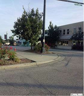
Main street intersecting with East Arch Street. | ||
| ||
| Nickname(s): The Red Rose City | ||
| Motto: "Forward Together, the Spirit of Lancaster" | ||
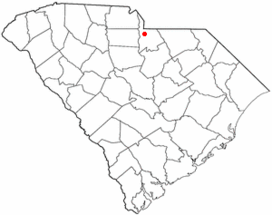 Location of Lancaster, South Carolina | ||
| Coordinates: 34°43′16″N 80°46′24″W / 34.72111°N 80.77333°WCoordinates: 34°43′16″N 80°46′24″W / 34.72111°N 80.77333°W | ||
| Country | United States | |
| State | South Carolina | |
| County | Lancaster | |
| Incorporated | 1830 | |
| Government | ||
| • Mayor | Pending special election[1] | |
| Area | ||
| • City | 5.9 sq mi (15.3 km2) | |
| • Land | 5.8 sq mi (15.1 km2) | |
| • Water | 0.1 sq mi (0.2 km2) | |
| Elevation | 568 ft (173 m) | |
| Population (2010) | ||
| • City | 10,160 | |
| • Density | 1,406.2/sq mi (543.0/km2) | |
| • Urban | 24,843 | |
| Time zone | Eastern (EST) (UTC-5) | |
| • Summer (DST) | EDT (UTC-4) | |
| ZIP codes | 29720-29722 | |
| Area code(s) | 803 | |
| FIPS code | 45-39895[2] | |
| GNIS feature ID | 1246285[3] | |
| Website |
www | |

The city of Lancaster /ˈleɪŋkəstər/ is the county seat of Lancaster County, South Carolina located in the Charlotte Metropolitan Area. As of the United States Census of 2010, the city population was 10,160 but due to South Carolina's strict annexation laws its actual population is well over twenty thousand people. The city was named after the famous House of Lancaster. Locally, Lancaster is pronounced /ˈleɪŋkᵻstər/ LANK-iss-tər, rather than the usual American pronunciation /ˈlænkæstər/ LAN-kast-ər. The modern British pronunciation is LANG-kast-ər.
History
The Robert Barnwell Allison House, Craig House, Cureton House, Thomas Walker Huey House, Lancaster Cotton Oil Company, Lancaster County Courthouse, Lancaster County Jail, Lancaster Downtown Historic District, Lancaster Presbyterian Church, Mount Carmel A.M.E. Zion Campground, North Carolina-South Carolina Cornerstone, Perry-McIlwain-McDow House, Leroy Springs House, Wade-Beckham House, and Waxhaw Presbyterian Church Cemetery are listed on the National Register of Historic Places.[4][5]
Geography
Lancaster is located at 34°43′16″N 80°46′24″W / 34.72111°N 80.77333°W (34.721100, -80.773315).[6]
According to the United States Census Bureau, the city has a total area of 5.9 square miles (15 km2), of which 5.8 square miles (15 km2) is land and 0.1 square miles (0.26 km2) of it (1.36%) is water.
Demographics
| Historical population | |||
|---|---|---|---|
| Census | Pop. | %± | |
| 1850 | 376 | — | |
| 1860 | 536 | 42.6% | |
| 1870 | 591 | 10.3% | |
| 1880 | 681 | 15.2% | |
| 1890 | 1,094 | 60.6% | |
| 1900 | 1,477 | 35.0% | |
| 1910 | 2,098 | 42.0% | |
| 1920 | 3,032 | 44.5% | |
| 1930 | 3,545 | 16.9% | |
| 1940 | 4,430 | 25.0% | |
| 1950 | 7,159 | 61.6% | |
| 1960 | 7,999 | 11.7% | |
| 1970 | 9,186 | 14.8% | |
| 1980 | 9,703 | 5.6% | |
| 1990 | 8,914 | −8.1% | |
| 2000 | 8,177 | −8.3% | |
| 2010 | 8,526 | 4.3% | |
| Est. 2015 | 8,956 | [7] | 5.0% |

As of the census[2] of 2010, there were 10,160 people, 5,396 households, and 3,115 families residing in the city. The population density was 1,406.2 people per square mile (543.4/km²). There were 3,778 housing units at an average density of 649.7 per square mile (251.1/km²). The racial makeup of the city was 49.49% African American, 47.54% White, 0.12% Native American, 0.88% Asian, 0.04% Pacific Islander, 1.15% from other races, and 0.78% from two or more races. Hispanic or Latino of any race were 2.25% of the population.
There were 3,396 households out of which 27.3% had children under the age of 18 living with them, 35.5% were married couples living together, 22.6% had a female householder with no husband present, and 37.7% were non-families. 33.1% of all households were made up of individuals and 15.2% had someone living alone who was 65 years of age or older. The average household size was 2.37 and the average family size was 3.01.
In the city the population was spread out with 25.8% under the age of 18, 8.9% from 18 to 24, 26.8% from 25 to 44, 21.8% from 45 to 64, and 16.6% who were 65 years of age or older. The median age was 37 years. For every 100 females there were 83.1 males. For every 100 females age 18 and over, there were 77.1 males.
The median income for a household in the city was $28,650, and the median income for a family was $33,380. Males had a median income of $27,090 versus $22,382 for females. The per capita income for the city was $16,828. About 18.0% of families and 23.0% of the population were below the poverty line, including 33.2% of those under age 18 and 17.8% of those age 65 or over.
Schools
Lancaster is home to the Lancaster County School District, SC which has around 11 elementary schools, 5 middle schools, and 4 high schools. In 2008 South Carolina Governor Mark Sanford named Andrew Jackson Middle School, located in nearby Kershaw, as the recipient of the state's Best Special Education School Award. The city of Lancaster is also home to the University of South Carolina at Lancaster also known as USCL.
Public Schools Located in Lancaster :
- Lancaster High School
- A.R. Rucker Middle School
- Erwin Elementary School
- South Middle School
- North Elementary School
- McDonald Green Elementary School
- Brooklyn Springs Elementary School
- Clinton Elementary School
- Discovery Elementary School
- Southside Pre-School
Private Schools
- Carolina Christian Academy
Universities:
Notable people
- Cathy Smith Bowers, poet and professor; North Carolina Poet Laureate, 2010–2012
- Danny Clyburn, baseball player
- Charles Duke, NASA astronaut-walked on moon
- Hattie N. Harrison, Maryland legislator and educator
- Nina Mae McKinney, one of the first African-American film stars in the United States and was one of the first African Americans to appear on British television.
- Julie Roberts, CMT artist
- Aaron Robinson, was a professional Baseball Player with the Yankees and Detroit.
- Shawn Crawford, from nearby Van Wyck, he won gold at the 2004 Summer Olympics and silver at the 2008 Summer Olympics in the 200 meters.
- Maurice Williams & the Zodiacs, singer Maurice Williams
References
- ↑ "Lancaster mayor Joe Shaw passes away at 81". WDTV. WDTV. Retrieved 1 February 2016.
- 1 2 "American FactFinder". United States Census Bureau. Retrieved 2008-01-31.
- ↑ "US Board on Geographic Names". United States Geological Survey. 2007-10-25. Retrieved 2008-01-31.
- ↑ National Park Service (2010-07-09). "National Register Information System". National Register of Historic Places. National Park Service.
- ↑ "National Register of Historic Places". Weekly List of Actions Taken on Properties: 12/03/12 through 12/07/12. National Park Service. 2012-12-14.
- ↑ "US Gazetteer files: 2010, 2000, and 1990". United States Census Bureau. 2011-02-12. Retrieved 2011-04-23.
- ↑ "Annual Estimates of the Resident Population for Incorporated Places: April 1, 2010 to July 1, 2015". Retrieved July 2, 2016.
- ↑ "Census of Population and Housing". Census.gov. Retrieved June 4, 2015.
External links
Municipalities and communities of Lancaster County, South Carolina, United States | ||
|---|---|---|
| City | 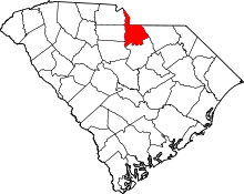 | |
| Towns | ||
| CDPs | ||
| Unincorporated communities | ||
| Footnotes | ‡This populated place also has portions in an adjacent county or counties | |
|  | ||||||||||||||||||||
|
| |||||||||||||||||||||