Indiana State Road 15
| ||||
|---|---|---|---|---|
 | ||||
| Route information | ||||
| Maintained by INDOT | ||||
| Length: | 94.82 mi[1] (152.60 km) | |||
| Existed: | October 1, 1926[2] – present | |||
| Major junctions | ||||
| South end: |
| |||
|
| ||||
| North end: |
| |||
| Location | ||||
| Counties: | Elkhart, Grant, Kosciusko, Wabash | |||
| Highway system | ||||
| ||||
State Road 15 is a north–south road in northeastern Indiana. Its southern terminus is at State Road 22 in Jonesboro. Its northern terminus is the Michigan state line north of Bristol. It is a surface highway that is mostly rural. It runs through the historic cities of Goshen, Warsaw, Marion and Wabash.
Route description
From the southern terminus at US 35/SR 22, SR 15 heads northwest toward Marion. In Marion SR 15 turns west and then meets State Road 9. At SR 9, SR 15 turns north on to SR 9 and the routes have a concurrency though downtown Marion. On the north side of Marion SR 9 turns northeast and SR 15 turns northwest. SR 15 passes though La Fontaine on the way to Wabash. In Wabash SR 15 crosses U.S. Route 24. SR 15 heads northwest, then due north toward Warsaw, passing though or near Silver Lake and Claypool. In Warsaw SR 15 has an interchange with U.S. Route 30. Between Warsaw and Goshen SR 15 passes though or near Leesburg, Milford, New Paris, and Waterford Mills. SR 15 enters Goshen from the south then SR 15 and U.S. Route 33 have a concurrency. At the southern intersection there is a truck bypass for US 33 and SR 15. The bypass ends at the northern intersection of US 33 and SR 15. SR 15 heads north toward Bristol; on the way to Bristol SR 15 and US 20 have an intersection. Then in downtown Bristol SR 15 meets State Road 120; after 0.23 miles (0.37 km), SR 15 heads northeast. On the way to Michigan SR 15 has an interchange with Interstate 80/Interstate 90/Indiana Toll Road. At the northern terminus at the Michigan State Line, SR 15 ends and M-103 begins.[3]
History
Before 1917, SR 15 was known as the Hoosier Dixie. When Indiana began using road numbers in 1917, SR 15 was known as Indiana State Road 27. From 1917 to 1926, Indiana State Road 15 was a route that went from Indianapolis, Indiana, to Michigan, following today's routes of U.S. Route 421, State Road 29, and U.S. Route 35. In 1926, when the Indiana changed the numbering system, the route became SR 15.[2] In the 1940s there was a southern section of SR 15 that passed began in Fortville and heading north to Perkinsville, following the route that State Road 13 now takes.
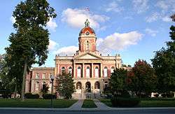
The cities of Goshen, Warsaw, Marion and Wabash are well known for their historical buildings and small town charm. Many of these buildings are located on SR 15.

Major intersections
| County | Location | mi[1] | km | Destinations | Notes |
|---|---|---|---|---|---|
| Grant | Jonesboro | 0.00 | 0.00 | Southern terminus of SR 15 | |
| Marion | 3.72 | 5.99 | Southern end of SR 9 concurrency | ||
| 7.38 | 11.88 | Northern end of SR 9 concurrency | |||
| Wabash | La Fontaine | 14.22 | 22.88 | Western terminus of SR 218 | |
| Noble Township | 20.50 | 32.99 | |||
| Wabash | 23.78 | 38.27 | Southern end of SR 13 concurrency | ||
| 24.90 | 40.07 | Northern end of SR 13 concurrency | |||
| 26.58 | 42.78 | ||||
| Noble Township | 29.38 | 47.28 | Northern terminus of SR 115 | ||
| Paw Paw Township | 34.20 | 55.04 | |||
| Pleasant Township | 40.17 | 64.65 | |||
| Kosciusko | Silver Lake | 45.19 | 72.73 | ||
| Warsaw | 56.79 | 91.39 | Northern terminus of SR 25 | ||
| 59.13 | 95.16 | ||||
| Elkhart | Jackson Township | 72.00 | 115.87 | ||
| Goshen | 79.18 | 127.43 | |||
| 80.87 | 130.15 | Northern terminus of SR 119 | |||
| 81.37 | 130.95 | Southern end of US 33 concurrency | |||
| Western terminus of SR 4 | |||||
| 81.93 | 131.85 | Northern end of US 33 concurrency | |||
| Jefferson Township | 87.54 | 140.88 | |||
| Bristol | 91.29 | 146.92 | Western end of SR 120 concurrency | ||
| 91.52 | 147.29 | Eastern end of SR 120 concurrency | |||
| 93.03 | 149.72 | Indiana Toll road exit 101 | |||
| Washington Township | 94.82 | 152.60 | Michigan state line; northern terminus of SR 15 | ||
1.000 mi = 1.609 km; 1.000 km = 0.621 mi
| |||||
References
- 1 2 "INDOT Roadway Referencing System" (PDF).
- 1 2 "Road Numbers to Be Changed". The Hancock-Democrat. The Indianapolis News. September 30, 1926. Retrieved June 9, 2016 – via Newspapers.com.

- ↑ Yahoo!; Navteq (January 13, 2011). "overview map of SR 15" (Map). Yahoo! Maps. Yahoo!. Retrieved January 13, 2011.
