Alexandria, Indiana
| Alexandria, Indiana | |
|---|---|
| City | |
| Nickname(s): Small Town USA | |
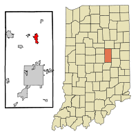 Location in the state of Indiana | |
| Coordinates: 40°15′47″N 85°40′35″W / 40.26306°N 85.67639°W | |
| Country | United States |
| State | Indiana |
| County | Madison |
| Township | Monroe |
| Government | |
| • Mayor | Ron Richardson (D) |
| Area[1] | |
| • Total | 2.63 sq mi (6.81 km2) |
| • Land | 2.63 sq mi (6.81 km2) |
| • Water | 0 sq mi (0 km2) |
| Elevation | 869 ft (265 m) |
| Population (2010)[2] | |
| • Total | 5,145 |
| • Estimate (2012[3]) | 5,080 |
| • Density | 2,000/sq mi (760/km2) |
| Time zone | EST (UTC-5) |
| • Summer (DST) | EDT (UTC-4) |
| ZIP code | 46001 |
| Area code(s) | 765 |
| FIPS code | 18-00910[4] |
| GNIS feature ID | 0430066[5] |
| Website | cityofalexandria.org |
Alexandria is a city in Monroe Township, Madison County, Indiana, United States. It is about 46 miles (74 km) northeast of Indianapolis. According to the 2010 census, its population was 5,145, a decrease of 17.8% from 6,260 in 2000.[6]
History
Alexandria was platted in 1836 when it was certain that the Indiana Central Canal would be extended to that point.[7] It was incorporated as a town in 1898.[8]
Geography
Alexandria is located at 40°15′47″N 85°40′35″W / 40.26306°N 85.67639°WCoordinates: 40°15′47″N 85°40′35″W / 40.26306°N 85.67639°W.[9] According to the 2010 census, Alexandria has a total area of 2.63 square miles (6.81 km2), all land.[10]
Demographics
| Historical population | |||
|---|---|---|---|
| Census | Pop. | %± | |
| 1870 | 287 | — | |
| 1880 | 488 | 70.0% | |
| 1890 | 715 | 46.5% | |
| 1900 | 7,221 | 909.9% | |
| 1910 | 5,096 | −29.4% | |
| 1920 | 4,172 | −18.1% | |
| 1930 | 4,408 | 5.7% | |
| 1940 | 4,801 | 8.9% | |
| 1950 | 5,147 | 7.2% | |
| 1960 | 5,582 | 8.5% | |
| 1970 | 5,600 | 0.3% | |
| 1980 | 6,028 | 7.6% | |
| 1990 | 5,709 | −5.3% | |
| 2000 | 6,260 | 9.7% | |
| 2010 | 5,145 | −17.8% | |
| Est. 2015 | 5,047 | [11] | −1.9% |
Alexandria is part of the Anderson, Indiana Metropolitan Statistical Area.
2010 census
As of the census[2] of 2010, there were 5,145 people, 2,113 households, and 1,362 families residing in the city. The population density was 1,956.3 inhabitants per square mile (755.3/km2). There were 2,507 housing units at an average density of 953.2 per square mile (368.0/km2). The racial makeup of the city was 97.4% White, 0.3% African American, 0.1% Native American, 0.2% Asian, 0.8% from other races, and 1.1% from two or more races. Hispanic or Latino of any race were 1.7% of the population.
There were 2,113 households of which 33.6% had children under the age of 18 living with them, 42.2% were married couples living together, 15.7% had a female householder with no husband present, 6.6% had a male householder with no wife present, and 35.5% were non-families. 30.1% of all households were made up of individuals and 12.8% had someone living alone who was 65 years of age or older. The average household size was 2.41 and the average family size was 2.95.
The median age in the city was 38.2 years. 25.6% of residents were under the age of 18; 8.8% were between the ages of 18 and 24; 24.8% were from 25 to 44; 25.1% were from 45 to 64; and 15.6% were 65 years of age or older. The gender makeup of the city was 47.8% male and 52.2% female.
2000 census
As of the census[4] of 2000, there were 6,260 people, 2,481 households, and 1,654 families residing in the city. The population density was 2,308.6 people per square mile (891.9/km²). There were 2,704 housing units at an average density of 997.2 per square mile (385.2/km²). The racial makeup of the city was 98.10% White, 0.46% Black or African American, 0.08% Native American, 0.11% Asian, 0.02% Pacific Islander, 0.43% from other races, and 0.80% from two or more races. 0.99% of the population were Hispanic or Latino of any race.
There were 2,481 households out of which 33.9% had children under the age of 18 living with them, 49.0% were married couples living together, 12.7% had a female householder with no husband present, and 33.3% were non-families. 28.9% of all households were made up of individuals and 13.1% had someone living alone who was 65 years of age or older. The average household size was 2.48 and the average family size was 3.04.
In the city the population was spread out with 27.8% under the age of 18, 8.9% from 18 to 24, 28.0% from 25 to 44, 19.5% from 45 to 64, and 15.9% who were 65 years of age or older. The median age was 35 years. For every 100 females there were 91.4 males. For every 100 females age 18 and over, there were 87.4 males.
The median income for a household in the city was $35,359, and the median income for a family was $42,731. Males had a median income of $30,529 versus $23,384 for females. The per capita income for the city was $15,578. About 4.2% of families and 7.0% of the population were below the poverty line, including 4.1% of those under age 18 and 15.0% of those age 65 or over.
Government
The city council consists of seven members. Five members are elected from individual districts and two are elected at-large. The city is governed by a "strong" mayor system who appoints two council members and/or city residents to serve at the mayor's pleasure on the board of public works and safety. The chief financial officer is the clerk-treasurer. The clerk-treasure and mayor are full-time elected officials. The Alexandria City Court has a part-time locally elected judge.
Transportation
Airport
Alexandria Airport is a public use airport located southeast of the central business district of Alexandria.[13]
Notable people
- Joey Feek, Country singer
- Bill Gaither, gospel singer
- Danny Gaither, gospel singer
- Gloria Gaither, author
References
- ↑ "US Gazetteer files 2010". United States Census Bureau. Archived from the original on January 24, 2012. Retrieved December 11, 2012.
- 1 2 "American FactFinder". United States Census Bureau. Retrieved December 11, 2012.
- ↑ "Population Estimates". United States Census Bureau. Archived from the original on June 17, 2013. Retrieved June 25, 2013.
- 1 2 "American FactFinder". United States Census Bureau. Archived from the original on September 11, 2013. Retrieved 2008-01-31.
- ↑ "US Board on Geographic Names". United States Geological Survey. 2007-10-25. Retrieved 2008-01-31.
- ↑ "Alexandria (city), Indiana – QuickFacts". United States Census Bureau. Retrieved April 19, 2012.
- ↑ Forkner, John La Rue (1914). History of Madison County, Indiana: A Narrative Account of Its Historical Progress, Its People and Its Principal Interests, Volume 1. Lewis Publishing Company. p. 119.
- ↑ Forkner, John La Rue; Dyson, Byron H. (1897). Historical Sketches and Reminiscences of Madison County, Indiana. Wilson, Humprheys & Co. p. 840.
- ↑ "US Gazetteer files: 2010, 2000, and 1990". United States Census Bureau. 2011-02-12. Retrieved 2011-04-23.
- ↑ "G001 - Geographic Identifiers - 2010 Census Summary File 1". United States Census Bureau. Retrieved 2015-07-25.
- ↑ "Annual Estimates of the Resident Population for Incorporated Places: April 1, 2010 to July 1, 2015". Retrieved July 2, 2016.
- ↑ "Census of Population and Housing". Census.gov. Archived from the original on May 11, 2015. Retrieved June 4, 2015.
- ↑ FAA Airport Master Record for I99 (Form 5010 PDF). Federal Aviation Administration. Effective June 3, 2010.
External links
| Wikimedia Commons has media related to Alexandria, Indiana. |
| Wikisource has the text of the 1911 Encyclopædia Britannica article Alexandria (Indiana). |
Municipalities and communities of Madison County, Indiana, United States | ||
|---|---|---|
| Cities | ||
| Towns | ||
| Townships | ||
| Unincorporated communities |
| |
| Footnotes | ‡This populated place also has portions in an adjacent county or counties | |