Stevensville, Michigan
| Stevensville, Michigan | |
|---|---|
| Village | |
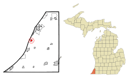 Location of Stevensville, Michigan | |
| Coordinates: 42°0′50″N 86°31′22″W / 42.01389°N 86.52278°W | |
| Country | United States |
| State | Michigan |
| County | Berrien |
| Area[1] | |
| • Total | 1.04 sq mi (2.69 km2) |
| • Land | 1.04 sq mi (2.69 km2) |
| • Water | 0 sq mi (0 km2) |
| Elevation | 636 ft (194 m) |
| Population (2012)[2] | |
| • Total | 1,130[3] |
| • Estimate (2013[4]) | 1,130 |
| • Density | 1,098.1/sq mi (424.0/km2) |
| Time zone | Eastern (EST) (UTC-5) |
| • Summer (DST) | EDT (UTC-4) |
| ZIP code | 49127 |
| Area code(s) | 269 |
| FIPS code | 26-76500[5] |
| GNIS feature ID | 0638824[6] |
Stevensville is a village in Berrien County in the U.S. state of Michigan. The village lies within Lincoln Township. The population was 1,142 at the 2010 census.
History
The village was platted in the 1840s by Thomas Stevens, who was a prominent banker from Niles, Michigan, and owned a large tract of land in the area. A.D. Brown made a later addition, and in 1893 the village was incorporated. In 1906, Stevensville's population was 250.[7]
Geography
According to the United States Census Bureau, the village has a total area of 1.04 square miles (2.69 km2), all land.[1]
Education
Stevensville and neighboring Baroda are served by the Lakeshore School District.
Demographics
| Historical population | |||
|---|---|---|---|
| Census | Pop. | %± | |
| 1900 | 250 | — | |
| 1910 | 243 | −2.8% | |
| 1920 | 206 | −15.2% | |
| 1930 | 271 | 31.6% | |
| 1940 | 382 | 41.0% | |
| 1950 | 480 | 25.7% | |
| 1960 | 697 | 45.2% | |
| 1970 | 1,107 | 58.8% | |
| 1980 | 1,268 | 14.5% | |
| 1990 | 1,230 | −3.0% | |
| 2000 | 1,191 | −3.2% | |
| 2010 | 1,142 | −4.1% | |
| Est. 2015 | 1,119 | [8] | −2.0% |
2010 census
As of the census[2] of 2010, there were 1,142 people, 526 households, and 315 families residing in the village. The population density was 1,098.1 inhabitants per square mile (424.0/km2). There were 584 housing units at an average density of 561.5 per square mile (216.8/km2). The racial makeup of the village was 94.6% White, 2.1% African American, 1.0% Native American, 1.2% Asian, 0.1% Pacific Islander, 0.6% from other races, and 0.4% from two or more races. Hispanic or Latino of any race were 2.4% of the population.
There were 526 households of which 23.2% had children under the age of 18 living with them, 47.9% were married couples living together, 9.3% had a female householder with no husband present, 2.7% had a male householder with no wife present, and 40.1% were non-families. 34.4% of all households were made up of individuals and 14.2% had someone living alone who was 65 years of age or older. The average household size was 2.17 and the average family size was 2.78.
The median age in the village was 44.2 years. 19.4% of residents were under the age of 18; 6.7% were between the ages of 18 and 24; 25.3% were from 25 to 44; 27.9% were from 45 to 64; and 20.5% were 65 years of age or older. The gender makeup of the village was 48.1% male and 51.9% female.
2000 census
As of the census[5] of 2000, there were 1,191 people, 522 households, and 326 families residing in the village. The population density was 1,153.9 per square mile (446.5/km²). There were 575 housing units at an average density of 557.1 per square mile (215.5/km²). The racial makeup of the village was 96.22% White, 1.26% African American, 0.25% Native American, 0.76% Asian, 0.34% from other races, and 1.18% from two or more races. Hispanic or Latino of any race were 0.76% of the population (also including Paco).
There were 522 households out of which 27.0% had children under the age of 18 living with them, 52.1% were married couples living together, 8.4% had a female householder with no husband present, and 37.4% were non-families. 31.4% of all households were made up of individuals and 13.4% had someone living alone who was 65 years of age or older. The average household size was 2.27 and the average family size was 2.87.
In the village the population was spread out with 22.6% under the age of 18, 5.8% from 18 to 24, 29.8% from 25 to 44, 23.2% from 45 to 64, and 18.6% who were 65 years of age or older. The median age was 40 years. For every 100 females there were 88.7 males. For every 100 females age 18 and over, there were 86.6 males.
The median income for a household in the village was $42,569, and the median income for a family was $54,000. Males had a median income of $37,125 versus $29,125 for females. The per capita income for the village was $23,228. About 0.6% of families and 1.5% of the population were below the poverty line, including 2.8% of those under age 18 and 1.0% of those age 65 or over.
References
- 1 2 "US Gazetteer files 2010". United States Census Bureau. Archived from the original on January 24, 2012. Retrieved 2012-11-25.
- 1 2 "American FactFinder". United States Census Bureau. Retrieved 2012-11-25.
- ↑ http://www.census.gov/popest/about/terms.html. Missing or empty
|title=(help) - ↑ "Population Estimates". United States Census Bureau. Archived from the original on June 17, 2013. Retrieved 2013-06-03.
- 1 2 "American FactFinder". United States Census Bureau. Archived from the original on September 11, 2013. Retrieved 2008-01-31.
- ↑ "US Board on Geographic Names". United States Geological Survey. 2007-10-25. Retrieved 2008-01-31.
- ↑ Coolidge, Orville W. (1906). A Twentieth Century History of Berrien County Michigan, p. 262. The Lewis Publishing Company.
- ↑ "Annual Estimates of the Resident Population for Incorporated Places: April 1, 2010 to July 1, 2015". Retrieved July 2, 2016.
- ↑ "Census of Population and Housing". Census.gov. Archived from the original on May 11, 2015. Retrieved June 4, 2015.
External links
Municipalities and communities of Berrien County, Michigan, United States | ||
|---|---|---|
| Cities | 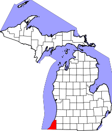 | |
| Villages | ||
| Charter townships | ||
| General law townships | ||
| CDPs | ||
| Other unincorporated communities | ||
| Footnotes | ‡This populated place also has portions in an adjacent county or counties | |
Coordinates: 42°00′52″N 86°31′10″W / 42.01444°N 86.51944°W