Buchanan, Michigan
| Buchanan, Michigan | |
|---|---|
| City | |
| Motto: "Life is better here."[1] | |
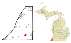 Location of Buchanan, Michigan | |
| Coordinates: 41°49′39″N 86°21′41″W / 41.82750°N 86.36139°W | |
| Country | United States |
| State | Michigan |
| County | Berrien |
| Area[2] | |
| • Total | 2.57 sq mi (6.66 km2) |
| • Land | 2.50 sq mi (6.47 km2) |
| • Water | 0.07 sq mi (0.18 km2) |
| Elevation | 696 ft (212 m) |
| Population (2010)[3] | |
| • Total | 4,456 |
| • Estimate (2012[4]) | 4,428 |
| • Density | 1,782.4/sq mi (688.2/km2) |
| Time zone | Eastern (EST) (UTC−5) |
| • Summer (DST) | EDT (UTC−4) |
| ZIP code | 49107 |
| Area code | 269 |
| FIPS code | 26-11400[5] |
| GNIS feature ID | 1618891[6] |
| Website | City of Buchanan, Michigan |
Buchanan is a city in Berrien County in the U.S. state of Michigan. The population was 4,456 at the 2010 census. The city is located at the southeast corner of Buchanan Township, about 5 miles (8 km) west of Niles.
History
The community was named after James Buchanan, the 15th President of the United States.[7] Popularly known as "Redbud City" because of the many redbud trees that have historically lined city streets and the major approaches to the city, Buchanan has long been recognized as a Tree City USA by the National Arbor Day Foundation.
The St. Joseph River was once a major transportation route for Native American tribes in the area, especially the Potawatomi, and a historical marker to that effect has been placed on Moccasin Trail north of Buchanan near Batchelors Island.[8]
The area was first settled in 1833 at the spot where McCoy Creek meets the St. Joseph River.[9] The village of Buchanan was platted in 1842 and incorporated in 1858.[10]
On April 12, 1979, farms, houses and mobile homes just north of the city were damaged by an F2 tornado. No lives were lost but several residences sustained significant damage.[11][12]
Geography
According to the United States Census Bureau, the city has a total area of 2.57 square miles (6.66 km2), of which 2.50 square miles (6.47 km2) is land and 0.07 square miles (0.18 km2) is water.[2]
Demographics
| Historical population | |||
|---|---|---|---|
| Census | Pop. | %± | |
| 1870 | 1,702 | — | |
| 1880 | 1,894 | 11.3% | |
| 1890 | 1,994 | 5.3% | |
| 1900 | 1,708 | −14.3% | |
| 1910 | 1,831 | 7.2% | |
| 1920 | 3,187 | 74.1% | |
| 1930 | 3,922 | 23.1% | |
| 1940 | 4,056 | 3.4% | |
| 1950 | 5,224 | 28.8% | |
| 1960 | 5,341 | 2.2% | |
| 1970 | 4,645 | −13.0% | |
| 1980 | 5,142 | 10.7% | |
| 1990 | 4,992 | −2.9% | |
| 2000 | 4,681 | −6.2% | |
| 2010 | 4,456 | −4.8% | |
| Est. 2015 | 4,362 | [13] | −2.1% |
2010 census
As of the census[3] of 2010, there were 4,456 people, 1,901 households, and 1,136 families residing in the city. The population density was 1,782.4 inhabitants per square mile (688.2/km2). There were 2,139 housing units at an average density of 855.6 per square mile (330.3/km2). The racial makeup of the city was 86.6% White, 7.5% African American, 1.2% Native American, 0.3% Asian, 1.3% from other races, and 3.1% from two or more races. Hispanic or Latino of any race were 3.3% of the population.
There were 1,901 households of which 31.5% had children under the age of 18 living with them, 40.1% were married couples living together, 13.3% had a female householder with no husband present, 6.4% had a male householder with no wife present, and 40.2% were non-families. 34.8% of all households were made up of individuals and 14.9% had someone living alone who was 65 years of age or older. The average household size was 2.34 and the average family size was 3.01.
The median age in the city was 37.6 years. 24.6% of residents were under the age of 18; 9.3% were between the ages of 18 and 24; 26.3% were from 25 to 44; 25.6% were from 45 to 64; and 14.3% were 65 years of age or older. The gender makeup of the city was 48.1% male and 51.9% female.
2000 census
As of the 2000 census,[5] there were 4,681 people, 1,915 households, and 1,191 families in the city. The population density was 1,950.8 per square mile (753.1/km²). There were 2,098 housing units, for an average density of 874.3 per square mile (337.5/km²). The racial makeup of the city was 86.26% White, 10.23% African American, 1.92% multiracial, 0.60% other races, 0.51% Asian, and 0.47% Native American. Hispanics or Latinos of any race were 1.84% of the population.
There were 1,915 households out of which 30.9% had children under the age of 18 living with them, 44.5% were married couples living together, 13.3% had a female householder with no husband present, and 37.8% were non-families. 32.0% of all households were made up of individuals and 14.7% had someone living alone who was 65 years of age or older. The average household size was 2.41 and the average family size was 3.05.
The age structure of the population was diffuse, with 25.6% under the age of 18, 9.6% aged 18–24, 29.0% aged 25–44, 21.3% aged 45–64, and 14.5% 65 years of age or older. The median age was 35. Sex ratio was skewed toward females, with 87.5 males for every 100 females of all ages and 83.1 males for every 100 females 18 years or older.
Median income was $34,244 for a household and $43,860 for a family. Males had a median income of $32,950 versus $21,857 for females. Per capita income was $16,600. About 10.9% of families and 12.4% of the population were below the poverty line, including 14.7% of those younger than 18 and 10.7% of those older than 64.
Economy
Buchanan was historically known as the headquarters for Clark Equipment Company, a manufacturer of truck axles, fork lift trucks, front-end loaders, and other heavy machinery. The company was formed in 1916 out of an acquisition of two other Buchanan companies.[15] Clark left the area in the 1990s, forcing the city to diversify, and a number of smaller businesses took over the buildings Clark essentially donated to the city.
Electro-Voice, a manufacturer of high quality audio equipment such as microphones, amplifiers and loudspeakers, was also headquartered in Buchanan.
Arts and culture
Attractions
Pears Mill, a flour mill using the water power of the swiftly flowing McCoy Creek, was built in 1857 and still stands. It is open during the summer for visitors.
The Tin Shop Theatre, located near Pears Mill, is a small theater with performances in the summer. The seasons run into September and a variety of shows for everyone of any age and any occasion are performed there.
Many other attractions are located in surrounding Buchanan Township.
Sports
The Red Bud MX motocross track, part of the AMA National Motocross, sits just outside Buchanan. It is home to the biggest jump in the circuit, "Larocco's Leap." Named after 250cc and 500cc Motocross Champion Mike Larocco. Every Fourth of July, Redbud MX hosts a professional AMA motocross race in Buchanan. The track holds professional Traxxas TORC Series off road buggy and truck races and it has held off-road races in the SODA days.
Education
Buchanan Community Schools consists of two elementary schools, Ottawa and Moccasin (grades K-4), Buchanan Middle School (grades 5-7), and Buchanan High School.[16]
Infrastructure
Transportation
Buchanan is located 1.5 miles (2.4 km) north of US 12, 2.3 miles (3.7 km) west of US 31, 9.3 miles (15.0 km) north of the US 31 interchange on the Indiana Toll Road (I-80|I-90), and 20 miles (32.2 km) east of I-94 (exit 4 via US 12).
The nearest rail hubs are the Amtrak stations at Niles and New Buffalo, and the South Shore Line station in South Bend, Indiana.
Commercial air service is provided by the South Bend International Airport, with flights to larger hubs such as Atlanta, Chicago O’Hare, Cincinnati, Cleveland, Detroit, Las Vegas, Minneapolis-St. Paul, Orlando, and St. Petersburg-Clearwater.
Notable people
- Virgil Exner, influential automobile designer, lived in Buchanan during his youth and graduated from Buchanan High School[17]
- Jack "Sky" Knight, aviation pioneer
- Harry Niles, outfielder and second baseman for St. Louis Browns, New York Highlanders, Boston Red Sox, and Cleveland Naps; born in Buchanan
- Jackson Scholz, the 200-m sprint champion in the 1924 Olympics (portrayed in the film Chariots of Fire), also a successful author; born in Buchanan
References
- ↑ "City of Buchanan, Michigan". City of Buchanan, Michigan. Retrieved August 24, 2012.
- 1 2 "US Gazetteer files 2010". United States Census Bureau. Archived from the original on 2012-07-14. Retrieved 2012-11-25.
- 1 2 "American FactFinder". United States Census Bureau. Retrieved 2012-11-25.
- ↑ "Population Estimates". United States Census Bureau. Archived from the original on 2013-06-17. Retrieved 2013-06-03.
- 1 2 "American FactFinder". United States Census Bureau. Archived from the original on 2013-09-11. Retrieved 2008-01-31.
- ↑ "US Board on Geographic Names". United States Geological Survey. 2007-10-25. Retrieved 2008-01-31.
- ↑ Hoogterp, Edward (2006). West Michigan Almanac, p. 168. The University of Michigan Press & The Petoskey Publishing Company.
- ↑ "Moccasin Bluff". The Michigan Historical Marker Web Site. Retrieved 2008-04-01.
- ↑ "City of Buchanan profile" (PDF). Berrien County Community Development Department. January 2008. Archived from the original (PDF) on August 20, 2008. Retrieved 2008-04-01.
- ↑ Coolidge, Orville W. (1906). A Twentieth Century History of Berrien County, Michigan, p. 216. The Lewis Publishing Company.
- ↑ "Berrien County MI Tornado Track Map" (PDF). National Weather Service Northern Indiana Weather Forecast Office: Historical Tornado Data, Statistics and Maps For NWS Northern Indiana County Warning Area. Retrieved 2008-04-01. External link in
|publisher=(help) - ↑ "On Apr 12 in weather history...". National Weather Service Northern Indiana Weather Forecast Office: Toady in Weather History. Retrieved 2008-04-01. External link in
|publisher=(help) - ↑ "Annual Estimates of the Resident Population for Incorporated Places: April 1, 2010 to July 1, 2015". Retrieved July 2, 2016.
- ↑ "Census of Population and Housing". Census.gov. Archived from the original on May 11, 2015. Retrieved June 4, 2015.
- ↑ Michigan Manufacturer and Financial Record, Dec. 30, 1916, "New Corporation Acquires Two Buchanan Companies", p. 15.
- ↑ "Buchanan Community Schools". buchananschools.com. Retrieved 4 February 2016.
- ↑ Virgil Exner Visioneer, by Peter Grist, Veloce Publishing Limited, 2007
External links
Coordinates: 41°49′38″N 86°21′40″W / 41.82722°N 86.36111°W
Municipalities and communities of Berrien County, Michigan, United States | ||
|---|---|---|
| Cities | 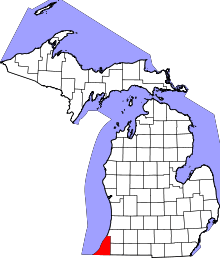 | |
| Villages | ||
| Charter townships | ||
| General law townships | ||
| CDPs | ||
| Other unincorporated communities | ||
| Footnotes | ‡This populated place also has portions in an adjacent county or counties | |