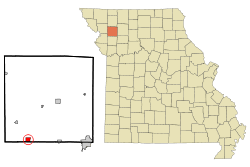
Stewartsville, Missouri
| Stewartsville, Missouri | |
|---|---|
| City | |
 | |
| Coordinates: 39°45′9″N 94°29′55″W / 39.75250°N 94.49861°WCoordinates: 39°45′9″N 94°29′55″W / 39.75250°N 94.49861°W | |
| Country | United States |
| State | Missouri |
| County | DeKalb |
| Area[1] | |
| • Total | 1.00 sq mi (2.59 km2) |
| • Land | 0.99 sq mi (2.56 km2) |
| • Water | 0.01 sq mi (0.03 km2) |
| Elevation | 965 ft (294 m) |
| Population (2010)[2] | |
| • Total | 750 |
| • Estimate (2012[3]) | 752 |
| • Density | 757.6/sq mi (292.5/km2) |
| Time zone | Central (CST) (UTC-6) |
| • Summer (DST) | CDT (UTC-5) |
| ZIP code | 64490 |
| Area code(s) | 816 |
| FIPS code | 29-70738[4] |
| GNIS feature ID | 0729660[5] |
Stewartsville is a city in DeKalb County, Missouri, United States. The population was 750 at the 2010 census. The community is named for Robert M. Stewart, a former Missouri governor. It is part of the St. Joseph, MO–KS Metropolitan Statistical Area.
History
Stewartsville was originally called Tethertown, and under the latter name was platted in 1854 by George Tetherow, and named for him.[6] A post office called Stewartsville has been in operation since 1855.[7]
Geography
Stewartsville is located at 39°45'9" North, 94°29'55" West (39.752627, -94.498624).[8] According to the United States Census Bureau, the city has a total area of 1.00 square mile (2.59 km2), of which, 0.99 square miles (2.56 km2) is land and 0.01 square miles (0.03 km2) is water.[1]
Stewartsville is located by U.S. Route 36.
Demographics
| Historical population | |||
|---|---|---|---|
| Census | Pop. | %± | |
| 1880 | 537 | — | |
| 1890 | 557 | 3.7% | |
| 1900 | 616 | 10.6% | |
| 1910 | 543 | −11.9% | |
| 1920 | 534 | −1.7% | |
| 1930 | 520 | −2.6% | |
| 1940 | 478 | −8.1% | |
| 1950 | 414 | −13.4% | |
| 1960 | 466 | 12.6% | |
| 1970 | 634 | 36.1% | |
| 1980 | 832 | 31.2% | |
| 1990 | 732 | −12.0% | |
| 2000 | 759 | 3.7% | |
| 2010 | 750 | −1.2% | |
| Est. 2015 | 735 | [9] | −2.0% |
2010 census
As of the census[2] of 2010, there were 750 people, 298 households, and 209 families residing in the city. The population density was 757.6 inhabitants per square mile (292.5/km2). There were 320 housing units at an average density of 323.2 per square mile (124.8/km2). The racial makeup of the city was 96.8% White, 0.5% African American, 0.1% Native American, 0.1% Pacific Islander, 0.8% from other races, and 1.6% from two or more races. Hispanic or Latino of any race were 2.0% of the population.
There were 298 households of which 30.5% had children under the age of 18 living with them, 51.0% were married couples living together, 12.8% had a female householder with no husband present, 6.4% had a male householder with no wife present, and 29.9% were non-families. 24.2% of all households were made up of individuals and 10.1% had someone living alone who was 65 years of age or older. The average household size was 2.52 and the average family size was 2.98.
The median age in the city was 40.1 years. 23.1% of residents were under the age of 18; 9.9% were between the ages of 18 and 24; 23.8% were from 25 to 44; 28.2% were from 45 to 64; and 14.8% were 65 years of age or older. The gender makeup of the city was 48.9% male and 51.1% female.
2000 census
As of the census[4] of 2000, there were 759 people, 288 households, and 211 families residing in the city. The population density was 779.5 people per square mile (302.1/km²). There were 308 housing units at an average density of 316.3 per square mile (122.6/km²). The racial makeup of the city was 96.84% White, 1.58% African American, 0.13% Native American, 0.13% Asian, 0.26% from other races, and 1.05% from two or more races. Hispanic or Latino of any race were 1.19% of the population.
There were 288 households out of which 35.8% had children under the age of 18 living with them, 57.6% were married couples living together, 9.7% had a female householder with no husband present, and 26.7% were non-families. 24.3% of all households were made up of individuals and 14.2% had someone living alone who was 65 years of age or older. The average household size was 2.64 and the average family size was 3.12.
In the city the population was spread out with 27.8% under the age of 18, 8.4% from 18 to 24, 29.4% from 25 to 44, 18.7% from 45 to 64, and 15.7% who were 65 years of age or older. The median age was 36 years. For every 100 females there were 89.3 males. For every 100 females age 18 and over, there were 87.7 males.
The median income for a household in the city was $35,063, and the median income for a family was $40,789. Males had a median income of $31,563 versus $19,917 for females. The per capita income for the city was $14,509. About 7.4% of families and 7.6% of the population were below the poverty line, including 4.6% of those under age 18 and 19.6% of those age 65 or over.
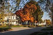
Gallery
|
.JPG)
References
- 1 2 "US Gazetteer files 2010". United States Census Bureau. Archived from the original on January 24, 2012. Retrieved 2012-07-08.
- 1 2 "American FactFinder". United States Census Bureau. Retrieved 2012-07-08.
- ↑ "Population Estimates". United States Census Bureau. Archived from the original on June 17, 2013. Retrieved 2013-05-30.
- 1 2 "American FactFinder". United States Census Bureau. Archived from the original on September 11, 2013. Retrieved 2008-01-31.
- ↑ "US Board on Geographic Names". United States Geological Survey. 2007-10-25. Retrieved 2008-01-31.
- ↑ "DeKalb County Place Names, 1928–1945 (archived)". The State Historical Society of Missouri. Retrieved 27 September 2016.
- ↑ "Post Offices". Jim Forte Postal History. Retrieved 27 September 2016.
- ↑ "US Gazetteer files: 2010, 2000, and 1990". United States Census Bureau. 2011-02-12. Retrieved 2011-04-23.
- ↑ "Annual Estimates of the Resident Population for Incorporated Places: April 1, 2010 to July 1, 2015". Retrieved July 2, 2016.
- ↑ "Census of Population and Housing". Census.gov. Archived from the original on May 11, 2015. Retrieved June 4, 2015.
External links
- Historic maps of Stewartsville in the Sanborn Maps of Missouri Collection at the University of Missouri
Municipalities and communities of DeKalb County, Missouri, United States | ||
|---|---|---|
| Cities | 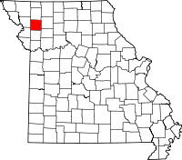 | |
| Villages | ||
| Townships | ||
| Unincorporated communities | ||
| Ghost towns | ||
| Footnotes | ‡This populated place also has portions in an adjacent county or counties | |