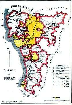
Surat district
| Surat district | |
|---|---|
| district | |
 Location of district in Gujarat | |
| Country |
|
| State | Gujarat |
| Headquarters | Surat |
| Languages | |
| • Official | Gujarati, Hindi, English |
| Time zone | IST (UTC+5:30) |
| Vehicle registration | GJ |
| Website |
gujaratindia |
Surat is a district in the state of Gujarat India with Surat city as the administrative headquarters of this district. It is surrounded by Bharuch, Narmada (North), Navsari (South) districts and east Tapi district To the west is the Gulf of Cambay. It is the second-most advanced district in Gujarat. It had a population of 6,079,231 of which 79.68% were urban as of 2011. On 2 October 2007 Surat district was split into two by the creation of a new Tapi district, under the Surat District Re-organisation Act 2007.
As of 2011 it is the second most populous district of Gujarat (out of 33), after Ahmadabad.[1]
Geography
Surat District's total area is 4,418 sq. km, and the density of Surat District was 1,376 per sq.km at the 2011 Census.
Climate
| Climate data for Surat, Gujarat (1932-1980) | |||||||||||||
|---|---|---|---|---|---|---|---|---|---|---|---|---|---|
| Month | Jan | Feb | Mar | Apr | May | Jun | Jul | Aug | Sep | Oct | Nov | Dec | Year |
| Source #1: Sistema de Clasificación Bioclimática Mundial[2] | |||||||||||||
| Source #2: World Climate Guide (sunshine only)[3] | |||||||||||||
Demographics
According to the 2011 census Surat district has a population of 6,079,231,[1] roughly equal to the nation of El Salvador[4] or the US state of Missouri.[5] This gives it a ranking of 12th in India (out of a total of 640).[1] The district has a population density of 1,376 inhabitants per square kilometre (3,560/sq mi) .[1] Its population growth rate over the decade 2001-2011 was 42.19%.[1] Surat has a sex ratio of 788 females for every 1000 males,[1] and a literacy rate of 86.5%.[1]
Culture
Places of tourist interest in Surat are the old fort build by Muhammad- Bin- Tughlaq, the Unai hot spring, the beautiful beaches of Ubharat and Tithal, the villages of Bardoli and Dandi where Gandhiji started Satyagraha movement and Dandi march respectively. The Vansada National Park in Surat is famous for the wild boars, leopards, tigers, panther it houses.[6]
Notable personalities
- Narmadashankar Dave (1833–1886) Author, poet, scholar and public speaker. Born in Surat.
- Shaikh Randeri (a.k.a. Shaikh Raneri) was famous for spreading the Islamic faith to Indonesia.
- Navalram (1836–1888) Author and literary critic. Born in Surat.
- Ranjitram Mehta (1881–1917) Author. Born in Surat.
- Gunvant Shah (1937- ) Author. Born in Rander.[7]
References
- 1 2 3 4 5 6 7 "District Census 2011". Census2011.co.in. 2011. Retrieved 2011-09-30.
- ↑ "INDIA - SURAT". Centro de Investigaciones Fitosociológicas. Retrieved 2011-09-24.
- ↑ "Surat Climate Guide". World Climate Guide. Retrieved 2011-09-24.
- ↑ US Directorate of Intelligence. "Country Comparison:Population". Retrieved 2011-10-01.
El Salvador 6,071,774 July 2011 est.
- ↑ "2010 Resident Population Data". U. S. Census Bureau. Retrieved 2011-09-30.
Missouri 5,988,927
- ↑ http://www.censusindiamaps.net/page/India_WhizMap/IndiaMap.htm
- ↑ {{Basic Information about Gunvant Shah}}
See also
List of tourist attractions in Surat
External links
| Wikimedia Commons has media related to Surat district. |
- Official site
- best places in Surat
 |
Gulf of Khambhat | Bharuch district | Narmada district | |
| |
Tapi district | |||
| ||||
| | ||||
| Arabian Sea | Navsari district |
| Topics | 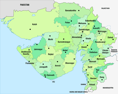 | |
|---|---|---|
| Regions of Gujarat |
| |
| Districts | ||
| Major cities | ||
| Ecoregions | ||
| Economy |
| |
| ||
Coordinates: 20°55′N 73°03′E / 20.917°N 73.050°E