Tassajara, California
| Tassajara | |
|---|---|
| Unincorporated community | |
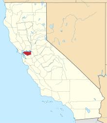
 Tassajara Location in California | |
| Coordinates: 37°47′45″N 121°51′49″W / 37.79583°N 121.86361°WCoordinates: 37°47′45″N 121°51′49″W / 37.79583°N 121.86361°W[1] | |
| Country | United States |
| State | California |
| County | Contra Costa County |
| Elevation[1] | 709 ft (216 m) |
| GNIS ID[1][2] | 253965 |
| FIPS code[1][2] | 06-77973 |
Tassajara (until 1959, Tassajero;[1] also formerly called Tasajero and Tassajera[3]) is an unincorporated community in Contra Costa County, California, United States.[1] It is located on the east bank of Tassajara Creek, 6.5 miles (10 km) south-southeast of Mount Diablo,[3] at an elevation of 709 feet (216 m).[1] Together with Blackhawk it forms the Blackhawk-Camino Tassajara census designated place (CDP).
A post office operated at Tassajara from 1896 to 1922.[3]
References
- 1 2 3 4 5 6 7 "Tassajara (Contra Costa County, California)". Geographic Names Information System. United States Geological Survey. Retrieved May 11, 2014.
- 1 2 "FIPS55 Data: California". FIPS55 Data. United States Geological Survey. February 23, 2006. Archived from the original on June 18, 2006. Retrieved May 11, 2014. External link in
|work=(help) - 1 2 3 Durham, David L. (1998). California's Geographic Names: A Gazetteer of Historic and Modern Names of the State. Clovis, Calif.: Word Dancer Press. p. 711. ISBN 1-884995-14-4.
This article is issued from Wikipedia - version of the 3/31/2016. The text is available under the Creative Commons Attribution/Share Alike but additional terms may apply for the media files.