Orwood, California
| Orwood | |
|---|---|
| Unincorporated community | |
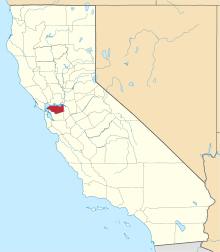
 Orwood Location in California | |
| Coordinates: 37°56′24″N 121°34′08″W / 37.94000°N 121.56889°WCoordinates: 37°56′24″N 121°34′08″W / 37.94000°N 121.56889°W | |
| Country | United States |
| State | California |
| County | Contra Costa County |
| Elevation[1] | 3 ft (1 m) |
| GNIS ID[1][2] | 252758 |
| FIPS code[1][2] | 06-54456 |
This article is about a community in California. For the ghost town in Mississippi, see Orwood, Mississippi.
Orwood is an unincorporated community in Contra Costa County, California, United States.[1] It is located on the Atchison, Topeka and Santa Fe Railroad 7 miles (11 km) east of Brentwood,[3] at an elevation of 3 feet (1 m). The ZIP Code is 94514. The community is inside area code 925.
A post office operated at Orwood from 1913 to 1921.[3] Orwood is named after its promoter, Orville Y. Woodward.[3]
References
- 1 2 3 4 "Orwood (Contra Costa County, California)". Geographic Names Information System. United States Geological Survey. Retrieved May 10, 2014.
- 1 2 "FIPS55 Data: California". FIPS55 Data. United States Geological Survey. February 23, 2006. Archived from the original on June 18, 2006. Retrieved May 10, 2014. External link in
|work=(help) - 1 2 3 Durham, David L. (1998). California's Geographic Names: A Gazetteer of Historic and Modern Names of the State. Clovis, Calif.: Word Dancer Press. p. 676. ISBN 1-884995-14-4.
| Bodies of water |
|  |
|---|---|---|
| Counties | ||
| Major cities | ||
| Cities and towns 100k–250k | ||
| Cities and towns 50k–99k | ||
| Cities and towns 25k-50k | ||
| Cities and towns 10k–25k |
| |
| Sub-regions | ||
This article is issued from Wikipedia - version of the 3/31/2016. The text is available under the Creative Commons Attribution/Share Alike but additional terms may apply for the media files.