Pacheco, California
| Pacheco | |
|---|---|
| Census-designated place | |
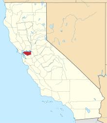
 Location in Contra Costa County and the state of California | |
 Pacheco Location in the United States | |
| Coordinates: 37°59′01″N 122°04′31″W / 37.98361°N 122.07528°WCoordinates: 37°59′01″N 122°04′31″W / 37.98361°N 122.07528°W | |
| Country |
|
| State |
|
| County | Contra Costa |
| Government | |
| • State senator | Steve Glazer (D)[1] |
| • Assemblymember | Tim Grayson (D)[2] |
| • U. S. rep. | Mark DeSaulnier (D)[3] |
| Area[4] | |
| • Total | 0.740 sq mi (1.917 km2) |
| • Land | 0.740 sq mi (1.917 km2) |
| • Water | 0 sq mi (0 km2) 0% |
| Elevation[5] | 75 ft (23 m) |
| Population (2010) | |
| • Total | 3,685 |
| • Density | 5,000/sq mi (1,900/km2) |
| Time zone | Pacific (UTC-8) |
| • Summer (DST) | PDT (UTC-7) |
| ZIP code | 94553 |
| Area code | 925 |
| FIPS code | 06-54764 |
| GNIS feature IDs | 1659330, 2409012 |
| [5] | |
Pacheco is a census-designated place (CDP) in Contra Costa County, California, United States. The population was 3,685 at the 2010 census. It is located 5.5 miles (9 km) north of Walnut Creek.[6]
Geography
According to the United States Census Bureau, the CDP has a total area of 0.7 square miles (1.8 km2), all of it land.
Climate
This region experiences warm (but not hot) and dry summers, with no average monthly temperatures above 71.6 °F. According to the Köppen Climate Classification system, Pacheco has a warm-summer Mediterranean climate, abbreviated "Csb" on climate maps.[7]
History
The town was laid out in 1857 by Dr. J.H. Carothers and named for Salvio Pacheco, grantee of the Rancho Monte del Diablo Mexican land grant.[6] A post office operated at Pacheco from 1859 to 1913 and from 1955 to the present.[6]
Pacheco was briefly a prosperous commercial center. During this period, Pacheco Slough was deep enough to receive ocean-based shipping. A series of fires and floods, as well as an earthquake, destroyed the town and filled the Slough with silt during the 1860s. Pacheco was subsequently depopulated by the attraction of the nearby town of Todos Santos, later to be known as Concord.[8]
Annexation
In January 2011 the Martinez City Council voted to annex those portions of Pacheco north of California State Route 4. In September 2011, Martinez reached a tax sharing deal to pave the way forward for the annexation.[9]
In March 2012, sufficient protests were registered to force an election on the issue.[10] In August 2012, the Martinez Police were mobilized to convince the voters to agree to the proposal.[11]
As part of the annexation, Martinez would take over the management of the new Pacheco transit hub.[12]
In August 2012 North Pacheco rejected annexation. Residents and property owners voted 40-39 against becoming part of Martinez. The 111-acre area remains unincorporated, governed by the County Board of Supervisors.
Opponents of the annexation called it a "bad deal for all" on a website created to slam the proposal. The site claims that annexing Pacheco would be too costly for Martinez — a city already suffering a deficit, and that property taxes would go up for residents and businesses.The Contra Costa Times reported that annexation of as area along Interstate 680 from Highway 4 north to the BNSF railroad crossing was approved by the Contra Costa County Local Area Formation Commission earlier this year. LAFCO's Executive Officer Lou Ann Texeira said that commissioners will have to take action to terminate the annexation at the Sept. 12 meeting,.
City leaders say that the North Pacheco gateway area offers the potential for profit-making development.
The Martinez city council has scheduled another vote on the issue, possibly with a larger area.[13]
Demographics
2010
The 2010 United States Census[14] reported that Pacheco had a population of 3,685. The population density was 4,978.4 people per square mile (1,922.2/km²). The racial makeup of Pacheco was 2,814 (76.4%) White, 78 (2.1%) African American, 27 (0.7%) Native American, 366 (9.9%) Asian, 11 (0.3%) Pacific Islander, 201 (5.5%) from other races, and 188 (5.1%) from two or more races. Hispanic or Latino of any race were 619 persons (16.8%).
The Census reported that 3,662 people (99.4% of the population) lived in households, 23 (0.6%) lived in non-institutionalized group quarters, and 0 (0%) were institutionalized.
There were 1,558 households, out of which 403 (25.9%) had children under the age of 18 living in them, 607 (39.0%) were opposite-sex married couples living together, 247 (15.9%) had a female householder with no husband present, 84 (5.4%) had a male householder with no wife present. There were 94 (6.0%) unmarried opposite-sex partnerships, and 19 (1.2%) same-sex married couples or partnerships. 498 households (32.0%) were made up of individuals and 206 (13.2%) had someone living alone who was 65 years of age or older. The average household size was 2.35. There were 938 families (60.2% of all households); the average family size was 2.97.
The population was spread out with 706 people (19.2%) under the age of 18, 264 people (7.2%) aged 18 to 24, 898 people (24.4%) aged 25 to 44, 1,231 people (33.4%) aged 45 to 64, and 586 people (15.9%) who were 65 years of age or older. The median age was 44.4 years. For every 100 females there were 92.5 males. For every 100 females age 18 and over, there were 87.9 males.
There were 1,642 housing units at an average density of 2,218.3 per square mile (856.5/km²), of which 1,267 (81.3%) were owner-occupied, and 291 (18.7%) were occupied by renters. The homeowner vacancy rate was 1.5%; the rental vacancy rate was 12.6%. 2,919 people (79.2% of the population) lived in owner-occupied housing units and 743 people (20.2%) lived in rental housing units.
2000
As of the census[15] of 2000, there were 3,562 people, 1,563 households, and 923 families residing in the CDP. The population density was 4,878.4 people per square mile (1,884.0/km²). There were 1,620 housing units at an average density of 2,218.7 per square mile (856.8/km²). The racial makeup of the CDP was 82.85% White, 2.22% Black or African American, 0.79% Native American, 7.41% Asian, 0.22% Pacific Islander, 2.95% from other races, and 3.57% from two or more races. 11.82% of the population were Hispanic or Latino of any race.
There were 1,563 households out of which 23.6% had children under the age of 18 living with them, 40.1% were married couples living together, 13.8% had a female householder with no husband present, and 40.9% were non-families. 32.8% of all households were made up of individuals and 13.4% had someone living alone who was 65 years of age or older. The average household size was 2.28 and the average family size was 2.87.
In the CDP the population was spread out with 20.5% under the age of 18, 6.5% from 18 to 24, 30.2% from 25 to 44, 26.7% from 45 to 64, and 16.1% who were 65 years of age or older. The median age was 40 years. For every 100 females there were 92.1 males. For every 100 females age 18 and over, there were 85.0 males.
The median income for a household in the CDP was $45,851, and the median income for a family was $58,938. Males had a median income of $48,466 versus $33,359 for females. The per capita income for the CDP was $26,064. About 7.9% of families and 10.2% of the population were below the poverty line, including 11.0% of those under age 18 and 7.7% of those age 65 or over.
Media
The town of Pacheco is served by the daily newspaper, Contra Costa Times published by Bay Area News Group-East Bay (part of the Media News Group, Denver, Colorado). The paper was originally run and owned by the Lesher family. Claycord.com is the independent news and talk blog serving the greater Pacheco area.
References
- ↑ "Senators". State of California. Retrieved March 30, 2013.
- ↑ "Members Assembly". State of California. Retrieved March 30, 2013.
- ↑ "California's 11th Congressional District - Representatives & District Map". Civic Impulse, LLC. Retrieved March 9, 2013.
- ↑ "2010 Census U.S. Gazetteer Files – Places – California". United States Census Bureau.
- 1 2 "Pacheco". Geographic Names Information System. United States Geological Survey.
- 1 2 3 Durham, David L. (1998). California's Geographic Names: A Gazetteer of Historic and Modern Names of the State. Clovis, Calif.: Word Dancer Press. p. 676. ISBN 1-884995-14-4.
- ↑ Climate Summary for Pacheco, California
- ↑ Tatam, Robert Daras (1996). Old Times in Contra Costa. Pittsburg, Calif.: Highland Publishers. pp. 114–115. ISBN 0-9637954-3-0.
- ↑ White, Lisa P. "Tax sharing deal for North Pacheco clears way for annexation into Martinez." Contra Costa Times, 21 October 2011. Archived June 19, 2013, at the Wayback Machine.
- ↑ Mart, Greta. "Residents Likely To Hit Polls Over N. Pacheco Annexation." Martinez News Gazette. March 10, 2012.
- ↑ Mart, Greta. "Measure T Realities Hit North Pacheco Residents." Gibson Publications, 12 August 2012.
- ↑ "Planned Pacheco transit hub will bring together buses, bikes and carpools."
- ↑ White, Lisa P. (29 November 2013). "Martinez may take another shot at annexing North Pacheco". contracostatimes.com. Contra Costa Times. Retrieved 29 November 2013.
- ↑ "2010 Census Interactive Population Search: CA - Pacheco CDP". U.S. Census Bureau. Retrieved July 12, 2014.
- ↑ "American FactFinder". United States Census Bureau. Retrieved 2008-01-31.
 |
Benicia | Suisun Bay | | |
| Martinez | |
Buchanan Field Airport | ||
| ||||
| | ||||
| Pleasant Hill | Concord |
| Bodies of water |
|  |
|---|---|---|
| Counties | ||
| Major cities | ||
| Cities and towns 100k–250k | ||
| Cities and towns 50k–99k | ||
| Cities and towns 25k-50k | ||
| Cities and towns 10k–25k |
| |
| Sub-regions | ||