Hercules, California
| Hercules, California | ||
|---|---|---|
| City | ||
| City of Hercules | ||
|
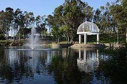
Refugio Valley Park | ||
| ||
| Motto: "The Dynamic City on the Bay"[1] | ||
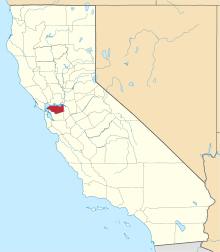
 Location of Hercules within California | ||
 Hercules, California Location in the United States | ||
| Coordinates: 38°01′02″N 122°17′19″W / 38.01722°N 122.28861°WCoordinates: 38°01′02″N 122°17′19″W / 38.01722°N 122.28861°W | ||
| Country |
| |
| State |
| |
| County | Contra Costa | |
| Incorporated | December 15, 1900[2] | |
| Government | ||
| • City Manager | Steve Duran[3] | |
| • City Council |
Mayor John Delgado Vice Mayor Myrna De Vera Bill Kelly Sherry McCoy Dan Romero[4] | |
| • State Leg. |
Sen. Nancy Skinner (D)[5] Asm. Tony Thurmond (D)[6] | |
| • U. S. Congress | Mike Thompson (D)[7] | |
| Area[8] | ||
| • Total | 18.179 sq mi (47.084 km2) | |
| • Land | 6.205 sq mi (16.072 km2) | |
| • Water | 11.974 sq mi (31.012 km2) 65.87% | |
| Elevation | 79 ft (24 m) | |
| Population (2010) | ||
| • Total | 24,060 | |
| • Density | 1,300/sq mi (510/km2) | |
| Time zone | PST (UTC-8) | |
| • Summer (DST) | PDT (UTC-7) | |
| ZIP code | 94547 | |
| Area code(s) | 510 | |
| FIPS code | 06-33308 | |
| GNIS feature IDs | 1658738, 2410746 | |
| Website |
www | |
Hercules is a city in western Contra Costa County, California. Situated along the coast of San Pablo Bay, it is located in the eastern region of the San Francisco Bay Area, about 10 miles (16 km) north of Berkeley. Hercules has a 2010 population of 24,060 according to the U.S. Census.
History
Upon relocating its operations from San Francisco in 1881, California Powder Works established company housing in the area that is now the city of Hercules. The city was named after the company's leading product,[9] in turn, named after the Roman hero, Hercules.
Hercules contributed significantly to the production of explosives during both World Wars. By the Second World War, the plant had diversified to produce fertilizers and other chemical products. However, by this time the surrounding area was experiencing rapid growth as the commuter belt moved further outward from San Francisco. Study has been made of upper layer soil contamination from prior emissions of the California Powder Works operations.[10] Eventually the facility was out-competed by foreign manufacturers, and the plant was closed in 1976. By the mid-1970s Centex Homes and other developers began to build new subdivisions and changed Hercules into a residential suburb.
In the 1970s, Hercules was one of the first cities in the United States to develop a comprehensive Noise Element of the General Plan. This work included the production of noise contour maps for all major highways and arterial roads, as well as a city-wide mitigation plan.
Hercules was incorporated in 1900.[11] The first post office was established in 1914.[11] By the 1940s Hercules organized its own law enforcement department and longtime Hercules Powder Company employee William Darke was named sheriff, becoming its first officer.[12]
Geography
Hercules is located at 38°01′02″N 122°17′19″W / 38.01722°N 122.28861°W,[13] at the southeast shore of the San Pablo Bay. According to the United States Census Bureau, the city has a total area of 18.2 square miles (47 km2), of which, 6.2 square miles (16 km2) of it is land and 12.0 square miles (31 km2) of it (65.87%) is water.
Demographics
| Historical population | |||
|---|---|---|---|
| Census | Pop. | %± | |
| 1910 | 279 | — | |
| 1920 | 373 | 33.7% | |
| 1930 | 392 | 5.1% | |
| 1940 | 343 | −12.5% | |
| 1950 | 343 | 0.0% | |
| 1960 | 310 | −9.6% | |
| 1970 | 252 | −18.7% | |
| 1980 | 5,963 | 2,266.3% | |
| 1990 | 16,829 | 182.2% | |
| 2000 | 19,488 | 15.8% | |
| 2010 | 24,060 | 23.5% | |
| Est. 2015 | 25,314 | [14] | 5.2% |
2010
The 2010 United States Census[16] reported that Hercules had a population of 24,060. The population density was 1,323.5 people per square mile (511.0/km²). The racial makeup of Hercules was 5,302 (22.0%) White, 4,547 (18.9%) African American, 102 (0.4%) Native American, 10,956 (45.5%) Asian, 101 (0.4%) Pacific Islander, 1,564 (6.5%) from other races, and 1,488 (6.2%) from two or more races. Hispanic or Latino of any race were 3,508 persons (14.6%).
The Census reported that 24,005 people (99.8% of the population) lived in households, 17 (0.1%) lived in non-institutionalized group quarters, and 38 (0.2%) were institutionalized.
There were 8,115 households, out of which 3,175 (39.1%) had children under the age of 18 living in them, 4,675 (57.6%) were opposite-sex married couples living together, 1,250 (15.4%) had a female householder with no husband present, 371 (4.6%) had a male householder with no wife present. There were 344 (4.2%) unmarried opposite-sex partnerships, and 66 (0.8%) same-sex married couples or partnerships. 1,482 households (18.3%) were made up of individuals and 449 (5.5%) had someone living alone who was 65 years of age or older. The average household size was 2.96. There were 6,296 families (77.6% of all households); the average family size was 3.38.
The population was spread out with 5,481 people (22.8%) under the age of 18, 2,064 people (8.6%) aged 18 to 24, 6,512 people (27.1%) aged 25 to 44, 7,473 people (31.1%) aged 45 to 64, and 2,530 people (10.5%) who were 65 years of age or older. The median age was 39.0 years. For every 100 females there were 90.1 males. For every 100 females age 18 and over, there were 86.0 males.
There were 8,553 housing units at an average density of 470.5 per square mile (181.7/km²), of which 6,450 (79.5%) were owner-occupied, and 1,665 (20.5%) were occupied by renters. The homeowner vacancy rate was 2.3%; the rental vacancy rate was 6.2%. 19,067 people (79.2% of the population) lived in owner-occupied housing units and 4,938 people (20.5%) lived in rental housing units.
2000
As of the census[17] of 2000, there were 19,488 people, 6,423 households, and 4,997 families residing in the city. The population density was 3,008.2 people per square mile (1,161.2/km²). There were 6,546 housing units at an average density of 1,010.5/sq mi (390.0/km²). The racial makeup of the city was 27.98% White, 18.78% Black or African American, 0.25% Native American, 42.73% Asian, 0.46% Pacific Islander, 4.47% from other races, and 5.33% from two or more races. 10.81% of the population were Hispanic or Latino of any race.
There were 6,423 households out of which 41.7% had children under the age of 18 living with them, 60.8% were married couples living together, 13.2% had a female householder with no husband present, and 22.2% were non-families. 17.8% of all households were made up of individuals and 3.7% had someone living alone who was 65 years of age or older. The average household size was 3.03 and the average family size was 3.46.
In the city the population was spread out with 26.6% under the age of 18, 8.5% from 18 to 24, 30.2% from 25 to 44, 27.3% from 45 to 64, and 7.4% who were 65 years of age or older. The median age was 37 years. For every 100 females there were 90.3 males. For every 100 females age 18 and over, there were 86.2 males.
According to a 2007 estimate, the median income for a household in the city was $88,966, and the median income for a family was $93,294.[18] Males had a median income of $50,672 versus $40,433 for females. The per capita income for the city was $27,699. About 1.9% of families and 3.2% of the population were below the poverty line, including 3.5% of those under age 18 and 5.4% of those age 65 or over.
Economy
Top employers
According to the City's 2009 Comprehensive Annual Financial Report,[19] the top employers in the city are:
| # | Employer | # of Employees |
|---|---|---|
| 1 | Bio-Rad Laboratories | 1,717 |
| 2 | Mechanics Bank | 250 |
| 3 | Hercules Middle/High School | 150 |
| 4 | City of Hercules | 135 |
Education
Public schools
Hercules is served by the West Contra Costa Unified School District.
- Hercules Middle/High School serves as the main middle and high school in the city.
- Hannah Ranch Elementary serves the Trees and Mandalay area.
- Ohlone Elementary serves the Birds, Gems and the Hercules Avenue area.
- Lupine Elementary serves the Trees and Flowers area.

Public libraries
The Contra Costa County Library System operates the Hercules Public Library.[20]
Infrastructure
Transportation
Public transportation is available through the WestCat bus system. The operator provides local and school buses throughout Hercules and to the neighboring cities of Rodeo, Pinole, and Richmond among other areas. WestCat also offers express buses to the county seat at Martinez, the El Cerrito del Norte BART station and the San Francisco Transbay Terminal. Its major hub is Hercules Transit Center. This had been the proposed location of a future Bay Area Rapid Transit station in BART's 20-year plan, but Hercules Mayor John Delgado and city council declined BART's request to fund a study, precluding the possibility of a BART stop.[21]
New development
In 2000, the City of Hercules chartered an urban-design-based land use planning effort. This plan attempted to balance the preservation of the city's undeveloped land against continued suburban sprawl and to redevelop the city's formerly industrial waterfront.
The resulting plan directs that Hercules be turned into a transit-oriented, pedestrian-friendly, mixed-use town.
On May 23, 2006, the Hercules city council voted unanimously to use its power of eminent domain to prevent Wal-Mart from building a store on an undeveloped 17-acre (69,000 m2) property overlooking San Pablo Bay which it deemed incompatible with the industrial waterfront redevelopment project.[22] In 2009 the city purchased the land back from Wal-Mart.
Sister city
Hercules's sister city is ![]() Tsushima, Aichi Prefecture Japan.[23][24]
Tsushima, Aichi Prefecture Japan.[23][24]
References
- ↑ "City of Hercules, California". City of Hercules, California. Retrieved September 4, 2012.
- ↑ "California Cities by Incorporation Date" (Word). California Association of Local Agency Formation Commissions. Retrieved March 27, 2013.
- ↑ "City Manager's Biography". City of Hercules. Retrieved March 21, 2013.
- ↑ "Council Members". City of Hercules. Retrieved March 21, 2013.
- ↑ "Senators". State of California. Retrieved March 21, 2013.
- ↑ "Members Assembly". State of California. Retrieved March 21, 2013.
- ↑ "California's 5th Congressional District - Representatives & District Map". Civic Impulse, LLC. Retrieved March 21, 2013.
- ↑ U.S. Census
- ↑ "Profile for Hercules, California, CA". ePodunk. Retrieved September 4, 2012.
- ↑ M. Papineau and C. Michael Hogan, Air quality analysis of stationary sources, Hercules, Ca., Earth Metrics inc. (1976)
- 1 2 Durham, David L. (1998). California's Geographic Names: A Gazetteer of Historic and Modern Names of the State. Clovis, Calif.: Word Dancer Press. p. 642. ISBN 1-884995-14-4.
- ↑ Wisniewski, Jeffrey. "Naming Contest Finalists". Waterfront Watch. Retrieved 29 December 2013.
- ↑ U.S. Geological Survey Geographic Names Information System: Hercules, California
- ↑ "Annual Estimates of the Resident Population for Incorporated Places: April 1, 2010 to July 1, 2015". Retrieved July 2, 2016.
- ↑ "Census of Population and Housing". Census.gov. Retrieved June 4, 2015.
- ↑ "2010 Census Interactive Population Search: CA - Hercules city". U.S. Census Bureau. Retrieved July 12, 2014.
- ↑ "American FactFinder". United States Census Bureau. Retrieved 2008-01-31.
- ↑ US Census Bureau official city fact sheet for Hercules, CA
- ↑ City of Hercules CAFR
- ↑ "Hercules Library." Contra Costa County Library. Retrieved on April 1, 2010.
- ↑ Hercules Says No to BART, accessed October 3, 2015
- ↑ San Francisco Chronicle (May 24, 2006). "Vote goes against Wal-Mart". San Francisco Chronicle. Knight Ridder. Retrieved 2006-05-24.
- ↑ "US-Japan Sister Cities by State". Asia Matters for America. Honolulu, HI: East-West Center. Retrieved 20 November 2015.
- ↑ http://www.ci.hercules.ca.us/index.aspx?page=519
External links
| Wikimedia Commons has media related to Hercules, California. |
- Official website - Government, Business, Library, Recreation and more
- Waterfront Watch, a development news blog
- City-Data.com Comprehensive Statistical Data and more about Hercules
- Hercules localwiki Local wiki dedicated to Hercules
| Bodies of water |
|  |
|---|---|---|
| Counties | ||
| Major cities | ||
| Cities and towns 100k–250k | ||
| Cities and towns 50k–99k | ||
| Cities and towns 25k-50k | ||
| Cities and towns 10k–25k |
| |
| Sub-regions | ||
 |
Vallejo Rodeo |
| ||
| |
Martinez | |||
| ||||
| | ||||
| Pinole |