Timeline of the 2005 Atlantic hurricane season

The Timeline of the 2005 Atlantic hurricane season documents the formations, strengthenings, weakenings, landfalls, extratropical transitions, and dissipations of the season's tropical and subtropical storms. The 2005 Atlantic hurricane season was the most active Atlantic hurricane season in recorded history.[1] The season saw a record twenty-eight tropical or subtropical storms of which a record four storms achieved Category 5 status. Officially beginning on June 1, 2005, and lasting until November 30, the 2005 season persisted into January 2006 due to continued storm activity.
The graphical bar below gives a brief overview of storm activity during the season. Each storm's maximum intensity is represented by the color of its bar. Tropical Storm Zeta persisted into 2006 necessitating the addition of January 2006 in both the graphical and text timelines. The timeline also makes use of information which was not operationally released. Every year, the National Hurricane Center re-analyzes all of the systems of the previous hurricane season and revises their storm histories. New data that was not available while the storm was active is incorporated into these revisions. In this season the revisions were very significant, as an unnamed subtropical storm that went entirely unnoticed was discovered during the post-season review.
Timeline of storms

June
- June 1
- The 2005 Atlantic hurricane season officially begins.
- June 8
- June 9
- 2 a.m. EDT (0600 UTC) – Tropical Depression One strengthens into Tropical Storm Arlene.[2]
- June 10
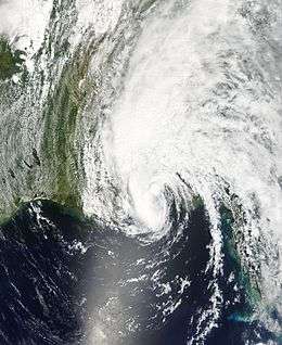
- 4 a.m. EDT (0800 UTC) – Tropical Storm Arlene makes its first landfall near Cabo Corrientes in western Cuba with 50 mph (80 km/h)[nb 1] winds.[2]
- June 11
- 2 p.m. CDT (1900 UTC) – Tropical Storm Arlene makes its second landfall west of Pensacola, Florida with 60 mph (97 km/h) winds.[2]
- 7 p.m. CDT (0000 UTC, June 12) – Tropical Storm Arlene weakens into a tropical depression.[2]
- June 13
- 5 p.m. EDT (2100 UTC) – The Hydrometeorological Prediction Center (HPC) stops monitoring Tropical Depression Arlene over Michigan.[2]
- June 28
- June 29
July
- July 3
- 1 p.m. CDT (1800 UTC) – Tropical Depression Three forms in the northwestern Caribbean Sea, about 80 mi (130 km) east of Chetumal, Quintana Roo, Mexico.[4]
- 10:30 p.m. CDT (0330 UTC, July 4) – Tropical Depression Three makes its first landfall on the Yucatán peninsula with 35 mph (56 km/h) winds.[4]
- July 4
- 2 p.m. EDT (1800 UTC) – Tropical Depression Four forms in the southeastern Caribbean Sea.[5]
- 5 p.m. EDT (2100 UTC) – Tropical Depression Four makes its first landfall on Grenada with 30 mph (48 km/h) winds.[5]
- July 5
- 1 a.m. CDT (0600 UTC) – Tropical Depression Three strengthens into Tropical Storm Cindy.[4]
- 8 a.m. EDT (1200 UTC) – Tropical Depression Four strengthens into Tropical Storm Dennis.[5]
- 8 p.m. EDT (0000 UTC, July 6) – Tropical Storm Cindy strengthens into Hurricane Cindy.[4]
- 10 p.m. CDT (0300 UTC, July 6) – Hurricane Cindy makes its second landfall southwest of Grand Isle, Louisiana, United States with winds of 75 mph (121 km/h).[4]
- approximately 10:30 p.m. CDT (0330 UTC, July 6) – Hurricane Cindy weakens into a tropical storm.[4]
- 5 a.m. CDT (0900 UTC) – Tropical Storm Cindy makes its third landfall near Waveland, Mississippi with winds of 50 mph (80 km/h).[4]
- July 6
- 7 a.m. CDT (1200 UTC) – Tropical Storm Cindy weakens into a tropical depression.[4]
- 5:27 p.m. EDT (2127 UTC) – Tropical Storm Dennis strengthens into Hurricane Dennis.[5]
- July 7
- 8 a.m. EDT (1200 UTC) – Hurricane Dennis reaches Category 2 intensity.[5]
- 11 a.m. EDT (1500 UTC) – Tropical Depression Cindy becomes extratropical over the Carolinas.[4]
- 2 p.m. EDT (1800 UTC) – Hurricane Dennis reaches Category 3 intensity.[5]
- 8 p.m. EDT (0000 UTC, July 8) – Hurricane Dennis reaches Category 4 intensity.[5]
- 10:45 p.m. EDT (0245 UTC, July 8) – Hurricane Dennis makes its second landfall in southeastern Cuba near Punta del Ingles with 140 mph (230 km/h) winds.[5]
- July 8
- July 10
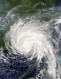
- 2:30 p.m. CDT (1930 UTC) – Hurricane Dennis makes its fourth landfall just west of Navarre Beach, Florida, United States with 120 mph (190 km/h) winds.[5]
- 7 p.m. CDT (0000 UTC, July 11) – Hurricane Dennis weakens into a tropical storm.[5]
- 8 p.m. AST (0000 UTC, July 11) – Tropical Depression Five forms in the central Atlantic about 1,250 mi (2,000 km) east of the Southern Windward Islands.[6]
- July 11
- July 13
- 10 a.m. CDT (1500 UTC) – The HPC ceases advisories on the remnants of Tropical Depression Dennis.[5]
- 8 p.m. AST (0000 UTC, July 13) – Tropical Storm Emily strengthens into Hurricane Emily.[6]
- July 14
- July 15
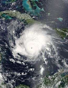
- 2 a.m. AST (0600 UTC) – Hurricane Emily reaches Category 4 intensity.[6]
- July 16
- 8 p.m. EDT (0000 UTC, July 17) – Hurricane Emily reaches Category 5 intensity, the earliest that a hurricane has achieved this intensity in the Atlantic basin.[6]
- July 18
- July 20
- 6:35 a.m. CDT (1135 UTC) – Hurricane Emily makes its third landfall near Boca Madre, Tamaulipas, Mexico with 125 mph (201 km/h) winds.[6]
- July 21
- 1 p.m. CDT (1800 UTC) – Tropical Depression Emily dissipates over central Mexico.[6]
- 1 p.m. EDT (1800 UTC) – Tropical Depression Six forms near the Bahamas.[7]
- 8 p.m. EDT (0000 UTC, July 22) – Tropical Depression Six strengthens into Tropical Storm Franklin.[7]
- July 23
- 3 p.m. CDT (1800 UTC) – Tropical Depression Seven forms in the Bay of Campeche.[8]
- July 24
- 1 a.m. CDT (0600 UTC) – Tropical Depression Seven becomes Tropical Storm Gert.[8]
- 7 p.m. CDT (0000 UTC, July 25) – Tropical Storm Gert makes landfall near Tampico, Tamaulipas, Mexico with 45 mph (72 km/h) winds.[8]
- July 25
- 8 p.m. CDT (0000 UTC, July 26) – Tropical Depression Gert dissipates over central Mexico.[8]
- July 29
- 8 p.m. EDT (0000 UTC, July 30) – Tropical Storm Franklin becomes extratropical east of Nova Scotia.[7]
August
- August 2
- August 3
- 2 a.m. AST (0600 UTC) – Tropical Depression Eight strengthens into Tropical Storm Harvey.[9]
- August 4
- 2 p.m. AST (1800 UTC) – Tropical Depression Nine forms about 690 mi (1,100 km) west of the Cape Verde Islands.[10]
- August 7
- 11 a.m. AST (1500 UTC) – Tropical Depression Nine strengthens into Tropical Storm Irene.[10]
- August 8
- 8 a.m. AST (1200 UTC) – Tropical Storm Irene weakens into a tropical depression.[10]
- 8 p.m. AST (0000 UTC, August 10) – Tropical Storm Harvey becomes extratropical in northern Atlantic 560 mi (900 km) southeast of Newfoundland.[9]
- August 10
- 8 p.m. AST (0000 UTC, August 11) – Tropical Depression Irene regains tropical storm strength.[10]
- August 13
- 8 a.m. AST (1200 UTC) – Tropical Depression Ten forms about 1100 mi (1,800 km) east of the Lesser Antilles.[11]
- August 14
- 11 a.m. AST (1500 UTC) – Tropical Depression Ten degenerates into a remnant low.[11]
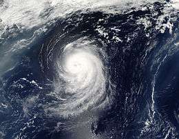
- 8 p.m. AST (0000 UTC, August 15) – Tropical Storm Irene strengthens into Hurricane Irene.[10]
- August 16
- 8 a.m. AST (1200 UTC) – Hurricane Irene reaches Category 2 intensity.[10]
- August 18
- 2 p.m. AST (1800 UTC) – Tropical Storm Irene is absorbed by a larger extratropical system 290 mi (460 km) southeast of Newfoundland.[10]
- August 22
- 8 a.m. EDT (1200 UTC) – Tropical Depression Eleven forms in the Bay of Campeche.[12]
- 2 p.m. EDT (1800 UTC) – Tropical Depression Eleven strengthens into Tropical Storm Jose.[12]
- 10:30 p.m. CDT (0330 UTC, August 23) – Tropical Storm Jose makes landfall in Veracruz, Mexico with 60 mph (97 km/h) winds.[12]
- August 23
- 1 p.m. CDT (1700 UTC) – Tropical Depression Jose dissipates.[12]
- 2 p.m. EDT (1800 UTC) – Tropical Depression Twelve forms near Long Island, Bahamas.[13]
- August 24
- 8 a.m. EDT (1200 UTC) – Tropical Depression Twelve strengthens into Tropical Storm Katrina.[13]
- August 25
- 5 p.m. EDT (2100 UTC) – Tropical Storm Katrina strengthens into Hurricane Katrina.[13]
- 6:30 p.m. EDT (2230 UTC) – Hurricane Katrina makes its first landfall between Hallandale Beach and North Miami Beach, Florida, United States with 80 mph (129 km/h) winds.[13]
- August 26
- 1 a.m. EDT (0500 UTC) – Hurricane Katrina weakens into a tropical storm.[13]
- 2 a.m. EDT (0600 UTC) – Tropical Storm Katrina again strengthens into Hurricane Katrina over the Gulf of Mexico.[13]
- 2 p.m. EDT (1800 UTC) – Hurricane Katrina reaches Category 2 intensity.[13]
- August 27
- 8 a.m. EDT (1200 UTC) – Hurricane Katrina reaches Category 3 intensity.[13]
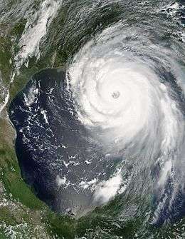
- August 28
- 1 a.m. CDT (0600 UTC) – Hurricane Katrina reaches Category 4 intensity.[13]
- 7 a.m. CDT (1200 UTC) – Hurricane Katrina becomes the second Category 5 hurricane of the 2005 season.[13]
- 8 a.m. AST (1200 UTC) – Tropical Depression Thirteen forms about 960 mi (1,550 km) east of the Lesser Antilles.[14]
- 1 p.m. CDT (1800 UTC) – Hurricane Katrina's central pressure drops to 902 mbar (26.64 inHg), making it the then fourth most intense Atlantic hurricane on record.[13]
- August 29
- 6:10 a.m. CDT (1110 UTC) – Hurricane Katrina makes its second landfall near Buras, Louisiana, United States with 110 kn (127 mph) winds, having just weakened from Category 4.[13]
- 9:45 a.m. CDT (1445 UTC) – Hurricane Katrina makes its third landfall near Pearlington, Mississippi, United States with 105 kn (121 mph) winds after crossing Breton Sound.[13]
- 2 p.m. AST (1800 UTC) – Tropical Depression Thirteen degenerates into a broad area of low pressure.[14]
- 7 p.m. CDT (0000 UTC, August 30) – Hurricane Katrina weakens into a tropical storm.[13]
- August 30
- August 31
- 2 a.m. AST (0600 UTC) – Tropical Depression Thirteen regenerates 890 mi (1,430 km) east-southeast of Bermuda.[14]
- 8 a.m. AST (1200 UTC) – Tropical Depression Thirteen strengthens into Tropical Storm Lee.[14]
- 8 p.m. AST (0000 UTC, September 1) – Tropical Storm Lee weakens into Tropical Depression Lee.[14]
- 11 p.m. EDT (0300 UTC, September 1) – The HPC stops monitoring the remnants of Tropical Depression Katrina over southeastern Canada.[13]
September
- September 1
- 8 a.m. AST (1200 UTC) – Tropical Depression Fourteen forms 1,050 mi (1,700 km) east of the Leeward Islands.[15]
- September 2
- September 4
- 5 a.m. AST (0900 UTC) – Tropical Storm Maria strengthens into Hurricane Maria.[15]
- September 5
- 8 a.m. AST (1200 UTC) – Hurricane Maria reaches Category 2 intensity.[15]
- 2 p.m. AST (1800 UTC) – Tropical Depression Fifteen forms 350 mi (560 km) south-southwest of Bermuda.[16]
- 8 p.m. AST (0000 UTC, September 6) – Hurricane Maria reaches Category 3 intensity.[15]
- 8 p.m. EDT (0000 UTC, September 6) – Tropical Depression Fifteen strengthens into Tropical Storm Nate.[16]
- September 6
- 2 a.m. EDT (0600 UTC) – Tropical Depression Sixteen forms over the northern Bahamas.[17]
- 12 p.m. EDT (1600 UTC) – Tropical Depression Sixteen makes landfall on Grand Bahama with 30 mph (48 km/h) winds.[17]
- September 7
- 2 a.m. EDT (0600 UTC) – Tropical Depression Sixteen strengthens into Tropical Storm Ophelia.[17]
- 8 a.m. EDT (1200 UTC) – Tropical Storm Nate strengthens into Hurricane Nate.[16]
- September 8
- 8 p.m. EDT (0000 UTC, September 9) – Tropical Storm Ophelia strengthens into Hurricane Ophelia. Ophelia oscillates between hurricane and tropical storm strength several times over the next few days.[17]
- September 10
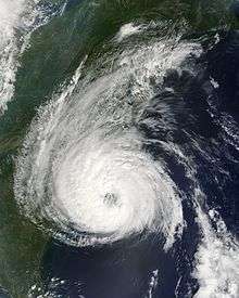
- September 14
- 11 p.m. EDT (0300 UTC, September 15) – Hurricane Ophelia passes southeast of Cape Lookout, North Carolina with the storm's center staying just offshore.[17]
- September 15
- 8 p.m. EDT (0000 UTC, September 16) – Hurricane Ophelia weakens into a tropical storm for the last time.[17]
- September 17
- 8 a.m. EDT (1200 UTC) – Tropical Depression Seventeen forms 345 mi (560 km) east of Barbados.[18]
- 2 p.m. EDT (1800 UTC) – Tropical Depression Seventeen strengthens into Tropical Storm Philippe.[18]
- 8 p.m. EDT (0000 UTC, September 18) – Tropical Storm Ophelia becomes extratropical off the coast of central Nova Scotia.[17]
- 8 p.m. EDT (0000 UTC, September 18) – Tropical Depression Eighteen forms 80 mi (130 km) east of Grand Turk Island.[19]
- September 18
- 2 p.m. EDT (1800 UTC) – Tropical Depression Eighteen strengthens into Tropical Storm Rita.[19]
- 8 p.m. EDT (0000 UTC, September 19) – Tropical Storm Philippe strengthens into Hurricane Philippe.[18]
- September 20
- 8 a.m. EDT (1200 UTC) – Tropical Storm Rita strengthens into Hurricane Rita.[19]
- 2 p.m. EDT (1800 UTC) – Hurricane Rita reaches Category 2 intensity.[19]
- 8 a.m. EDT (1200 UTC) – Hurricane Philippe weakens into a tropical storm.[18]
- September 21
- 2 a.m. EDT (0600 UTC) – Hurricane Rita reaches Category 3 intensity.[19]
- 8 a.m. EDT (1200 UTC) – Hurricane Rita reaches Category 4 intensity.[19]
- 2 p.m. CDT (1800 UTC) – Hurricane Rita becomes the record-breaking third Category 5 hurricane of the season.[19]
- 10 p.m. CDT (0300 UTC, September 22) – Hurricane Rita's central pressure drops to 895 mbar (26.43 inHg), making it the then third most intense Atlantic hurricane on record.[19]
- September 23

- September 24
- 2:40 a.m. CDT (0740 UTC) – Hurricane Rita makes landfall in Louisiana just east of Sabine Pass with 115 mph (185 km/h) winds.[19]
- 1 p.m. CDT (1800 UTC) – Hurricane Rita weakens into a tropical storm.[19]
- September 25
- 1 a.m. CDT (0600 UTC) – Tropical Storm Rita weakens into a tropical depression.[19]
- September 26
- 4 a.m. CDT (0900 UTC) – The HPC stops monitoring Tropical Depression Rita while over the U.S. Midwest, the moisture having been absorbed by a cold front. This leads to the first lull period in the Atlantic since Tropical Depression Twelve formed on August 23rd.[19]
- September 30
- 8 a.m. EDT (1200 UTC) – Tropical Depression Nineteen forms 665 mi (1,065 km) west-southwest of the Cape Verde Islands.[20]
October
- October 1
- October 2
- 1 a.m. CDT (0600 UTC) – Tropical Depression Twenty strengthens into Tropical Storm Stan.[21]
- 5 a.m. CDT (1000 UTC) – Tropical Storm Stan makes its first landfall on the Yucatán Peninsula about 40 mi south of Tulum with 40 mph (64 km/h) winds.[21]
- 3 p.m. AST (1800 UTC) – Tropical Depression Nineteen dissipates.[20]
- 5 p.m. CDT (0000 UTC, October 3) – Tropical Storm Stan weakens into a tropical depression.[21]
- October 3
- 1 a.m. CDT (0600 UTC) – Tropical Depression Stan restrengthens into Tropical Storm Stan.[21]
- October 4
- 0600 UTC — A low pressure area in the open eastern Atlantic gains some tropical characteristics and becomes a subtropical depression. This depression is not assigned a number by the National Hurricane Center.[22]
- 1 a.m. CDT (0600 UTC) – Tropical Storm Stan strengthens into Hurricane Stan.[21]
- 1200 UTC — The subtropical depression in the eastern Atlantic becomes a subtropical storm, but is not noticed, and thus not named. No advisories are issued on it by the National Hurricane Center.[22]
- 7 a.m. CDT (1200 UTC) – Hurricane Stan makes its second landfall about 90 mi (150 km) east-southeast of the Mexican port of Veracruz with 80 mph (129 km/h) winds.[21]
- 1 p.m. CDT (1800 UTC) – Hurricane Stan weakens into a tropical storm.[21]
- 7 p.m. CDT (0000 UTC, October 5) – Tropical Storm Stan weakens into a tropical depression.[21]
- October 5
- 0600 UTC — The unnamed subtropical storm becomes extratropical over the northeastern Atlantic.[22]
- 1 a.m. CDT (0600 UTC) – Tropical Depression Stan dissipates over southeastern Mexico.[21]
- 2 a.m. EDT (0600 UTC) – Tropical Storm Tammy forms 25 mi (35 km) east of Jupiter, Florida.[23]
- 7 p.m. EDT (2300 UTC) – Tropical Storm Tammy makes landfall near Atlantic Beach, Florida with 50 mph (80 km/h) winds.[23]
- October 6
- October 8
- 2 a.m. EDT (0600 UTC) – Subtropical Depression Twenty-two forms 615 mi (1,000 km) south-east of Bermuda.[24]
- 7 a.m. WEST (0600 UTC) – Subtropical Storm Vince forms about 760 mi (930 km) southeast of the Azores, notably near the Iberian Peninsula of Europe.[25]
- October 9
- 1 p.m. WEST (1200 UTC) – Subtropical Storm Vince gains tropical characteristics and becomes Tropical Storm Vince.[25]
- 7 p.m. WEST (1800 UTC) – Tropical Storm Vince strengthens into Hurricane Vince.[25]
- October 10
- October 11
- 2 a.m. CEST (0000 UTC) – Tropical Storm Vince weakens into a tropical depression.[25]
- 11 a.m. CEST (0900 UTC) – Tropical Depression Vince makes landfall near Huelva, Spain, with 35 mph (56 km/h) winds, becoming the first tropical cyclone on record to make landfall in the country.[25]
- 2 p.m. CEST (1200 UTC) – Tropical Depression Vince dissipates over Spain.[25]
- October 15
- 2 p.m. EDT (1800 UTC) – Tropical Depression Twenty-four forms 220 mi (350 km) east-southeast of Grand Cayman.[26]
- October 17
- 2 a.m. EDT (0600 UTC) – Tropical Depression Twenty-four strengthens into Tropical Storm Wilma.[26]
- October 18
- 8 a.m. EDT (1200 UTC) – Tropical Storm Wilma strengthens into Hurricane Wilma.[26]
- 3 p.m. EDT (1900 UTC) – Hurricane Wilma reaches Category 2 intensity (time estimated).[26]
- 5 p.m. EDT (2100 UTC) – Hurricane Wilma reaches Category 3 intensity (time estimated).[26]
- 8 p.m. EDT (0000 UTC, October 19) – Hurricane Wilma reaches Category 4 intensity.[26]
- October 19
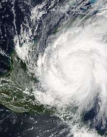
- 2 a.m. EDT (0600 UTC) – Hurricane Wilma becomes the fourth Category 5 hurricane of the season.[26]
- 4 a.m. EDT (0800 UTC) – Hurricane Wilma's central pressure is recorded at 884 mbar (26.11 inHg), making it the most intense hurricane ever recorded in the Atlantic basin.[26]
- 8 a.m. EDT (1200 UTC) – Hurricane Wilma's central pressure drops again to 882 mbar (26.05 inHg), confirming it as the most intense hurricane ever recorded in the Atlantic basin.[26]
- October 21
- 4:45 p.m. CDT (2145 UTC) – Hurricane Wilma makes its first landfall over the Mexican island of Cozumel with 150 mph (240 km/h) winds.[26]
- 10:30 p.m. CDT (0330 UTC, October 22) – Hurricane Wilma makes its second landfall at Puerto Morelos, Quintana Roo, near Cancún, with 140 mph (230 km/h) winds.[26]
- October 22
- 8 a.m. EDT (1200 UTC) – Tropical Depression Twenty-five forms in the eastern Caribbean Sea.[27]
- 2 p.m. EDT (1800 UTC) – Tropical Depression Twenty-five strengthens into Tropical Storm Alpha.[27]
- October 23
- 6 a.m. EDT (1000 UTC) – Tropical Storm Alpha makes landfall near Barahona, Dominican Republic with 50 mph (80 km/h) winds.[27]
- 2 p.m. EDT (1800 UTC) – Tropical Storm Alpha weakens into a tropical depression.[27]
- October 24
- 2 a.m. EDT (0600 UTC) – Hurricane Wilma restrengthens to Category 3 intensity.[26]
- 6:30 a.m. EDT (1030 UTC) – Hurricane Wilma makes its third landfall near Goodland, Florida, with 120 mph (190 km/h) winds.[26]
- 8 p.m. EDT (0000 UTC, October 25) – Tropical Depression Alpha degenerates into a trough connected to Hurricane Wilma.[27]
- October 25
- 8 p.m. EDT (0000 UTC, October 26) – Hurricane Wilma becomes extratropical over the Atlantic Ocean.[26]
- October 26
- 2 p.m. EDT (1800 UTC) – Tropical Depression Twenty-six forms in the southwestern Caribbean Sea, just off Central America.[28]
- October 27
- 2 a.m. EDT (0600 UTC) – Tropical Depression Twenty-six strengthens into Tropical Storm Beta.[28]
- October 28
- 8 p.m. EDT (0000 UTC, October 29) – Tropical Storm Beta passes near the island of Providencia.[28]
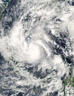
- October 29
- 2 a.m. EDT (0600 UTC) – Tropical Storm Beta strengthens into Hurricane Beta.[28]
- 8 p.m. EDT (0000 UTC, October 30) – Hurricane Beta reaches Category 2 intensity.[28]
- October 30
- 1 a.m. EST (0600 UTC) – Hurricane Beta reaches Category 3 intensity.[28]
- 7 a.m. EST (1200 UTC) – Hurricane Beta makes landfall near La Barra in the South Caribbean Coast Autonomous Region, Nicaragua, with 105 mph (169 km/h) winds.[28]
- 1 p.m. EST (1800 UTC) – Hurricane Beta weakens into a tropical storm.[28]
- 7 p.m. EST (0000 UTC, October 31) – Tropical Storm Beta weakens into a tropical depression, and advisories are discontinued.[28]
November
- November 13
- 7 p.m. EST (0000 UTC, November 14) – Tropical Depression Twenty-seven forms 100 mi (160 km) west of St. Vincent.[29]
- November 15
- 1 a.m. EST (0600 UTC) – Tropical Depression Twenty-seven strengthens into Tropical Storm Twenty-seven, although the NHC forecasters do not notice it at the time.[29]
- November 16
- 10 a.m. EST (1500 UTC) – Tropical Storm Twenty-seven weakens to Tropical Depression Twenty-seven and loses its closed circulation south of Kingston, Jamaica, and advisories are discontinued.[29]
- November 18
- 12 p.m. CST (1800 UTC) – Tropical Depression Twenty-seven regenerates in the Western Caribbean and strengthens into Tropical Storm Gamma.[29]
- November 20
- 12 a.m. EST (0600 UTC, November 21) – Tropical Depression Gamma degenerates into a remnant low north of Honduras and advisories are discontinued.[29]
- November 22
- 2 p.m. AST (1800 UTC) – Subtropical Storm Delta forms 870 mi (1,400 km) southwest of the Azores from a previously non-tropical low.[30]
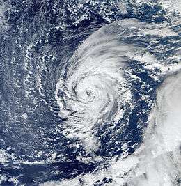
- November 23
- 8 a.m. AST (1200 UTC) – Subtropical Storm Delta gains tropical characteristics and becomes Tropical Storm Delta.[30]
- November 28
- 8 a.m. AST (1200 UTC) – Tropical Storm Delta becomes extratropical about 250 mi (400 km) west-northwest of the Canary Islands.[30]
- November 29
- 2 a.m. AST (0600 UTC) – Tropical Storm Epsilon forms east of Bermuda from a previously non-tropical low.[31]
- November 30

December
- December 2
- 2 p.m. AST (1800 UTC) – Tropical Storm Epsilon strengthens into Hurricane Epsilon.[31]
- December 7
- 2 p.m. AST (1800 UTC) – Hurricane Epsilon weakens into a tropical storm.[31]
- December 8
- 12 a.m. AST (1200 UTC) – Tropical Storm Epsilon weakens into a tropical depression and loses its convection.[31]
- December 29
- 8 p.m. AST (0000 UTC, December 30) – Tropical Depression Thirty forms over the eastern Atlantic.[33]
- December 30
- 2 a.m. AST (0600 UTC) – Tropical Depression Thirty strengthens into Tropical Storm Zeta, the second latest tropical cyclone forming in the Atlantic (after Hurricane Alice in 1954).[33]
January 2006
- January 1
- The year 2006 begins with Tropical Storm Zeta still active, making Zeta only the second cross-season North Atlantic tropical cyclone ever recorded.[33]
- January 6
See also
- 2005 Atlantic hurricane season
- List of 2005 Atlantic hurricane season storms
- 2005 Atlantic hurricane season statistics
- Timeline of Hurricane Katrina
- List of Atlantic hurricane seasons
- Timeline of the 2005 Pacific hurricane season
- Timeline of the 2005 Pacific typhoon season
Notes
- ↑ The figures for maximum sustained winds and position estimates are rounded to the nearest 5 units (knots, miles, or kilometers), following the convention used in the National Hurricane Center's operational products for each storm. All other units are rounded to the nearest digit.
References
- ↑ NOAA (2006-04-13). "NOAA Reviews Record-Setting 2005 Atlantic Hurricane Season". National Oceanic and Atmospheric Administration. Retrieved 2006-04-26.
- 1 2 3 4 5 6 Lixion A. Avila; Daniel P. Brown (2005-07-20). "Tropical Cyclone Report: Tropical Storm Arlene" (PDF). NOAA. Retrieved 2006-05-21.
- 1 2 3 4 Richard J. Pasch (2006-01-23). "Tropical Cyclone Report: Tropical Storm Bret" (PDF). NOAA. Retrieved 2006-05-21.
- 1 2 3 4 5 6 7 8 9 10 Stacy R. Stewart (2006-02-14). "Tropical Cyclone Report: Hurricane Cindy" (PDF). NOAA. Retrieved 2006-05-21.
- 1 2 3 4 5 6 7 8 9 10 11 12 13 Jack Beven (2005-11-22). "Tropical Cyclone Report: Hurricane Dennis" (PDF). NOAA. Retrieved 2006-05-21.
- 1 2 3 4 5 6 7 8 9 10 11 James l. Franklin; Daniel P. Brown (2006-03-10). "Tropical Cyclone Report: Hurricane Emily" (PDF). NOAA. Retrieved 2006-05-21.
- 1 2 3 Richard D. Knabb (2006-03-17). "Tropical Cyclone Report: Tropical Storm Franklin" (PDF). NOAA. Retrieved 2006-05-21.
- 1 2 3 4 Lixion A. Avila (2005-08-10). "Tropical Cyclone Report: Tropical Storm Gert" (PDF). NOAA. Retrieved 2006-05-21.
- 1 2 3 Richard D. Knabb (2006-03-17). "Tropical Cyclone Report: Tropical Storm Harvey" (PDF). NOAA. Retrieved 2006-05-21.
- 1 2 3 4 5 6 7 Stacy R. Stewart (2006-01-20). "Tropical Cyclone Report: Hurricane Irene" (PDF). NOAA. Retrieved 2006-05-21.
- 1 2 Jack Beven (2006-01-17). "Tropical Cyclone Report: Tropical Depression Ten" (PDF). NOAA. Retrieved 2006-05-21.
- 1 2 3 4 James L. Franklin (2006-01-13). "Tropical Cyclone Report: Tropical Storm Jose" (PDF). NOAA. Retrieved 2006-05-21.
- 1 2 3 4 5 6 7 8 9 10 11 12 13 14 15 16 17 Richard D. Knabb; Jamie D. Rhome; Daniel P. Brown (2005-12-20). "Tropical Cyclone Report: Hurricane Katrina" (PDF). NOAA. Retrieved 2006-05-21.
- 1 2 3 4 5 6 Lixion A. Avila (2005-12-07). "Tropical Cyclone Report: Tropical Storm Lee" (PDF). NOAA. Retrieved 2006-05-21.
- 1 2 3 4 5 6 National Richard J. Pasch; Eric S. Blake (2005-12-07). "Tropical Cyclone Report: Hurricane Maria" (PDF). NOAA. Retrieved 2006-05-21.
- 1 2 3 4 Stacy R. Stewart (2005-11-21). "Tropical Cyclone Report: Hurricane Nate" (PDF). NOAA. Archived from the original (PDF) on December 17, 2008. Retrieved 2006-05-21.
- 1 2 3 4 5 6 7 Jack Beven; Hugh D. Cobb III (2006-01-24). "Tropical Cyclone Report: Hurricane Ophelia" (PDF). NOAA. Archived from the original (PDF) on December 17, 2008. Retrieved 2006-05-21.
- 1 2 3 4 5 6 James L. Franklin (2006-02-09). "Tropical Cyclone Report: Hurricane Philippe" (PDF). NOAA. Retrieved 2006-05-21.
- 1 2 3 4 5 6 7 8 9 10 11 12 Richard D. Knabb; Daniel P. Brown; Jamie R. Rhome (2006-03-17). "Tropical Cyclone Report: Hurricane Rita" (PDF). NOAA. Retrieved 2006-05-21.
- 1 2 Lixion A. Avila (2005-01-01). "Tropical Cyclone Report: Tropical Depression Nineteen" (PDF). NOAA. Retrieved 2006-05-21.
- 1 2 3 4 5 6 7 8 9 10 Richard J. Pasch; David P. Roberts (2006-02-14). "Tropical Cyclone Report: Hurricane Stan" (PDF). NOAA. Retrieved 2006-05-21.
- 1 2 3 Jack Beven; Eric S. Blake (2006-04-10). "Tropical Cyclone Report: Unnamed Subtropical Storm" (PDF). NOAA. Retrieved 2006-05-21.
- 1 2 3 4 Stacy R. Stewart (2006-01-28). "Tropical Cyclone Report: Tropical Storm Tammy" (PDF). NOAA. Retrieved 2005-05-21.
- 1 2 Jack Beven (2006-01-17). "Tropical Cyclone Report: Subtropical Depression Twenty-two" (PDF). NOAA. Retrieved 2006-05-21.
- 1 2 3 4 5 6 7 James L. Franklin (2006-02-22). "Tropical Cyclone Report: Hurricane Vince" (PDF). NOAA. Retrieved 2006-05-21.
- 1 2 3 4 5 6 7 8 9 10 11 12 13 14 Richard J. Pasch; Eric S. Blake; Hugh D. Cobb III; David P. Roberts (2006-01-12). "Tropical Cyclone Report: Hurricane Wilma" (PDF). NOAA. Retrieved 2006-05-21.
- 1 2 3 4 5 Lixion A. Avila (2006-01-04). "Tropical Cyclone Report: Tropical Storm Alpha" (PDF). NOAA. Retrieved 2006-05-21.
- 1 2 3 4 5 6 7 8 9 Richard J. Pasch; David P. Roberts (2006-03-28). "Tropical Cyclone Report: Hurricane Beta" (PDF). NOAA. Retrieved 2006-05-21.
- 1 2 3 4 5 Stacy R. Stewart (2005-11-24). "Tropical Cyclone Report: Tropical Storm Gamma" (PDF). NOAA. Retrieved 2006-05-21.
- 1 2 3 Jack Beven (2006-02-14). "Tropical Cyclone Report: Tropical Storm Delta" (PDF). NOAA. Retrieved 2006-05-21.
- 1 2 3 4 5 James L. Franklin (2006-01-07). "Tropical Cyclone Report: Hurricane Epsilon" (PDF). NOAA. Retrieved 2006-05-21.
- ↑ Neal Dorst (2007-06-01). "Subject: G1) When is hurricane season ?". National Oceanic and Atmospheric Administration. Retrieved 2008-08-12.
- 1 2 3 4 5 Richard D. Knabb; Daniel P. Brown (2006-03-17). "Tropical Cyclone Report: Tropical Storm Zeta" (PDF). NOAA. Retrieved 2006-05-21.
External links
| Wikimedia Commons has media related to 2005 Atlantic hurricane season. |
- National Hurricane Center
- NCDC: Climate of 2005: Atlantic Hurricane Season Summary
- National Hurricane Center's 2005 Archive