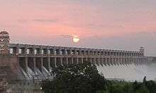
Tungabhadra Dam
| Tungabhadra Dam ತುಂಗಭದ್ರಾ ಜಲಾಶಯ | |
|---|---|
 | |
| Location | Hospet, Ballari district, Karnataka, India |
| Construction began | 1949 |
| Opening date | 1953 |
| Owner(s) | Karnataka state |
| Operator(s) | Tungabhadra Board |
| Dam and spillways | |
| Type of dam | Composite, Spillway length (701 m) |
| Impounds | Tungabhadra River |
| Height | 49.50 m (162 ft) from the deepest foundation. |
| Length | 2,449 m (8,035 ft) |
| Spillway capacity | 650,000 cusecs |
| Reservoir | |
| Creates | Tungabhadra Reservoir |
| Total capacity | 101 tmcft at FRL 498 m msl |
| Active capacity | 98.7 tmcft (at 498 m msl) |
| Inactive capacity | 2.3 tmcft (below 477.01 m msl) |
| Catchment area | 28,180 km2 (10,880 sq mi) |
| Surface area | 350 km2 (140 sq mi) |
| Power station | |
| Operator(s) | Karnataka Govt |
| Turbines | Near toe of the dam and canal drops |
| Installed capacity | 127MW |
The Tungabhadra Dam is constructed across the Tungabhadra River, a tributary of the Krishna River.[1] The dam is near the town of Hospet in Karnataka. It is a multipurpose dam serving irrigation, electricity generation, flood control, etc. This is a joint project of erstwhile Hyderabad state and erstwhile Madras Presidency when the construction was started; later it became a joint project of Karnataka and Andhra Pradesh after its completion in 1953. The main architect of the dam was Dr Thirumala Iyengar, an engineer from Madras.
Technical details
The dam creates the biggest reservoir on the Tungabhadra River with 101 tmcft of gross storage capacity at full reservoir level (FRL) 498 m MSL, and a water spread area of 378 square kilometres.[2] The dam is 49.39 meters high above its deepest foundation.[3] The left canals emanating from the reservoir supplies water for irrigation entirely in Karnataka state. Two right bank canals are constructed — one at low level and the other at high level serving irrigation in Karnataka and Rayalaseema region of Andhra Pradesh. Hydropower units are installed on canal drops. The reservoir water is used to supply water to downstream barrages Rajolibanda and Sunkesula located on the Tungabhadra River. The identified water use from the project is 220 tmcft by the Krishna Water Disputes Tribunal. Karnataka and Andhra Pradesh got 151 tmcft and 79 tmcft water use entitlement respectively.[4]
Future potential
On the right side of the dam, tall Sanduru hill ranges extending up to 800 m MSL are close to the periphery of the Tungabhadra reservoir. These hill ranges form the Sanduru valley located above 600 m MSL. This reservoir is an ideal place to install pumped storage hydropower plants and lift irrigation projects. A moderate high level storage reservoir[5] of capacity 20 tmcft at FRL 620 m MSL, can be constructed by damming the Sanduru valley. This reservoir will serve as upper pond and existing Tungabhadra reservoir as tail pond for installing pumped-storage hydroelectricity units. The water pumped during the monsoon months into the upper pond can be diverted by gravity to irrigate an extensive area in the uplands up to 600 m MSL in Rayalaseema and Karnataka. This water can be pumped further to meet the drinking water requirements of Bengaluru city.
However, the available water resources at Tungabhadra dam are over-used, and water shortages are frequent. Water availability in the reservoir could be augmented by transferring water from the Krishna River, if a link canal were constructed from the Almatti reservoir to the Tungabhadra reservoir.[6] Envisaging small balancing reservoirs where this link canal is intercepting the tributaries of Tungabhadra River would facilitate water diversion to Tungabhadra reservoir for augmenting further water availability. Once the Almatti reservoir FRL is raised to 524 m MSL, this canals full supply level (FSL) can also be increased to 516 m MSL from 510 m MSL to reduce its construction cost and serve more area for irrigation in Karnataka.[7]
Nearly 180 tmcft out of 230 tmcft water presently supplied from Tungabhadra reservoir to various canals can be replaced by reliable Krishna river water from the Narayanpur reservoir.[8] These are water supply to mid and lower reaches of Tungabhadra left bank canal, water assistance to Rajolibanda canal, water assistance to KC canal and mid and lower reaches of Tungabhadra right bank low level canal. This is achieved with a 20 km long tunnel from Narayanpur reservoir to the Maski nala reservoir / tank situated at 475 m MSL for drawing nearly 250 tmcft Krishna river water.[9] From this tank, north canal would supply Krishna river water by gravity flow to the lower reaches of Tungabhadra left bank canal in addition to bringing substantial uplands under irrigation in Karnataka and Telangana. From this tank, south canal would supply Krishna river water by gravity flow to the middle portion of Tungabhadra left bank canal in addition to bringing substantial uplands under irrigation in Karnataka and also connected to the Tungabhadra right bank low level canal at 425 m MSL near 15°22′09″N 76°32′55″E / 15.36917°N 76.54861°E through a 1.5 km long aqueduct over Tungabhadra main river. Water is also released from the Maski nala in to downstream Tungabhadra main river to meet continuous water needs of downstream Rajolibanda canal and KC canal. 180 tmcft water in addition to the water diverted from the Almatti reservoir to Tunghbadra reservoir can be utilised for uplands irrigation in Tungabhadra basin and Rayalaseema region of Andhra Pradesh. When these joint projects of Karnataka and Andhra Pradesh are constructed, nearly 400 tmcft water additionally will be available for irrigation and drinking purposes in the high drought risk uplands of Rayalaseema and Karnataka.
See also
References
- ↑ Map of Krishna River basin
- ↑ "Salient data of Tungabhadra dam". Retrieved 23 July 2013.
- ↑ "Tungabhadra Dam D05483". Retrieved 23 July 2016.
- ↑ "Page 97, Further report of KWDT 1, Volume IV" (PDF). 1976. Retrieved 17 August 2016.
- ↑ Blue Print for Godavari River Water Utilization in Andhra Pradesh
- ↑ NWDA. "Feasibility Report of Krishna (Almatti) Pennar Link". Retrieved 15 January 2015.
- ↑ NWDA. "Section 6.5.4 of Chapter 6, Feasibility Report of Krishna (Almatti) Pennar Link" (PDF). Retrieved 15 August 2016.
- ↑ "Narayanapura Dam D04315". Retrieved 15 August 2015.
- ↑ "Maskinala D05465". Retrieved 15 August 2015.
External links
| Wikimedia Commons has media related to Tungabhadra Dam. |
Coordinates: 15°18′N 76°20′E / 15.300°N 76.333°E
| Rivers | 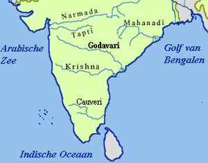 | ||||||||||||||
|---|---|---|---|---|---|---|---|---|---|---|---|---|---|---|---|
| Dams and barrages | |||||||||||||||
| Hydro power stations | |||||||||||||||
| Geographical features/regions | |||||||||||||||
| Riparian districts |
| ||||||||||||||
| Cities | |||||||||||||||
| Ores and minerals | |||||||||||||||
| Oil/gas fields | |||||||||||||||
| Industries |
| ||||||||||||||
| Transport | |||||||||||||||
| Pollution concerns, River basin's sustainable productivity & ecology |
| ||||||||||||||
| Related topics | |||||||||||||||
| Other river basins | |||||||||||||||