Sindhudurg district
| Sindhudurg district सिंधुदुर्ग जिल्हा | |
|---|---|
| District of Maharashtra | |
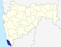 Location of Sindhudurg district in Maharashtra | |
| Country | India |
| State | Maharashtra |
| Administrative division | Konkan Division |
| Headquarters | Oros, Sindhudurg |
| Tehsils | 1. Dodamarg, 2. Sawantwadi, 3. Vengurla, 4. Kudal, 5. Malvan, 6. Kankavli, 7. Devgad, 8. Vaibhavwadi |
| Government | |
| • Lok Sabha constituencies | 1. Ratnagiri-Sindhudurg (shared with Ratnagiri district) (Based on Election Commission website) |
| • Assembly seats | 4 |
| Area | |
| • Total | 5,207 km2 (2,010 sq mi) |
| Population (2011) | |
| • Total | 849,651 |
| • Density | 160/km2 (420/sq mi) |
| • Urban | 12.59% |
| Demographics | |
| • Literacy | 85.56% |
| • Sex ratio | 1036 |
| Major highways | NH-66 |
| Average annual precipitation | 3,287 mm |
| Website | Official website |
Sindhudurg is an administrative district in the state of Maharashtra in India, which was carved out of the erstwhile Ratnagiri District. The district headquarters are located at Oros (ओरस). The district occupies an area of 5207 km² and has a population of 849,651 of which 12.59% were urban (as of 2011).[1]
As of 2011 it is the least populous district of Maharashtra (out of 39).[2]
Origin of name
The district is named after the fort of Sindhudurg (which means "fort in the sea"), which lies on a rocky island just off the coast of Malvan. Sindhudurg fort, built in the 16th century by King Shivaji is the only fort which has Shivaji's temple inside the fort and a palm imprint of King Shivaji. Sindhudurg district has 37 forts, the highest number of forts in Maharashtra as well as all types of forts (Jaldurg – Sea), (Bhuikot – fort on land) and (Giri- fort on hilltop).
About The District
Established on 1 May 1981,
Tahsils and Panchayat Samiti:
- Dodamarg
- Sawantwadi
- Vengurla
- Kudal
- Malvan
- Kankavli
- Devgad
- Vaibhavwadi
Nagar Palika:
- Vengurla
- Sawantwadi
- Malvan
- devgad-jamsande
- Kankavli
Cities
Smaller towns include
- Gram Panchayat: 433
- Tot. Villages: 743
- No. of Towns: 5
- Police Stations: 9
- Police outpost: 23
Agriculture
Major Crops are Rice, Coconut, Kokam, Mango, Cashew.
Annual Crop Kokam, Mango, Cashew
Irrigated 33,910 Hector
Non-Irrigated. 104,390 Hector
Forest 38,643 Hector
74% of total land holding in the district, are held by small and marginal farmers. The irrigated area is only 23.48% through well and small channels.
Irrigation
Major Projects 2 (Tilari & Talamba)
Medium Projects 4
Small Projects State owned : 33, Z.P. owned : 460
Education Section
Primary Schools - Zilla Parishad – 1469, Private – 49
Secondary Schools Grantable : 184, Central Govt. : 1, Private : 22
Junior Colleges :43
Senior Colleges :7
D.Ed./ BEd Colleges: 4 + 1
Medical Colleges :2
Engineering Colleges: 2
Polytechnic Colleges :3
Industrial Training Institutes (ITI)- (7) 1.Sawntwadi 2.Malvan 3.Deogad 4.Sindhudurgnagari 5.Vengurla 6.Phondaghat 7.Vaibhavwadi
Banking Sector
Nationalised Banks 66 Branches
Cooperative Banks 106 Branches
Rural Banks 15 Branches
Fisheries
Sea Coast Length 121 km Fishing Area 16000 km2.
Main Fisheries Centers – (8) Vijaydurg, Devgad, Achara, Malvan, Sarjekot, Kochara, Vengurla, Shiroda
Fisherman Population 25365
Total Fish Production 19273 M. Tons
Fisheries Co.Op. Soc. 34 (Total Members 14216)
Location and Climate
Sindhudurg is bordered on the north by Ratnagiri District, on the south by the state of Goa, on the west by the Arabian Sea, and to the east across the crest of the Western Ghats or Sahyadris is Kolhapur District. Sindhudurg is part of Konkan (coastal) region, a narrow coastal plain in western Maharashtra which lies between the Western Ghats and the Arabian Sea.
Sindhudurg has a semi-tropical climate and remains warm and humid in most of the year. It has three clear seasons : Rainy (June – October), winter (November-mid February) and Summer (mid February–May). Temperatures vary between Max. 32 °C and monsoon winds bring heavy rains (average rainfall 3240.10 mm).
People
Language - The people of Sindhudurg District mostly speak a distinct Konkani dialect Malvani, almost all are fluent in Marathi as well. Hindi, English and Konkani are also spoken and understood by a majority of the population.
Cuisine
The cuisine of the district is popularly known as Malvani cuisine. Coconut, Rice and Fish assume prime significance in the Malavani cuisine. Seafood containing fish, especially Bangada (Soloman) Paplet (Pomfret), Prawns, and Tisrya (Mussels) is very popular. "Kombdi Vade"also called Vade Sagoti, a chicken savoury, is the most popular dish here. Others include Ukadya Tandulachi Pej (उकड्या तांदळाची पेज – a semi-fluid boiled preparation made of brown-red rice variety) and Sol Kadhi (सोल कढी – A preparation made of Sol (Kokum) सोल and coconut milk). Dry fish is also a local delicacy like "Golma" (dried prawns).
Malvani cuisine is one of the unique cuisine than rest of the Maharashtra with very low oil and spices but very tasty with use of locally available spices. Even TAJ group has also included Malvani cuisine in their menu. Below are some of the famous dishes/ sweets are Malvani
- Kombadi vade or Vade Sagoti (कोंबडी वडे Thick puris made of rice atta)
- Ghavane – Ras (घावने - Rice dosa with sweet coconut milk)
- Amboli – Usal (आंबोळी उसळ - fermented rice dosa with spicy curry)
- Shirvale (शिरवाळे - noodles served with sweet coconut milk)
- Dhondas (धोंडस)
- All types of fry fishes and fish curries in Malvani masala
- Solkadi (सोलकढी)
- Khaprolya (खापरोळ्या)
- Ukadiche Modak in Malvani style
- Nhevre/Karanjee (करंजी - Stuffed crunchy sweet delicacy)
- Olya Kajuchi Usal
- Pithi Bhat (पिठी-भात - Pithi is made of kulith unlike the besan one prevalent across maharashtra)
- Ukdya Tandlachi Pej with
Mango is a major factor to the life of Sindhudurg. Varieties of Alphonso Mango (हापुस आंबा ) from Devgad are particularly popular. Other varieties of mango: Mankur (मानकुर), Pāyari (पायरी) and Karel (करेल – used for preparing Mango Pickle) are also popular for their distinct taste.
The Malvani cuisine also has many vegetarian dishes, including garyache sandan, pickle of karmal, bimble, amba halad, karadichi bhakri, kanyacha sanja, appe, ghavan, dalimichi usual, and kaju usual, Raiwal Ambyacha Rayta, Yelapp.
Places of attraction
Tourist Destinations
- Amboli Hill Station Sawantwadi
- Sindhudurg Fort in Malvan
- Vijaydurg Fort Devgad
- Scuba diving in Tarkarlli (Malvan)
- Tarkarli Beach
- Bhagvati Temple, Dhamapur Lake
- Sawantwadi Palace
- Sawantwadi Lake (Moti Talav)
- Rock Garden at Malvan
- Tilari Dam (Dodamarg)
- Mangeli Waterfall (Dodamarg) - One of the famous waterfall in recent years
- Navdurga Redi
- Napapne Waterfall, Vaibhavwadi
- Achara Beach and Rameshwar Temple (16th Century)
- Mangeli waterfall (Dodamarg Taluka – near Goa)
Temples
- Kunkeshwar temple, Devgad[3]
- Lakshminarayan Temple, Walwal
- Shri Bramhanand Swami Math, Ozar (Taluka Malvan)
- Bharadi Devi temple, Aangnewadi, Masure
- Shri Sai Baba Temple (First and oldest temple of Saibaba in India), Kudal
- Redi Ganesh Vengurla
- Navadurga Temple at Redi
- Shri Dev Rameshwar temple (17th Century) in Aakeri, Sawantwadi
- Shri Dev Rameshwar Temple (16th Century) in Rameshwar, Girye-Vijaydurg
- Shree Dev Rameshwar Temple, Achara
- Bhalchandra Maharaj Ashram, Kankavli
- Shri Dev Gangeshvar,Lore No. 1(Kankavli)
- Shri Dev Kaleshwar temple, Nerur (Kudal)
- Shri Dev Kudaleshwar Temple, Kudal
- Shri Dev Laxmi Narayan, Walawal (Kudal)
- Shri Dev ravalnath temple (ambdos, malvan)
- Shri Devi Mauli Temple, Walawal (Kudal)
- Shri Devi Yakshini Temple, Mangaon (Kudal)
- Shri Dev Gopalkrishna Temple, Talashil-Tondavali (Malvan)
- Shri Dev Rameshwar Temple, Humarmala- walawal (Kudal)
- Shri Devi Sateri Shantadurga Temple, Mhapan (Vengurle)
- Shri Dev Siddheshwar Temple, Mhapan (Vengurle)
- Shri Dev Adnarayan Temple, Parule (Vengurle)
- Shri Devi Chamundeshwari Temple, Aandurle (Kudal)
- Shri Dev Vetoba temple, Parule (Vengurle)
- Shri Dev Mahapurush temple,bhogave wadi Parule (Vengurle)
- Shri Dev Kshetrapal temple, Parule-chipi (Vengurle)
- Shri Dev Maruti Temple, Kudal City
- Shri Dev Vetal Temple, Pendur (Kudal)
- Shri Ganesh Temple at Sawarwadi
- Shri Lingeshwar-Pavanadevi Mandir,Janavali(Kanakavli)
- Shri Maooli-Ravalnath-Vetal-Bagwe Maharaj Samadhi, Masure.
- Shri kalbhairav temple, kharepatan(kankavli).
- Shri Dev Kunkeshwar Temple (Devgad)
- Bhagwati Devi Temple (Kot Kamte)
- Shri Dev Jaiteer Temple, Tulas (Vengurla)
- Shri Dev Vetoba Temple, Ajgaon (Sawantwadi)
- Shri Devi Shanta Durga Temple, Vadachapat (Malvan).
Beaches
- Redi
- Shiroda
- Tarkarli
- Malvan
- Talashil Beach
- Tondavali Beach
- Vijaydurg
- Rameshwar
- Kotharwadi Beach, Girye
- Velagar
- Bhogve mahapurush
- Nivati (Mhapan – Taluka Vengurle)
- Khavne (Mhapan – Taluka Vengurle)
- Kondura (Dabholi – Taluka Vengurle)
- Devbaug (Malvan)
- Waingani (aachra)
- Sagareshwar (Vengurle)
- Aachra (Malvan)
- Mochemad, Aravali(Vengurle)
- Mithbaon (Devgad)
- Chivla, Rajkot (Malvan)
- Bhogve (Vengurle) – you can see this beach in famous marathi movie 'Shwaas'
Demographics
According to the 2011 census Sindhudurg district has a population of 849,651,[2] roughly equal to the nation of Qatar[4] or the US state of South Dakota.[5] This gives it a ranking of 474th in India (out of a total of 640).[2] The district has a population density of 163 inhabitants per square kilometre (420/sq mi) .[2] Its population growth rate over the decade 2001–2011 was -2.21%.[2]
Sindhudurg has a sex ratio of 1037 females for every 1000 males which is second highest in Maharashtra,[2] and a literacy rate of 85.56%.[2]
| Population | Literacy | |
| Overall | 8,49,651 | 85.56% |
| Male | 4,17,890 | 91.58% |
| Female | 4,50.935 | 79.81% |
The area is largely rural populated with 87.41% of rural population.
Divisions
The 8 talukas of this district are Devgad, Kankavli, Malvan, Kudal, Sawantwadi, Vengurla and Dodamarg and Vaibhavwadi.
There are 3 Vidhan Sabha constituencies in this district. These are Kankavli, Sawantwadi and Kudal. All of these are part of the Ratnagiri-Sindhudurg Lok Sabha constituency.[6]
Transportation
The Sindudurg district is connected to state capital Mumbai by road through National Highway 17( NH-17 ) which is now renumbered as NH-66.[7] This highway also connects district to neighbouring state Goa and Karnataka also. There are regular MSRTC and private luxury buses connecting to adjoining cities like Kolhapur (110 km away from Kanakavli City), Belgaum (90 km away from Sawantwadi City), Panaji – Goa (55 km away from Sawantwadi & Vengurle). Towns and major villages has good connectivity with Mumbai as major migrated population of district is located in Mumbai area. According to one source, there are roughly more than 120 luxury buses running daily towards Mumbai and suburbs. District is also well connected by Konkan railway to Mumbai, Thane,Goa and other parts of the country like Mangalore, Karwar Ernakulam, Thiruvananthapuram, Coimbatore, Tirunelveli, Hapa, Veraval, New Delhi, Jodhpur, Porbundar by Konkan Railway. The main railway stations on this route are Kudal, Kankavli and Sawantwadi. Many trains halt at these stations. The nearest airport is Dabolim Airport in Goa which is very close(80 km) for cities like Sawantwadi, Kudal and Vengurle. New airport Sindhudurg Airport at Chipi-Parule is under construction.[8]
References
- ↑ http://www.census2011.co.in/census/district/367-sindhudurg.html
- 1 2 3 4 5 6 7 "District Census 2011". Census2011.co.in. 2011. Retrieved 30 September 2011.
- ↑ "Kunkeshwar Temple and Beach | Sindhudurg". Konkanonline.com. Retrieved 21 October 2013.
- ↑ US Directorate of Intelligence. "Country Comparison:Population". Retrieved 1 October 2011.
Qatar 2,374,860 may 2015 est.
- ↑ "2010 Resident Population Data". U. S. Census Bureau. Retrieved 30 September 2011.
South Dakota 814,180
- ↑ Election Commission, Maharashtra – No. of Voters 1.8.2006
- ↑ "NH in state renumbered". www.thehindu.com. Retrieved 9 October 2012.
- ↑ http://timesofindia.indiatimes.com/city/goa/Work-on-Chipi-airport-takes-off/articleshow/19534792.cms
External links
 |
Ratnagiri district | | ||
| Arabian Sea | |
Kolhapur district | ||
| ||||
| | ||||
| North Goa district, Goa | Belgaum district, Karnataka |
| Topics | |||||||||||||||||||||||
|---|---|---|---|---|---|---|---|---|---|---|---|---|---|---|---|---|---|---|---|---|---|---|---|
| Regions | |||||||||||||||||||||||
| Divisions and Districts |
| ||||||||||||||||||||||
| Million-plus cities in Maharashtra | |||||||||||||||||||||||
| Other cities with municipal corporations | |||||||||||||||||||||||
Portal: Maharashtra | |||||||||||||||||||||||
Coordinates: 19°04′58″N 72°50′00″E / 19.082823°N 72.833443°E