Lake County, Montana
| Lake County, Montana | |
|---|---|
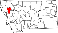 Location in the U.S. state of Montana | |
 Montana's location in the U.S. | |
| Founded | 1923 |
| Seat | Polson |
| Largest city | Polson |
| Area | |
| • Total | 1,654 sq mi (4,284 km2) |
| • Land | 1,490 sq mi (3,859 km2) |
| • Water | 164 sq mi (425 km2), 9.9% |
| Population (est.) | |
| • (2015) | 29,457 |
| • Density | 19/sq mi (7/km²) |
| Congressional district | At-large |
| Time zone | Mountain: UTC-7/-6 |
| Website |
www |
Lake County is a county located in the U.S. state of Montana. As of the 2010 census, the population was 28,746.[1] Its county seat is Polson.[2]
Geography
According to the U.S. Census Bureau, the county has a total area of 1,654 square miles (4,280 km2), of which 1,490 square miles (3,900 km2) is land and 164 square miles (420 km2) (9.9%) is water.[3] Over two-thirds (67.7%) of the county's land lies within the Flathead Indian Reservation.
Adjacent counties
- Flathead County, Montana - north
- Missoula County, Montana - east
- Sanders County, Montana - west
National protected areas
- Flathead National Forest (part)
- National Bison Range (part)
- Ninepipe National Wildlife Refuge
- Pablo National Wildlife Refuge
- Swan River National Wildlife Refuge
Demographics
| Historical population | |||
|---|---|---|---|
| Census | Pop. | %± | |
| 1930 | 9,541 | — | |
| 1940 | 13,490 | 41.4% | |
| 1950 | 13,835 | 2.6% | |
| 1960 | 13,104 | −5.3% | |
| 1970 | 14,445 | 10.2% | |
| 1980 | 19,056 | 31.9% | |
| 1990 | 21,041 | 10.4% | |
| 2000 | 26,507 | 26.0% | |
| 2010 | 28,746 | 8.4% | |
| Est. 2015 | 29,457 | [4] | 2.5% |
| U.S. Decennial Census[5] 1790-1960[6] 1900-1990[7] 1990-2000[8] 2010-2015[1] | |||
2000 census
As of the census[9] of 2000, there were 26,507 people, 10,192 households, and 7,215 families residing in the county. The population density was 18 people per square mile (7/km²). There were 13,605 housing units at an average density of 9 per square mile (4/km²). The racial makeup of the county was 71.38% White, 0.12% Black or African American, 23.79% Native American, 0.30% Asian, 0.04% Pacific Islander, 0.67% from other races, and 3.70% from two or more races. 2.52% of the population were Hispanic or Latino of any race. 19.7% were of German, 8.8% Irish, 7.8% English, 5.4% Norwegian and 5.4% American ancestry according to Census 2000. 94.3% spoke English, 1.6% Salish and 1.2% Spanish as their first language.
There were 10,192 households out of which 33.00% had children under the age of 18 living with them, 54.80% were married couples living together, 11.50% had a female householder with no husband present, and 29.20% were non-families. 24.50% of all households were made up of individuals and 9.90% had someone living alone who was 65 years of age or older. The average household size was 2.54 and the average family size was 3.02.
In the county the population was spread out with 28.10% under the age of 18, 8.00% from 18 to 24, 24.50% from 25 to 44, 24.90% from 45 to 64, and 14.50% who were 65 years of age or older. The median age was 38 years. For every 100 females there were 96.70 males. For every 100 females age 18 and over, there were 93.10 males.
The median income for a household in the county was $28,740, and the median income for a family was $34,033. Males had a median income of $27,009 versus $19,162 for females. The per capita income for the county was $15,173. About 14.00% of families and 18.70% of the population were below the poverty line, including 24.20% of those under age 18 and 8.30% of those age 65 or over.
2010 census
As of the 2010 United States Census, there were 28,746 people, 11,432 households, and 7,770 families residing in the county.[10] The population density was 19.3 inhabitants per square mile (7.5/km2). There were 16,588 housing units at an average density of 11.1 per square mile (4.3/km2).[11] The racial makeup of the county was 69.4% white, 22.0% American Indian, 0.4% Asian, 0.3% black or African American, 0.1% Pacific islander, 0.5% from other races, and 7.3% from two or more races. Those of Hispanic or Latino origin made up 3.5% of the population.[10] In terms of ancestry, 22.3% were German, 11.6% were English, 11.5% were Irish, 6.9% were Norwegian, and 3.8% were American.[12]
Of the 11,432 households, 31.0% had children under the age of 18 living with them, 51.0% were married couples living together, 11.5% had a female householder with no husband present, 32.0% were non-families, and 26.5% of all households were made up of individuals. The average household size was 2.46 and the average family size was 2.97. The median age was 41.3 years.[10]
The median income for a household in the county was $37,274 and the median income for a family was $47,437. Males had a median income of $37,461 versus $26,637 for females. The per capita income for the county was $20,164. About 15.4% of families and 21.6% of the population were below the poverty line, including 33.9% of those under age 18 and 9.3% of those age 65 or over.[13]
Communities
Cities
Town
Census-designated places
See also
- List of cemeteries in Lake County, Montana
- List of lakes in Lake County, Montana
- List of mountains in Lake County, Montana
- National Register of Historic Places listings in Lake County, Montana
References
- 1 2 "State & County QuickFacts". United States Census Bureau. Retrieved September 15, 2013.
- ↑ "Find a County". National Association of Counties. Retrieved 2011-06-07.
- ↑ "2010 Census Gazetteer Files". United States Census Bureau. August 22, 2012. Retrieved November 28, 2014.
- ↑ "County Totals Dataset: Population, Population Change and Estimated Components of Population Change: April 1, 2010 to July 1, 2015". Retrieved July 2, 2016.
- ↑ "U.S. Decennial Census". United States Census Bureau. Retrieved November 28, 2014.
- ↑ "Historical Census Browser". University of Virginia Library. Retrieved November 28, 2014.
- ↑ "Population of Counties by Decennial Census: 1900 to 1990". United States Census Bureau. Retrieved November 28, 2014.
- ↑ "Census 2000 PHC-T-4. Ranking Tables for Counties: 1990 and 2000" (PDF). United States Census Bureau. Retrieved November 28, 2014.
- ↑ "American FactFinder". United States Census Bureau. Retrieved 2008-01-31.
- 1 2 3 "DP-1 Profile of General Population and Housing Characteristics: 2010 Demographic Profile Data". United States Census Bureau. Retrieved 2016-01-10.
- ↑ "Population, Housing Units, Area, and Density: 2010 - County". United States Census Bureau. Retrieved 2016-01-10.
- ↑ "DP02 SELECTED SOCIAL CHARACTERISTICS IN THE UNITED STATES – 2006-2010 American Community Survey 5-Year Estimates". United States Census Bureau. Retrieved 2016-01-10.
- ↑ "DP03 SELECTED ECONOMIC CHARACTERISTICS – 2006-2010 American Community Survey 5-Year Estimates". United States Census Bureau. Retrieved 2016-01-10.
 |
Flathead County | | ||
| Sanders County | |
Flathead County and Missoula County | ||
| ||||
| | ||||
| Missoula County |
Municipalities and communities of Lake County, Montana, United States | ||
|---|---|---|
| Cities | | |
| Town | ||
| CDPs | ||
| Unincorporated community | ||
| Indian reservation | ||
| Footnotes | ‡This populated place also has portions in an adjacent county or counties | |
Coordinates: 47°39′N 114°05′W / 47.65°N 114.09°W