Hamoir
| Hamoir | |||
|---|---|---|---|
| Municipality | |||
|
Looking west over Hamoir from the Belvédère de Coïsse | |||
| |||
 Hamoir Location in Belgium | |||
|
Location of Hamoir in the province of Liège  | |||
| Coordinates: 50°26′N 05°32′E / 50.433°N 5.533°ECoordinates: 50°26′N 05°32′E / 50.433°N 5.533°E | |||
| Country | Belgium | ||
| Community | French Community | ||
| Region | Wallonia | ||
| Province | Liège | ||
| Arrondissement | Huy | ||
| Government | |||
| • Mayor | Patrick Lecerf (IC) | ||
| • Governing party/ies | IC | ||
| Area | |||
| • Total | 27.80 km2 (10.73 sq mi) | ||
| Population (1 January 2016)[1] | |||
| • Total | 3,883 | ||
| • Density | 140/km2 (360/sq mi) | ||
| Postal codes | 4180, 4181 | ||
| Area codes | 086 | ||
| Website | www.hamoir.be | ||


Hamoir is a Walloon municipality located in the Belgian province of Liège. On January 1, 2006, Hamoir had a total population of 3,592. The total area is 27.80 km² which gives a population density of 129 inhabitants per km². Hamoir is situated on the river Ourthe.
The municipality consists of the following sub-municipalities: Hamoir proper, Comblain-Fairon, and Filot.
.jpg)
The Ourthe in Hamoir
See also
References
- ↑ Population per municipality as of 1 January 2016 (XLS; 397 KB)
External links
-
 Media related to Hamoir at Wikimedia Commons
 |
Anthisnes | Comblain-au-Pont | | |
| Ouffet | |
Ferrières | ||
| ||||
| | ||||
| Durbuy (WLX) | Ferrières |
Municipalities of the Province of Liège | ||
|---|---|---|
| Huy | 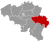 | |
| Liège | ||
| Verviers | ||
| Waremme | ||
This article is issued from Wikipedia - version of the 12/1/2016. The text is available under the Creative Commons Attribution/Share Alike but additional terms may apply for the media files.