Ōtama, Fukushima
| Ōtama 大玉村 | |||
|---|---|---|---|
| Village | |||
|
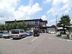
Ōtama Village Hall | |||
| |||
|
Location of Ōtama in Fukushima Prefecture | |||
 Ōtama
| |||
| Coordinates: 37°32′04″N 140°22′16″E / 37.53444°N 140.37111°ECoordinates: 37°32′04″N 140°22′16″E / 37.53444°N 140.37111°E | |||
| Country | Japan | ||
| Region | Tōhoku | ||
| Prefecture | Fukushima Prefecture | ||
| District | Adachi District | ||
| Area | |||
| • Total | 79.46 km2 (30.68 sq mi) | ||
| Population (December 2014) | |||
| • Total | 8,442 | ||
| • Density | 106/km2 (270/sq mi) | ||
| Time zone | Japan Standard Time (UTC+9) | ||
| City symbols | |||
| • Tree | Pinus densiflora | ||
| • Flower | Sakura | ||
| • Bird | Green pheasant | ||
| Phone number | 0243-48-3131 | ||
| Address | Tamai Hoshinai 70 Ōtama-mura, Adachi-gun, Fukushima-ken 969-1392 | ||
| Website | Official HP | ||
Ōtama (大玉村 Ōtama-mura) is a village located in Adachi District, Fukushima Prefecture, in northern Honshū, Japan. As of December 2014, the village had an estimated population of 8,442 and a population density of 106 persons per km2. The total area was 79.46 km2.
Geography
Ōtama is located in north-central Fukushima prefecture, sandwiched between the cities of Kōriyama and Nihonmatsu.
- Mountains: Mount Adatara (1728m)
- Rivers: Abukuma River
Neighboring municipalities
- Fukushima Prefecture
History
The area of present-day Ōtama was part of ancient Mutsu Province and the area has many burial mounds from the Kofun period. The area formed part of the holdings of Nihonmatsu Domain during the Edo period. After the Meiji Restoration, it was organized as part of Nakadōri region of Iwaki Province.
Ōtama Village was formed on March 31, 1955 with the merger of the villages of Oyama and Tamanoi, both in Adachi District.
Economy
The economy of Ōtama is primarily agricultural.
Education
- Ōtama Middle School
- Ōtama Oyama Elementary School
- Ōtama Tamanoi Elementary School
Transportation
Railway
- The Tohoku Main Line passes through the village, but is not served by any train stations.
Highway
External links
![]() Media related to Ōtama, Fukushima at Wikimedia Commons
Media related to Ōtama, Fukushima at Wikimedia Commons
- Official website (Japanese)