List of airports in the Greater Manila Area
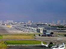
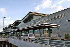
There are currently two airports in the Greater Manila Area with scheduled passenger service: Clark International Airport and Ninoy Aquino International Airport (NAIA); however, the majority of passenger traffic goes through Metro Manila's NAIA, which is the Philippines' busiest airport and major hub. Subic Bay International Airport, although classified as an international airport by the Civil Aviation Authority of the Philippines (CAAP), has yet to host any commercial airlines.
International Airports

The Greater Manila Area has three major airports, but only two with airline service.
| Airport name | IATA | ICAO | Location | Coordinates |
|---|---|---|---|---|
| Clark International Airport | CRK | RPLC | Clark Freeport (Angeles) | 15°11′09″N 120°33′35″E / 15.18583°N 120.55972°E |
| Ninoy Aquino International Airport | MNL | RPLL | Parañaque/Pasay | 14°30′31″N 121°01′10″E / 14.50861°N 121.01944°E |
| Subic Bay International Airport | SFS | RPLB | Subic Bay Freeport (Morong) | 14°47′40″N 120°16′16″E / 14.79444°N 120.27111°E |
Military Airfields
The following airports are operated by the Philippine Air Force for military or mixed military-civilian use.
| Airport name | IATA | ICAO | Location | Coordinates |
|---|---|---|---|---|
| Basilio Fernando Air Base | RPUL | Lipa | 13°57′17″N 121°07′29″E / 13.95472°N 121.12472°E | |
| Camp Mateo Capinpin Airfield | Tanay | 14°32′05″N 121°21′49″E / 14.53472°N 121.36361°E | ||
| Camp Olivas (Moras) Airfield | San Fernando | 15°01′11″N 120°42′16″E / 15.01972°N 120.70444°E | ||
| Cesar Basa Air Base | RPUF | Floridablanca | 14°59′11″N 120°29′33″E / 14.98639°N 120.49250°E | |
| Clark Air Base | CRK | RPLC | Clark Freeport (Angeles) | 15°11′09″N 120°33′35″E / 15.18583°N 120.55972°E |
| Danilo Atienza Air Base | SGL | RPLS | Cavite City | 14°29′29″N 120°53′38″E / 14.49139°N 120.89389°E |
| Jesus Villamor Air Base | MNL | RPLL | Pasay | 14°30′31″N 121°01′10″E / 14.50861°N 121.01944°E |
General Aviation towered airports
| Airport name | IATA | ICAO | Location | Coordinates |
|---|---|---|---|---|
| Plaridel Airport | PRB | RPUX | Plaridel | 14°53′26″N 120°51′10″E / 14.89056°N 120.85278°E |
General Aviation non-towered airports
| Airport name | IATA | ICAO | Location | Coordinates |
|---|---|---|---|---|
| Barradas Airfield | Tanauan | 14°05′49″N 121°06′58″E / 14.09694°N 121.11611°E | ||
| Bundagul Airstrip | Mabalacat | 15°14′26″N 120°35′56″E / 15.24056°N 120.59889°E | ||
| Gordon Boyce Airfield | Magalang | 15°15′02″N 120°40′39″E / 15.25056°N 120.67750°E | ||
| Hacienda Zobel Airstrip | Calatagan | 13°50′36″N 120°38′01″E / 13.84333°N 120.63361°E | ||
| OMNI Aviation Complex | RPLC | Angeles | 15°10′08″N 120°33′49″E / 15.16889°N 120.56361°E | |
| Samal Airport | Samal | 14°46′15″N 120°30′26″E / 14.77083°N 120.50722°E | ||
Proposed airports
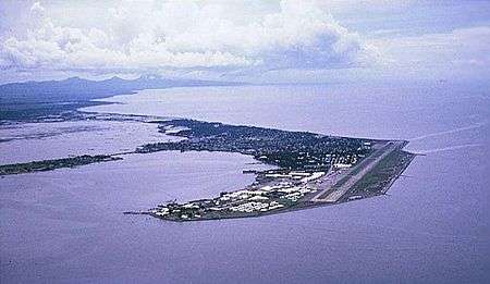
There is a proposal to develop the Danilo Atienza Air Base located southwest of the metropolis at Sangley Point as the new international gateway for Manila. The Philippine government has previously recommended the closure of the NAIA airport due to capacity issues.[1] Danish construction firm Rambøll Group A.S. is leading the project study started in August 2013 which calls for the reclamation of 50 hectares offshore of Sangley Point and the development of a 50-million-a-year airport terminal with two runways.[2]
Notable historical airports
- Bataan Airfield in Mariveles (closed 1942)
- Clark Air Base in Angeles (closed 1991; now CRK)
- Grace Park Airfield in Caloocan (the first commercial airfield in Manila;[3] closed 1946)
- Kindley Landing Field in Corregidor Island (closed 1942)
- Naval Air Station Cubi Point in Morong (closed 1991; now SFS)
- Naval Station Sangley Point in Cavite City (closed 1971; now Danilo Atienza AB)
- Nichols Field in Parañaque and Pasay (closed 1946; now NAIA)
- Nielson Field in Makati (closed 1948; redeveloped into the Makati Central Business District)
- Porac Airfield in Porac (closed 1945)

