Blair County, Pennsylvania
| Blair County, Pennsylvania | |
|---|---|
|
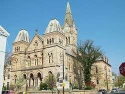
Blair County Courthouse, Hollidaysburg | |
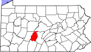 Location in the U.S. state of Pennsylvania | |
 Pennsylvania's location in the U.S. | |
| Founded | February 26, 1846 |
| Seat | Hollidaysburg |
| Largest city | Altoona |
| Area | |
| • Total | 527 sq mi (1,365 km2) |
| • Land | 526 sq mi (1,362 km2) |
| • Water | 1.3 sq mi (3 km2), 0.2% |
| Population (est.) | |
| • (2015) | 125,593 |
| • Density | 239/sq mi (92/km²) |
| Congressional district | 9th |
| Time zone | Eastern: UTC-5/-4 |
| Website |
www |
|
Footnotes: | |
| Designated | April 13, 1982[1] |
Blair County is a county located in the U.S. state of Pennsylvania. As of the 2010 census, the population was 127,089.[2] Its county seat is Hollidaysburg.[3] The county was created on February 26, 1846, from parts of Huntingdon and Bedford Counties.
Blair County comprises the Altoona, PA Metropolitan Statistical Area.
Geography
According to the U.S. Census Bureau, the county has a total area of 527 square miles (1,360 km2), of which 526 square miles (1,360 km2) is land and 1.3 square miles (3.4 km2) (0.2%) is water.[4]
Features
- Brush Mountain
- Logan Valley
- Morrison Cove
- Tussey Mountain
Adjacent counties
- Centre County (north)
- Huntingdon County (east)
- Bedford County (south)
- Cambria County (west)
- Clearfield County (northwest)
National protected area
Demographics
| Historical population | |||
|---|---|---|---|
| Census | Pop. | %± | |
| 1850 | 21,777 | — | |
| 1860 | 27,829 | 27.8% | |
| 1870 | 38,051 | 36.7% | |
| 1880 | 52,740 | 38.6% | |
| 1890 | 70,866 | 34.4% | |
| 1900 | 85,099 | 20.1% | |
| 1910 | 108,858 | 27.9% | |
| 1920 | 128,334 | 17.9% | |
| 1930 | 139,840 | 9.0% | |
| 1940 | 140,358 | 0.4% | |
| 1950 | 139,519 | −0.6% | |
| 1960 | 137,270 | −1.6% | |
| 1970 | 135,356 | −1.4% | |
| 1980 | 136,621 | 0.9% | |
| 1990 | 130,542 | −4.4% | |
| 2000 | 129,144 | −1.1% | |
| 2010 | 127,089 | −1.6% | |
| Est. 2015 | 125,593 | [5] | −1.2% |
| U.S. Decennial Census[6] 1790-1960[7] 1900-1990[8] 1990-2000[9] 2010-2013[2] | |||
As of the census[10] of 2000, there were 127,089 people and 52,159 households within the county. The population density was 246 people per square mile (95/km²). There were 55,061 housing units at an average density of 105 per square mile (40/km²). The racial makeup of the county was 96.18% White, 1.68% Black or African American, 0.11% Native American, 0.56% Asian, 0.02% Pacific Islander, 0.23% from other races, and 1.22% from two or more races. 0.97% of the population were Hispanic or Latino of any race. 40.0% were of German, 12.2% Irish, 10.7% Italian, 9.9% American and 6.0% English ancestry according to Census 2000.
There were 52,159 households out of which 28.4% had children under the age of 18 living with them, 52.60% were married couples living together, 11.20% had a female householder with no husband present, and 32.30% were non-families. 27.80% of all households were made up of individuals and 13.30% had someone living alone who was 65 years of age or older. The average household size was 2.43 and the average family size was 2.96.
In the county, the population was spread out with 21.1% under the age of 18, 3.5% from 18 to 19, 5.9% from 20 to 24, 11.1% from 25 to 34, 19.3% from 35 to 49, 21.4% from 50 to 64, and 17.7% who were 65 years of age or older. The median age was 40 years. The population was 48.55% male, and 51.45% female.
Law and government
County commissioners
- Bruce Erb, Chair, Republican
- Terry Tomassetti, Vice-chair, Republican
- Ted Beam, Secretary, Democrat
Other county offices
- Clerk of Courts and Prothonotary, Carol Newman, Republican
- Controller, A.C. Stickel, Republican
- Coroner, Patricia Ross, Republican
- District Attorney, Richard Consiglio, Republican
- Register of Wills and Recorder of Deeds, Mary Ann Bennis, Republican
- Sheriff, Mitch Cooper, Republican
- Treasurer, James Carothers, Republican
State Senate
State House of Representatives
- John McGinnis, Republican, Pennsylvania's 79th Representative District
- Judy Ward, Republican, Pennsylvania's 80th Representative District
United States House of Representatives
United States Senate
Politics
As of November 2014, there are 84,077 registered voters in Blair County.[11]
- Democratic: 27,875 (33.15%)
- Republican: 45,573 (54.20%)
- Libertarian: 473 (0.56%)
- No Party Affiliation: 4,820 (5.73%)
- Other: 5,336 (6.35%)
Education

Colleges and universities
Community, junior and technical colleges
- South Hills School of Business and Technology
- YTI Career Institute
- Pennsylvania Highlands Community College
Public school districts
- Altoona Area School District
- Bellwood-Antis School District
- Claysburg-Kimmel School District (also in Bedford County)
- Hollidaysburg Area School District
- Penn Cambria School District (also in Cambria County)
- Spring Cove School District
- Tyrone Area School District (also in Centre and Huntingdon Counties)
- Williamsburg Community School District
Charter schools
- Agora Cyber Charter School
- Central Pennsylvania Digital Learning Foundation Charter School (K-12). Altoona.
- There are 17 public cyber charter schools in Pennsylvania that are available statewide for free, to children K-12. See: Education in Pennsylvania.[12]
Technology school
Private schools
|
|
Data taken from Pennsylvania EdNA - PDE database of public private schools 2012
Libraries
- Altoona Area Pub Library Media Center - Altoona
- Altoona Area Public Library - Altoona
- Bellwood Antis Public Library - Bellwood
- Blair County Library System - Altoona
- Claysburg Area Public Library Inc - Claysburg
- Hollidaysburg Area Public Library - Hollidaysburg
- Martinsburg Community Library - Martinsburg
- Roaring Spring Community Library - Roaring Spring
- Tyrone-Snyder Twnshp Pub Library - Tyrone
- Williamsburg Public Library - Williamsburg
Recreation
There is one Pennsylvania state park in Blair County.
Communities

Under Pennsylvania law, there are four types of incorporated municipalities: cities, boroughs, townships, and, in at most two cases, towns. The following cities, boroughs and townships are located in Blair County:
City
Boroughs
- Bellwood
- Duncansville
- Hollidaysburg (county seat)
- Martinsburg
- Newry
- Roaring Spring
- Tunnelhill (mostly in Cambria County)
- Tyrone
- Williamsburg
Townships
Census-designated places
Census-designated places are geographical areas designated by the U.S. Census Bureau for the purposes of compiling demographic data. They are not actual jurisdictions under Pennsylvania law. Other unincorporated communities, such as villages, may be listed here as well.
Population ranking
The population ranking of the following table is based on the 2010 census of Blair County.[13]
† county seat
| Rank | City/Town/etc. | Population (2010 Census) | Municipal type | Incorporated |
|---|---|---|---|---|
| 1 | Altoona | 46,320 | City | 1854 (borough) 1868 (city) |
| 2 | † Hollidaysburg | 5,791 | Borough | 1836 |
| 3 | Tyrone | 5,477 | Borough | 1857 |
| 4 | Bellwood | 3,564 | Borough | 1898 |
| 5 | Roaring Spring | 2,585 | Borough | 1888 |
| 6 | Greenwood | 2,458 | CDP | |
| 7 | Martinsburg | 1,958 | Borough | 1832 |
| 8 | Lakemont | 1,868 | CDP | |
| 9 | Claysburg | 1,625 | CDP | |
| 10 | Williamsburg | 1,254 | Borough | 1827 |
| 11 | Duncansville | 1,233 | Borough | 1891 |
| 12 | Tipton | 1,083 | CDP | |
| 13 | East Freedom | 972 | CDP | |
| 14 | Foot of Ten | 672 | CDP | |
| 15 | Grazierville | 665 | CDP | |
| 16 | Tunnelhill (mostly in Cambria County) | 363 | Borough | 1876 |
| 17 | Northwood | 296 | CDP | |
| 18 | Newry | 270 | Borough | 1876 |
See also
References
- ↑ "PHMC Historical Markers Search" (Searchable database). Pennsylvania Historical and Museum Commission. Commonwealth of Pennsylvania. Retrieved 2014-01-25.
- 1 2 "State & County QuickFacts". United States Census Bureau. Retrieved November 16, 2013.
- ↑ "Find a County". National Association of Counties. Archived from the original on 2011-05-31. Retrieved 2011-06-07.
- ↑ "2010 Census Gazetteer Files". United States Census Bureau. August 22, 2012. Retrieved March 5, 2015.
- ↑ "County Totals Dataset: Population, Population Change and Estimated Components of Population Change: April 1, 2010 to July 1, 2015". Retrieved July 2, 2016.
- ↑ "U.S. Decennial Census". United States Census Bureau. Archived from the original on May 11, 2015. Retrieved March 5, 2015.
- ↑ "Historical Census Browser". University of Virginia Library. Retrieved March 5, 2015.
- ↑ Forstall, Richard L., ed. (March 24, 1995). "Population of Counties by Decennial Census: 1900 to 1990". United States Census Bureau. Retrieved March 5, 2015.
- ↑ "Census 2000 PHC-T-4. Ranking Tables for Counties: 1990 and 2000" (PDF). United States Census Bureau. April 2, 2001. Retrieved March 5, 2015.
- ↑ "American FactFinder". United States Census Bureau. Archived from the original on 2013-09-11. Retrieved 2008-01-31.
- ↑ Voter Registration Statistics. Dos.state.pa.us. Retrieved on 2014-11-04.
- ↑ Pennsylvania Department of Education. "Charter Schools in Pennsylvania". Retrieved February 9, 2011.
- ↑ "Archived copy". Archived from the original on 2013-12-21. Retrieved 2016-02-13.
External links
- Blair County Business and Information Directory
- Forever Free: Blair County's Civil War
- The Blair County Historical Society
- Blair County government
- Blair County Chamber of Commerce
- Catharine Township
- Morrisons Cove Herald website
| Wikimedia Commons has media related to Blair County, Pennsylvania. |
 |
Clearfield County | Centre County | | |
| Cambria County | |
Huntingdon County | ||
| ||||
| | ||||
| Bedford County |
Municipalities and communities of Blair County, Pennsylvania, United States | ||
|---|---|---|
| City | | |
| Boroughs | ||
| Townships | ||
| CDPs | ||
| Unincorporated communities | ||
| Footnotes | ‡This populated place also has portions in an adjacent county or counties | |
Coordinates: 40°28′N 78°21′W / 40.47°N 78.35°W