Arroio dos Ratos
| Arroio dos Ratos | ||
|---|---|---|
| Municipality | ||
| O Município de Arroio dos Ratos The Municipality of Arroio dos Ratos | ||
| ||
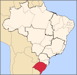
 Location within Rio Grande do Sul | ||
 Arroio dos Ratos Location in Brazil | ||
| Coordinates: 30°04′37″S 51°43′44″W / 30.07694°S 51.72889°W / -30.07694; -51.72889Coordinates: 30°04′37″S 51°43′44″W / 30.07694°S 51.72889°W / -30.07694; -51.72889 | ||
| Country |
| |
| State | Rio Grande do Sul | |
| Mesoregion | Metropolitana de Porto Alegre | |
| Microregion | Porto Alegre | |
| Founded | 28 December 1964 | |
| Government | ||
| • Mayor | José Carlos Garcia de Azeredo (PDT) | |
| Area | ||
| • Total | 425.9 km2 (164.4 sq mi) | |
| Elevation | 69 m (226 ft) | |
| Population (2010) | ||
| • Total | 13,608 | |
| • Density | 32/km2 (83/sq mi) | |
| Demonym(s) | arroio-ratenses or ratenses | |
| Time zone | UTC-3 (UTC-3) | |
| • Summer (DST) | UTC-2 (UTC-2) | |
| Postal Code | 96740-000 | |
| Area code(s) | +55 51 | |
| Website | Arroio dos Ratos, Rio Grande do Sul | |
Arroio dos Ratos is a municipality in the Brazilian state of Rio Grande do Sul. Thanks to its soil, is nationally known as the National Cradle of the Coal industry and National Capital of the Watermelon.
See also
This article is issued from Wikipedia - version of the 5/15/2016. The text is available under the Creative Commons Attribution/Share Alike but additional terms may apply for the media files.

