Alegrete
| City of Alegrete | |||
|---|---|---|---|
| Municipality | |||
|
Fountain at the lake of Neytha Ramos Park | |||
| |||
| Nickname(s): "Baita Chão" ("Hell of a Ground") | |||
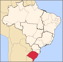
 Location in Rio Grande do Sul and Brazil | |||
| Coordinates: 29°47′01.63″S 55°47′27.54″W / 29.7837861°S 55.7909833°WCoordinates: 29°47′01.63″S 55°47′27.54″W / 29.7837861°S 55.7909833°W | |||
| Country | Brazil | ||
| Region | Sul | ||
| State | Rio Grande do Sul | ||
| Founded | October 25, 1831 | ||
| Government | |||
| • Mayor | Erasmo Guterres da Silva (PMDB) | ||
| Area | |||
| • Total | 7,804 km2 (3,013 sq mi) | ||
| Elevation | 102 m (335 ft) | ||
| Population (2010)[1] | |||
| • Total | 78,984 | ||
| • Density | 10/km2 (26/sq mi) | ||
| Time zone | UTC-3 (UTC-3) | ||
| • Summer (DST) | UTC-2 (UTC-2) | ||
| HDI' (2000) | 0.793 – medium[2] | ||
| Website | alegrete.rs.gov.br | ||

.svg.png)

Alegrete is a municipality in Rio Grande do Sul located in southern Brazil. Its medium altitude is 102 m (335 ft). Its estimated population in 2008 was 78,984 inhabitants and the total area is 7,803.967 km2 (3,013.129 sq mi) (the largest municipality of the State and of Southern Brazil). Its inhabitants are called Alegretenses.
.jpg)
Alegrete was settled in 1816 and became a municipality in 1857. It is the hometown of the abolitionist leader Franklin Gomes Souto, of the politician, diplomat and statesman Osvaldo Aranha, first President of the United Nations General Assembly, and of the Brazilian poet Mário Quintana. Every September 20 (Ragamuffin War Day), about 8,000 young, adult and old horsemen and horsewomen parade through its streets, using their native costumes and riding their horses with trappings.
Alegrete is served by Gaudêncio Machado Ramos Airport.
The municipality contains part of the 351 hectares (870 acres) Ibirapuitã Biological Reserve, a fully protected conservation unit created in 1982 to preserve an area of the pampas biome.[3]
References
- ↑ "Censo Populacional 2010". Censo Populacional 2010. Instituto Brasileiro de Geografia e Estatística (IBGE). 29 November 2010. Retrieved 11 December 2010.
- ↑ "Ranking decrescente do IDH-M dos municípios do Brasil" (in Portuguese). Atlas do Desenvolvimento Humano, Programa das Nações Unidas para o Desenvolvimento (PNUD). 2000. Retrieved December 17, 2009.
- ↑ "Reserva Biológica de Ibirapuitã", Portal Uruguaiana (in Portuguese), retrieved 2016-04-26