Guaporé, Rio Grande do Sul
| Guaporé | |||
|---|---|---|---|
| Municipality | |||
| The Municipality of Guaporé | |||
| |||
| Nickname(s): Capital of hospitality | |||
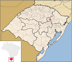
 Location in Rio Grande do Sul | |||
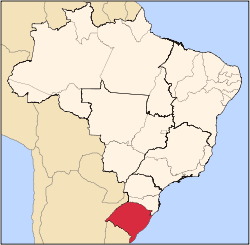
 Guaporé Location in Brazil | |||
| Coordinates: 28°50′45″S 51°53′24″W / 28.84583°S 51.89000°WCoordinates: 28°50′45″S 51°53′24″W / 28.84583°S 51.89000°W | |||
| Country |
| ||
| Region | South | ||
| State |
| ||
| Founded | 11 December 1903 | ||
| Government | |||
| • Mayor | Paulo Mazutti (PP) (2013-2016) | ||
| Area | |||
| • Total | 297.661 km2 (114.928 sq mi) | ||
| IBGE/2002 [1] | |||
| Elevation | 478 m (1,568 ft) | ||
| Population (2010)Census IBGE/2010[2] | |||
| • Total | 22,810 | ||
| • Density | 76.63/km2 (198.5/sq mi) | ||
| Time zone | UTC-3 (UTC-3) | ||
| • Summer (DST) | UTC-2 (UTC-2) | ||
| Postal Code | 99200-000 | ||
| Area code(s) | +55 54 | ||
| Website |
www | ||
Guaporé is a Brazilian municipality located in the state of Rio Grande do Sul. It is the state's greatest jewelry and lingerie producer, ranking second in the country. The city was mainly colonized by Italian immigrants in the 19th century and still retains their traditions. The name comes from the Guaraní language and its meaning is disputed, most likely being Desert Valley.
History
The immigrant settlement that would eventually give birth to the city began in the early 19th century in the area that is the present-day municipality of Muçum, a smaller number of German cattle herders also established themselves in the area now known as São Valentim do Sul, both towns that used to be part of Guaporé.[3]
In 1892 the colony of Guaporé was established, on area belonging to the cities of Lajeado and Passo Fundo. The colony's manager, Eng. José Montauri de Aguiar Leitão, designated to Eng. Vespasiano Corrêa the task of zoning and dividing the town's area in some 5000 shares of 0.25 to 0.30 km2. Soon after, settlers from the first Italian colonies in the state (mainly Caxias do Sul, Bento Gonçalves and Veranópolis) came to the newly formed town and, in 1896, the colony had already reached 7,000 inhabitants.[3]
In 1897 the Santo Antônio Parish was created, under the Porto Alegre Diocese, being an important step the formation of a city in local culture. By 1900 the population had grown to 13,727. This success led to the formal establishment, on 11 December 1903, of the Municipality of Guaporé, with Eng. Vespasiano Rodrigues Corrêa as the first mayor, inaugurated on 1 January 1904.[3]
By 1910, Guaporé had around 30,000 inhabitants, even more than today, with 1,020 living in the town center, which had over 170 buildings, a town square, telegraph, post office and church. Agriculture was the most important economical activity, the main crops being rice, beans, corn, soy, orange and vines. Furthermore, 82 businesses and a few industries were established by the time, producing aguardente, wine, cheese and lard.
Through the years, several districts emancipated from Guaporé, significantly reducing the city's area and population. Today, several municipalities make up what was once Guaporé, the largest being Casca (emancipated in 1954), Muçum (1959), Serafina Corrêa (1960) and Dois Lajeados (1987), among many others.
The Immigrants
Upon their arrival, throughout the 19th century, the immigrants were devoid of anything of value and had to rely on their strong will and bold spirits to build a new life on a new land. With over a century gone by, the memory of these origins is still felt in the religious strength and willingness to work of the community. The religious passion is clearly seen in the numerous chapels on rural areas and the Central Church, built in Neogothic style between 1897 and 1947. The city also has a 13 m Christ statue placed on a 7 m pedestal on the city's tallest mountain.
In 1907, with the arrival of the Pasqualli family to the city, the industry that would become an economical backbone had its humble beginnings as they applied their goldsmith knowledge to become the first jewellers established in Guaporé.
Over a hundred years after its foundation, Guaporé has set itself as an important commercial, industrial, cultural and touristic centre for dozens of cities in the region.
Geography
Guaporé is located on the Serra Gaúcha a mountainous area of the north-eastern Rio Grande do Sul. The city center is at an altitude of 478 m above sea level, although some peaks reach the 700 m mark. It is situated between the highlands of the Planalto and lowlands of the Depressão Central and is composed of Igneous rock formed in the end of the Mesozoic Era. It is in an area of Basaltic Rock, that lay's upon layers of Arenite and Granite. The rivers Carreiro and Guaporé flow on the eastern and western borders of the city, respectively.
Climate
Due to its location, Guaporé is subject to a Humid subtropical climate, summers are cool and winters are moderately cold, with common occurrence of frost and occasional snowfall.
Statistics
Below are some available figures on the city's economy and life.
- GDP: R$ 323,682,673 IBGE/2008[4]
- GDP per capita: R$ 14468.20 IBGE/2008[4]
- Total Exports: US$ 18,509,548 FOB 2008 [5]
- HDI: 0.826 high UNDP/2000 [6]
- Illiteracy: 6.48% 2000 [5]
- Life expectancy: 73.84 years 2000 [5]
- Infant mortality rate: 3.83 2007 [5]
Culture
In addition to the Italian majority, there is significant presence of German and Polish descendants, as well as other European nationalities. Despite generations of foreign influence, those of Italian descent still maintain several traditions including the use of the Talian dialect, itself derived from the Venetian language, an Italian dialect. Furthermore, the cold winters gave rise to the tradition of gathering family and friends around wood-burning-stoves (used for heating and cooking) to eat pine nuts, chat and play cards. Typical Italian cousine is very common and served in any occasion. Hunting and fishing, once important sources of sustenance, have now become usual pastime sports.
The Gaucho culture has also found its way into peoples lives over time. Nowadays the tradition of drinking chimarrão is very widespread, and public celebrations of the Ragamuffin War are held every year in the central square, usually on the week leading up to the state holiday of September 20.
Tourism
The city has always attracted tourists from many places and for many different reasons, be it shopping tourism, racing enthusiasts, railway fans, religious people or even those simply attracted by the small town charm.
Main tourist attractions include:
- Igreja Matriz de Santo Antônio - city's central church built in French Neogothic style starting in 1947. The church was designed by the Italian Tiziano Bettanin.
- Christ the Redeemer Statue - The 13 m tall statue is placed on a 7 m pedestal on top of a 741 m peak west of the city centre. Every year, on Good Friday, thousands march up the mountain in honour of Christ's sacrifice.
- Guaporé Commercial Center - With dozens of Jewellery and Lingerie shops, it attracts tourists from all over on the look for new items and low prices. Official Site(Portuguese)
- Vespasiano Corrêa Square - Central square in the center of town, bordered by the Santo Antônio Church, City Hall and the city's main streets.
- Autódromo Internacional de Guaporé - Racetrack that has always offered entertainment to the local population and numerous tourists. The main event is the yearly leg of the Formula Truck championship, a Brazilian Truck Racing competition.
- Kartódromo - Kart track by the aforementioned racetrack.
- Ferrovia do Trigo (Wheat Railway) - Railway built in the 60s and 70s to complete the connection of the whole north-east of the state to the capital. The mountainous terrain ensued in the construction of over 20 viaducts and bridges as well as several tunnels of up to 2 km in length. Every year, many enthusiasts walk these rails in order to catch a glimpse of the amazing and beautiful engineering works.
Sport and Leisure
Many locations are available to the population for practising sports and other leisure activities. Many football fields are spread throughout the city and many locals have some sort of countryside retreat for the weekends. Other sport and leisure options include:
- Autódromo Internacional de Guaporé - Aside from the many races held in the local motorsports circuit over the whole year, the area still holds a Kart Racing Track, a swimming pool, camping area and facilities for the traditional Sunday barbecues and other activities.
- AFAG - Caça e Pesca - Offers areas for fishing, Shooting Sports, Camping and Off-road motorcycling.
- AABB (Banco do Brasil Athletic Association) - With a football field and facilities for parties and other events, the usually members-only location is often rented for private occasions.
- Clube União Guaporense - The old building by the central square hosts a restaurant and ballroom used by many for celebrations. Swimming Pools, Tennis Courts, Snooker and card playing tables are also available for members.
- Guaporé Aerodrome - (ICAO: SSGR) The airfield's 1,100 m gravel runway is occasionally used by light aircraft.
Notable people
- Renato Gaúcho: retired football player, having played for clubs such as Esportivo, Grêmio, Flamengo, Botafogo and Fluminense, currently coaches Grêmio.
- Ale Vanzella: bossa nova / indie rock musician
External links
- (Portuguese) Official city government website
- (Portuguese) Autodromo Internacional de Guaporé - City's racetrack website
Notes
- ↑ Brazilian Institute of Geography and Statistics - IBGE (10 October 2002). "Área territorial oficial" (in Portuguese). Retrieved 5 December 2010.
- ↑ "Populational Census 2010". Populational Census 2010 (in Portuguese). Brazilian Institute of Geography and Statistics - IBGE. 29 November 2010. Retrieved 11 December 2010.
- 1 2 3 (Portuguese) Prefeitura Municipal de Guaporé. "Guaporé, conheça melhor nossa cidade". Retrieved 28 January 2011.
- 1 2 "Produto Interno Bruto dos Municípios 2004-2008" (in Portuguese). Brazilian Institute of Geography and Statistics. Retrieved 11 December 2010.
- 1 2 3 4 "Resumo Estatístico dos Municípios" (in Portuguese). Fundação de Economia e Estatística Siegfried Emanuel Heuser. Retrieved 29 January 2011.
- ↑ "Ranking decrescente do IDH-M dos municípios do Brasil". Atlas do Desenvolvimento Humano (in Portuguese). United Nations Development Programme (UNDP). 2000. Retrieved 11 October de 2008. Check date values in:
|access-date=(help)
_-_Bandeira.png)
_-_Brasao.png)
