Auffreville-Brasseuil
| Auffreville-Brasseuil | ||
|---|---|---|
|
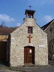
The Chapel in Auffreville-Brasseuil | ||
| ||
 Auffreville-Brasseuil | ||
|
Location within Île-de-France region  Auffreville-Brasseuil | ||
| Coordinates: 48°57′14″N 1°42′40″E / 48.954°N 1.711°ECoordinates: 48°57′14″N 1°42′40″E / 48.954°N 1.711°E | ||
| Country | France | |
| Region | Île-de-France | |
| Department | Yvelines | |
| Arrondissement | Mantes-la-Jolie | |
| Canton | Guerville | |
| Government | ||
| • Mayor (2014–2020) | Serge Ancelot | |
| Area1 | 2.37 km2 (0.92 sq mi) | |
| Population (2008)2 | 596 | |
| • Density | 250/km2 (650/sq mi) | |
| Time zone | CET (UTC+1) | |
| • Summer (DST) | CEST (UTC+2) | |
| INSEE/Postal code | 78031 / 78930 | |
| Elevation |
24–127 m (79–417 ft) (avg. 32 m or 105 ft) | |
|
1 French Land Register data, which excludes lakes, ponds, glaciers > 1 km² (0.386 sq mi or 247 acres) and river estuaries. 2 Population without double counting: residents of multiple communes (e.g., students and military personnel) only counted once. | ||

Auffreville-Brasseuil is a commune in the Yvelines department in north-central France.
Population
| Historical population | ||
|---|---|---|
| Year | Pop. | ±% |
| 1793 | 294 | — |
| 1800 | 279 | −5.1% |
| 1806 | 235 | −15.8% |
| 1821 | 242 | +3.0% |
| 1831 | 243 | +0.4% |
| 1836 | 249 | +2.5% |
| 1841 | 253 | +1.6% |
| 1846 | 251 | −0.8% |
| 1851 | 241 | −4.0% |
| 1856 | 219 | −9.1% |
| 1861 | 204 | −6.8% |
| 1866 | 216 | +5.9% |
| 1872 | 239 | +10.6% |
| 1876 | 248 | +3.8% |
| 1881 | 203 | −18.1% |
| 1886 | 211 | +3.9% |
| 1891 | 191 | −9.5% |
| 1896 | 218 | +14.1% |
| 1901 | 222 | +1.8% |
| 1906 | 234 | +5.4% |
| 1911 | 207 | −11.5% |
| 1921 | 193 | −6.8% |
| 1926 | 220 | +14.0% |
| 1931 | 272 | +23.6% |
| 1936 | 291 | +7.0% |
| 1946 | 258 | −11.3% |
| 1954 | 303 | +17.4% |
| 1962 | 326 | +7.6% |
| 1968 | 338 | +3.7% |
| 1975 | 445 | +31.7% |
| 1982 | 454 | +2.0% |
| 1990 | 560 | +23.3% |
| 1999 | 586 | +4.6% |
| 2008 | 596 | +1.7% |
See also
References
| Wikimedia Commons has media related to Auffreville-Brasseuil. |
This article is issued from Wikipedia - version of the 7/21/2016. The text is available under the Creative Commons Attribution/Share Alike but additional terms may apply for the media files.