Les Alluets-le-Roi
| Les Alluets-le-Roi | ||
|---|---|---|
|
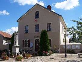
Town hall | ||
| ||
 Les Alluets-le-Roi | ||
|
Location within Île-de-France region  Les Alluets-le-Roi | ||
| Coordinates: 48°54′54″N 1°55′12″E / 48.915000°N 01.92°ECoordinates: 48°54′54″N 1°55′12″E / 48.915000°N 01.92°E | ||
| Country | France | |
| Region | Île-de-France | |
| Department | Yvelines | |
| Arrondissement | Saint-Germain-en-Laye | |
| Canton | Poissy-Sud | |
| Government | ||
| • Mayor (2008–2014) | Daniel Gorbaty | |
| Area1 | 7.39 km2 (2.85 sq mi) | |
| Population (2008)2 | 1,194 | |
| • Density | 160/km2 (420/sq mi) | |
| Time zone | CET (UTC+1) | |
| • Summer (DST) | CEST (UTC+2) | |
| INSEE/Postal code | 78010 / 78580 | |
| Elevation |
150–187 m (492–614 ft) (avg. 180 m or 590 ft) | |
|
1 French Land Register data, which excludes lakes, ponds, glaciers > 1 km² (0.386 sq mi or 247 acres) and river estuaries. 2 Population without double counting: residents of multiple communes (e.g., students and military personnel) only counted once. | ||
.svg.png)

Saint-Nicolas church
Les Alluets-le-Roi is a commune in the Yvelines department in northern France.
Population
| Historical population | ||
|---|---|---|
| Year | Pop. | ±% |
| 1793 | 453 | — |
| 1800 | 425 | −6.2% |
| 1806 | 479 | +12.7% |
| 1821 | 533 | +11.3% |
| 1831 | 541 | +1.5% |
| 1836 | 550 | +1.7% |
| 1841 | 552 | +0.4% |
| 1846 | 520 | −5.8% |
| 1851 | 523 | +0.6% |
| 1856 | 475 | −9.2% |
| 1861 | 441 | −7.2% |
| 1866 | 453 | +2.7% |
| 1872 | 442 | −2.4% |
| 1876 | 448 | +1.4% |
| 1881 | 447 | −0.2% |
| 1886 | 468 | +4.7% |
| 1891 | 470 | +0.4% |
| 1896 | 434 | −7.7% |
| 1901 | 383 | −11.8% |
| 1906 | 395 | +3.1% |
| 1911 | 381 | −3.5% |
| 1921 | 347 | −8.9% |
| 1926 | 393 | +13.3% |
| 1931 | 370 | −5.9% |
| 1936 | 379 | +2.4% |
| 1946 | 319 | −15.8% |
| 1954 | 396 | +24.1% |
| 1962 | 393 | −0.8% |
| 1968 | 483 | +22.9% |
| 1975 | 632 | +30.8% |
| 1982 | 826 | +30.7% |
| 1990 | 1,062 | +28.6% |
| 1999 | 1,266 | +19.2% |
| 2008 | 1,194 | −5.7% |
See also
References
| Wikimedia Commons has media related to Les Alluets-le-Roi. |
This article is issued from Wikipedia - version of the 7/20/2016. The text is available under the Creative Commons Attribution/Share Alike but additional terms may apply for the media files.