Saint-Forget
| Saint-Forget | |
|---|---|
|
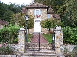
Town hall | |
 Saint-Forget | |
|
Location within Île-de-France region  Saint-Forget | |
| Coordinates: 48°42′30″N 1°59′49″E / 48.7083°N 1.9969°ECoordinates: 48°42′30″N 1°59′49″E / 48.7083°N 1.9969°E | |
| Country | France |
| Region | Île-de-France |
| Department | Yvelines |
| Arrondissement | Rambouillet |
| Canton | Chevreuse |
| Government | |
| • Mayor (2001–2008) | Françoise Gossare |
| Area1 | 6 km2 (2 sq mi) |
| Population (2006)2 | 497 |
| • Density | 83/km2 (210/sq mi) |
| Time zone | CET (UTC+1) |
| • Summer (DST) | CEST (UTC+2) |
| INSEE/Postal code | 78548 / 78720 |
| Elevation |
77–168 m (253–551 ft) (avg. 165 m or 541 ft) |
|
1 French Land Register data, which excludes lakes, ponds, glaciers > 1 km² (0.386 sq mi or 247 acres) and river estuaries. 2 Population without double counting: residents of multiple communes (e.g., students and military personnel) only counted once. | |
Saint-Forget is a commune in the Yvelines department in the Île-de-France in north-central France.[1]
See also
| Wikimedia Commons has media related to Saint-Forget. |
References
- ↑ INSEE "latest releases" Check
|url=value (help). National Institute of Statistics and Economic Studies. Retrieved February 2, 2013.
This article is issued from Wikipedia - version of the 12/30/2013. The text is available under the Creative Commons Attribution/Share Alike but additional terms may apply for the media files.