Prunay-en-Yvelines
| Prunay-en-Yvelines | |
|---|---|
|
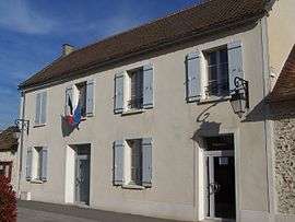
The town hall in Prunay-en-Yvelines | |
 Prunay-en-Yvelines | |
|
Location within Île-de-France region  Prunay-en-Yvelines | |
| Coordinates: 48°31′44″N 1°47′46″E / 48.5289°N 1.7961°ECoordinates: 48°31′44″N 1°47′46″E / 48.5289°N 1.7961°E | |
| Country | France |
| Region | Île-de-France |
| Department | Yvelines |
| Arrondissement | Rambouillet |
| Canton | Saint-Arnoult-en-Yvelines |
| Intercommunality | Contrée d'Ablis-Porte des Yvelines |
| Government | |
| • Mayor (2001–2007) | Jean-Pierre Malardeau |
| Area1 | 26.95 km2 (10.41 sq mi) |
| Population (2006)2 | 824 |
| • Density | 31/km2 (79/sq mi) |
| Time zone | CET (UTC+1) |
| • Summer (DST) | CEST (UTC+2) |
| INSEE/Postal code | 78506 / 78660 |
| Elevation |
127–164 m (417–538 ft) (avg. 150 m or 490 ft) |
|
1 French Land Register data, which excludes lakes, ponds, glaciers > 1 km² (0.386 sq mi or 247 acres) and river estuaries. 2 Population without double counting: residents of multiple communes (e.g., students and military personnel) only counted once. | |
Prunay-en-Yvelines is a commune in the Yvelines department in the Île-de-France in north-central France.
See also
References
| Wikimedia Commons has media related to Prunay-en-Yvelines. |
This article is issued from Wikipedia - version of the 2/17/2015. The text is available under the Creative Commons Attribution/Share Alike but additional terms may apply for the media files.