Andrésy
| Andrésy | ||
|---|---|---|
|
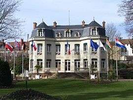
Town hall | ||
| ||
 Andrésy | ||
|
Location within Île-de-France region  Andrésy | ||
| Coordinates: 48°58′54″N 2°03′33″E / 48.9817°N 02.0592°ECoordinates: 48°58′54″N 2°03′33″E / 48.9817°N 02.0592°E | ||
| Country | France | |
| Region | Île-de-France | |
| Department | Yvelines | |
| Arrondissement | Saint-Germain-en-Laye | |
| Canton | Andrésy | |
| Intercommunality | Deux Rives de la Seine | |
| Government | ||
| • Mayor (2008–2014) | Hugues Ribault | |
| Area1 | 6.91 km2 (2.67 sq mi) | |
| Population (2008)2 | 12,233 | |
| • Density | 1,800/km2 (4,600/sq mi) | |
| Time zone | CET (UTC+1) | |
| • Summer (DST) | CEST (UTC+2) | |
| INSEE/Postal code | 78015 / 78570 | |
| Elevation |
17–168 m (56–551 ft) (avg. 30 m or 98 ft) | |
|
1 French Land Register data, which excludes lakes, ponds, glaciers > 1 km² (0.386 sq mi or 247 acres) and river estuaries. 2 Population without double counting: residents of multiple communes (e.g., students and military personnel) only counted once. | ||

Andrésy is a commune in the Yvelines department in north-central France.
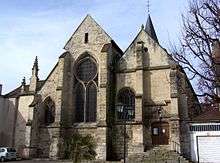
Saint-Germain church
Population
| Historical population | ||
|---|---|---|
| Year | Pop. | ±% |
| 1793 | 1,079 | — |
| 1800 | 1,017 | −5.7% |
| 1806 | 938 | −7.8% |
| 1821 | 895 | −4.6% |
| 1831 | 919 | +2.7% |
| 1836 | 942 | +2.5% |
| 1841 | 862 | −8.5% |
| 1846 | 945 | +9.6% |
| 1851 | 937 | −0.8% |
| 1856 | 907 | −3.2% |
| 1861 | 952 | +5.0% |
| 1866 | 939 | −1.4% |
| 1872 | 942 | +0.3% |
| 1876 | 970 | +3.0% |
| 1881 | 962 | −0.8% |
| 1886 | 1,117 | +16.1% |
| 1891 | 1,256 | +12.4% |
| 1896 | 1,265 | +0.7% |
| 1901 | 1,323 | +4.6% |
| 1906 | 1,310 | −1.0% |
| 1911 | 1,469 | +12.1% |
| 1921 | 1,759 | +19.7% |
| 1926 | 1,977 | +12.4% |
| 1931 | 2,234 | +13.0% |
| 1936 | 2,456 | +9.9% |
| 1946 | 2,968 | +20.8% |
| 1954 | 3,279 | +10.5% |
| 1962 | 4,189 | +27.8% |
| 1968 | 4,876 | +16.4% |
| 1975 | 8,927 | +83.1% |
| 1982 | 11,185 | +25.3% |
| 1990 | 12,548 | +12.2% |
| 1999 | 12,484 | −0.5% |
| 2008 | 12,233 | −2.0% |
International relations
Twin towns
Andrésy is twinned with:
See also
References
| Wikimedia Commons has media related to Andrésy. |
This article is issued from Wikipedia - version of the 1/12/2015. The text is available under the Creative Commons Attribution/Share Alike but additional terms may apply for the media files.