City of Bankstown
| City of Bankstown New South Wales | |||||||||||||
|---|---|---|---|---|---|---|---|---|---|---|---|---|---|
 Location in Metropolitan Sydney | |||||||||||||
| Coordinates | 33°55′S 151°02′E / 33.917°S 151.033°ECoordinates: 33°55′S 151°02′E / 33.917°S 151.033°E | ||||||||||||
| Population | 193,398 (2011 census)[1] (15th) | ||||||||||||
| • Density | 2,374/km2 (6,150/sq mi) | ||||||||||||
| Established | 7 September 1895 | ||||||||||||
| Abolished | 12 May 2016 | ||||||||||||
| Area | 76.8 km2 (29.7 sq mi) | ||||||||||||
| Time zone | AEST (UTC+10) | ||||||||||||
| • Summer (DST) | AEDT (UTC+11) | ||||||||||||
| Mayor | Clr Khal Ashfour (Labor) | ||||||||||||
| Council seat | Bankstown | ||||||||||||
| Region | Canterbury-Bankstown | ||||||||||||
| Website | City of Bankstown | ||||||||||||
| |||||||||||||
The City of Bankstown was a local government area in the south-west region of Sydney, Australia, centred on the suburb of Bankstown.
In 2006, the NSW government released a planning strategy for Metropolitan Sydney, known as the City of Cities plan for Sydney. The plan identified Bankstown as a 'major centre' for the south west Sydney region. Bankstown Airport was also identified as a 'specialist centre' and the Hume Highway as part of a potential transport corridor.[2][3][4] Under the most recent Draft Metropolitan Strategy for Sydney released in 2013, the NSW Government has reaffirmed Bankstown as a major centre, and Bankstown Airport as a specialised centre.[5]
The last Mayor of the City of Bankstown Council was Clr Khal Asfour, a member of the Labor Party.
A 2015 review of local government boundaries by the NSW Government Independent Pricing and Regulatory Tribunal recommended that the City of Bankstown merge with the City of Canterbury to form a new council with an area of 110 square kilometres (42 sq mi) and support a population of approximately 351,000.[6] On 12 May 2016, the NSW Government announced that Bankstown would merge with neighbour City of Canterbury to be known as Canterbury-Bankstown Council.
Suburbs of the City of Bankstown
Suburbs and localities in the former local government area were:
- Bankstown
- Bankstown Aerodrome
- Bass Hill
- Birrong
- Chester Hill
- Chullora
- Condell Park
- East Hills
- Georges Hall
- Greenacre
- Lansdowne
- Leightonfield
- Manahan
- Milperra
- Mount Lewis
- One Tree Point
- Padstow
- Padstow Heights
- Panania
- Picnic Point
- Potts Hill
- Regents Park
- Revesby
- Revesby Heights
- Sefton
- Villawood
- Yagoona
Demographics
At the 2011 Census, there were 182,352 people in the Bankstown local government area, of these 49.3% were male and 50.7% were female. Aboriginal and Torres Strait Islander people made up 0.8% of the population. The median age of people in the City of Bankstown was 35 years, which is slightly lower than the national median of 37 years. Children aged 0 – 14 years made up 21.7% of the population and people aged 65 years and over made up 13.7% of the population. Of people in the area aged 15 years and over, 52.1% were married and 11.0% were either divorced or separated.[1]
Population growth in the City of Bankstown between the 2001 Census and the 2006 Census was 3.43%; and in the subsequent five years to the 2011 Census, population growth was 6.96%. When compared with total population growth of Australia for the same periods, being 5.78% and 8.32% respectively, population growth in Bankstown local government area was approximately 75% of the national average.[7] The median weekly income for residents within the City of Bankstown was slightly lower than the national average.[1][8]
At the 2011 Census, the proportion of residents in the Bankstown local government area who stated their ancestry as Lebanese, was in excess of eight times the national average. The proportion of residents who stated an affiliation with Islam was in excess of eleven times the national average. Meanwhile, as at the Census date, the area was linguistically diverse, with Arabic or Vietnamese languages spoken in 30% of households, both languages approximately seven times the national averages.[1]
| Selected historical census data for Bankstown local government area | |||||
|---|---|---|---|---|---|
| Census year | 2001[7] | 2006[8] | 2011[1] | ||
| Population | Estimated residents on Census night | 164,841 | 170,489 | 182,352 | |
| LGA rank in terms of size within New South Wales | 6th | ||||
| % of New South Wales population | 2.64% | ||||
| % of Australian population | 0.88% | ||||
| Cultural and language diversity | |||||
| Ancestry, top responses | Australian | 15.2% | |||
| Lebanese | 14.9% | ||||
| English | 12.5% | ||||
| Vietnamese | 7.2% | ||||
| Chinese | 6.3% | ||||
| Language, top responses (other than English) | Arabic | 13.6% | |||
| Vietnamese | 7.2% | ||||
| Greek | 4.1% | ||||
| Cantonese | 3.0% | ||||
| Mandarin | n/c | ||||
| Religious affiliation | |||||
| Religious affiliation, top responses | Catholic | 31.1% | |||
| Islam | 11.9% | ||||
| Anglican | 15.5% | ||||
| Eastern Orthodox | 8.7% | ||||
| No Religion | 6.3% | ||||
| Median weekly incomes | |||||
| Personal income | Median weekly personal income | A$372 | A$428 | ||
| % of Australian median income | 79.8% | 74.2% | |||
| Family income | Median weekly family income | A$926 | A$1,228 | ||
| % of Australian median income | 90.2% | 82.9% | |||
| Household income | Median weekly household income | A$1,069 | A$1,091 | ||
| % of Australian median income | 91.3% | 88.4% | |||
Council

Final composition and election method
Bankstown City Council was composed of twelve Councillors elected proportionally as four separate wards, each electing three Councillors. All Councillors were elected for a fixed four-year term of office. The Mayor was elected by the Councillors at the first meeting of the Council. The most recent and last election was held on 8 September 2012, and the makeup of the Council prior to its abolition was as follows:[9][10][11][12] The last Council, elected in 2012 prior to its abolition, in order of election by ward, was:
| Ward | Councillor | Party | Notes | |
|---|---|---|---|---|
| East Ward[9] | Khal Asfour | Labor | Mayor | |
| Naji Najjar | Liberal | |||
| Dan Nguyen | Labor | Deputy Mayor | ||
| North Ward[10] | Alex Kuskoff | Labor | ||
| Michael Tadros | Liberal | |||
| Jenny Golledge | Labor | |||
| South Ward[11] | Jim Daniel | Liberal | ||
| Linda Downey | Labor | |||
| Scott Parker | Independent | [13] | ||
| West Ward[12] | Glen Waud | Liberal | ||
| Ian Stromborg | Labor | |||
| Allan Winterbottom | Labor | |||
History

District of Bankstown was named by Governor Hunter in 1797 in honour of botanist Sir Joseph Banks, who travelled to Australia with Captain James Cook in 1770. The area was discovered during an expedition of the Georges River by George Bass and Matthew Flinders. The area of first European settlement along the river has been partially preserved as part of the Mirrumbeena Regional Reserve. Bankstown also includes large areas of the Georges River National Park. Railway formed an important part of the development of Bankstown. After the extension of the railway from Belmore to Bankstown in the 1890s, rapid development of the area followed – so much so that the commercial centre of Bankstown moved from its former position in Irish Town (Now Yagoona) on Liverpool Road to the vicinity of Bankstown railway station.
In March 1895 a petition was submitted to the NSW Colonial Government by 109 residents of the Bankstown area, requesting the establishment of the "Municipal District of Bankstown" under the Municipalities Act, 1867.[14] The petition was subsequently accepted and the Municipal District of Bankstown was proclaimed by Lieutenant Governor Sir Frederick Darley on 7 September 1895.[15] The first six-member council, standing in one at-large constituency, was elected on 4 November 1895.[16] With the passing of the Local Government Act 1906, the council area became known as the Municipality of Bankstown.
Bankstown's city status was proclaimed in 1980 in the presence of Queen Elizabeth II, becoming the "City of Bankstown".[17] On 12 May 2016, the City of Bankstown was merged with the City of Canterbury to form the Canterbury-Bankstown Council.
World War II
The Bankstown Bunker was an exact replica of the underground Ops rooms of wartime England, which directed Britain's air defence fighter plane attacks on the invading German Luftwaffe. Entrance to the bunker was obtained through a concrete passageway which was well screened by a grassy slope; a stairway led to a virtual maze of corridors and hallways leading to various sections. There were two points into to the bunker (escape hatches) which were guarded by military police, and access was gained via the bottom level.[18]
The walls of the bunker could almost withstand a direct hit from a 300 pounds (140 kg) bomb. It had all the attenuated fixtures necessary to run a top secret operational defence base. It consisted of three Fixer Stations and one Homing Station. The bunker was also equipped with its own code room, plotting rooms, two escape tunnels and a radio transmitter room. In the centre of the bunker was a large room of about two-stories in height. This was the main operations room and control centre for all RAAF Missions in the Pacific area.[19]:89
Geography
The former Bankstown City region was approximately 76 square kilometres (29 sq mi) and had a population density of about 21.46 people per hectare.[20] The boundaries of the former Bankstown City were, clockwise, the Prospect water supply pipeline and Liverpool Road (also known as Hume Highway) along the north, Roberts Road, Juno Parade, Koala Road, Punchbowl Road, Canterbury Road and the Salt Pan Creek along the east, the Georges River in the south and the Georges River, Prospect Creek, the Hume Highway and Woodville Road along the west. Salt Pan Creek is a saltmarsh and mangrove swamp that extends from Canterbury Road to Georges River.
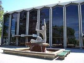
Paul Keating Park, in the centre of Bankstown, stands on the old site of the Council Administration building, which burned down in an accidental fire in 1997. The Park is used for a variety of concerts and festivals (including the annual Bankstown Christmas Carols), and is otherwise a large playing field. Nowadays, all of the Council operations are contained in the Civic Tower, adjacent to the Park. Bankstown Town Hall faces opposite.


Parks
Bankstown had 293 parks covering 730 hectares (1,800 acres) within its city limits. There are 41 sports grounds, 12 community parks and 18 natural parklands.[21] In the CBD, major parks include Bankstown Oval, McLeod Reserve, Paul Keating Park and Bankstown City Gardens. Other major parks include Mirambeena Regional Park, The Crest, Middleton Park, O'Neill Park, Terry Lamb Complex, Garrison Point, Jensen Oval and the extensive parklands around Georges River, among others. The entrance to Georges River National Park is also located within the city.
Mayors and General Managers
Mayors
| Mayor | Party | Term | Notes | |
|---|---|---|---|---|
| Joseph James Cooper | Independent | 7 November 1895 – 11 June 1896 | [22] | |
| Ines Peter Miller | Independent | 11 June 1896 – 16 February 1899 | [23] | |
| Nicholas Goyen, Jnr | Independent | 16 February 1899 – 15 February 1900 | [24] | |
| William Gilliver | Independent | 15 February 1900 – 12 February 1903 | [25] | |
| Arthur Bransgrove | Independent | 12 February 1903 – 16 February 1905 | [26] | |
| William John Gibson | Independent | 16 February 1905 – 1 March 1908 | [27] | |
| William Henry Watson | Independent | 1 March 1908 – 28 February 1909 | [28] | |
| William Gilliver | Independent | 1 March 1909 – 28 February 1911 | [29] | |
| Arthur Bransgrove | Independent | 1 March 1911 – 28 February 1913 | [30] | |
| Frederick George White | Independent | 1 March 1913 – August 1913 | [31] | |
| John Arthur Hoskins | Independent | August 1913 – February 1915 | [32] | |
Sister cities
Sister Cities of Bankstown include:
-
 Broken Hill, a city in remote New South Wales. Bankstown signed its first Sister City Agreement with Broken Hill on 16 September 1986.[33]
 -
 Suita, Osaka, Japan. Bankstown signed its first international Sister City agreement with Suita City, Japan, in March 1989.[33]
 -
 Colorado Springs, Colorado, United States. Colorado students in Bankstown signed a new Sister City Agreement with Colorado Springs, home of the United States Olympic Committee, on 13 July 2001.[33]
 -
 Yangcheon-gu City, Seoul, South Korea. In 1997, Bankstown signed a Friendship Agreement with Yangcheon-gu City in South Korea, resulting in the establishment of youth exchanges and the sharing of information between both local authorities. During a tour in 2001, Bankstown Council delegates met with Korean officials to discuss ways of promoting Bankstown companies with a view to creating new export markets. The Cities exchanged details of Management Planning Processes and inspections of community facilities took place in Yangcheon. A Sister City Agreement was subsequently signed with Yangcheon City in September 2002.[33]
 -
 Shijiazhuang, Hebei, China. In February 2000 a friendship agreement was made between Shijiazhuang City and Bankstown. The friendship agreement signifies that the two cities are exploring the possibility of venturing into a sister city agreement.[34]
References
- 1 2 3 4 5 Australian Bureau of Statistics (30 June 2012). "2011 Census QuickStats: Bankstown (C)". Retrieved 26 June 2012.
- ↑ Historical Tour of the Bankstown District (5th ed.). Bankstown Historical Society. 1991.
- 1 2 Rosen, Sue (1996). Bankstown, a Sense of Identity.
- ↑ "About Bankstown – Yesterday & Today". Bankstown City Council.
- ↑ http://strategies.planning.nsw.gov.au/MetropolitanStrategyforSydney.aspx
- ↑ "Merger proposal: Bankstown City Council, Canterbury City Council" (PDF). Government of New South Wales. January 2016. p. 7. Retrieved 28 February 2016.
- 1 2 Australian Bureau of Statistics (9 March 2006). "Bankstown (C)". 2001 Census QuickStats. Retrieved 12 November 2012.
- 1 2 Australian Bureau of Statistics (25 October 2007). "Bankstown (C)". 2006 Census QuickStats. Retrieved 12 November 2012.
- 1 2 "Bankstown City Council – East Ward". Local Government Elections 2012. Electoral Commission of New South Wales. 14 September 2012. Retrieved 21 September 2012.
- 1 2 "Bankstown City Council – North Ward". Local Government Elections 2012. Electoral Commission of New South Wales. 14 September 2012. Retrieved 21 September 2012.
- 1 2 "Bankstown City Council – South Ward". Local Government Elections 2012. Electoral Commission of New South Wales. 14 September 2012. Retrieved 21 September 2012.
- 1 2 "Bankstown City Council – West Ward". Local Government Elections 2012. Electoral Commission of New South Wales. 14 September 2012. Retrieved 21 September 2012.
- ↑ Vidler, Adam (25 September 2012). "ALP split over Bankstown Council mayoral deal". The Canterbury Bankstown Express. Retrieved 13 October 2013.
- ↑ "BANKSTOWN.—PETITION FOR A MUNICIPALITY.". New South Wales Government Gazette (203). New South Wales, Australia. 23 March 1895. p. 2021. Retrieved 19 November 2016 – via National Library of Australia.
- ↑ "Government Gazette Proclamations and Legislation". New South Wales Government Gazette (603). New South Wales, Australia. 9 September 1895. p. 5823. Retrieved 19 November 2016 – via National Library of Australia.
- ↑ "MUNICIPAL DISTRICT OF BANKSTOWN.". New South Wales Government Gazette (742). New South Wales, Australia. 8 November 1895. p. 7231. Retrieved 19 November 2016 – via National Library of Australia.
- ↑ "Development Over Time". Bankstown City Council. Retrieved 20 July 2007.
- ↑ (information supplied by R. Eyers VAOC worker)
- ↑ Lawrence, Joan; Madden, Brian; Muir, Lesley (September 1999). Pictorial History of Canterbury Bankstown. Kingsclear Books. p. 124. ISBN 0-908272-55-3. Retrieved 4 October 2013.
- ↑ "Community Profile – Summary." Retrieved on 29 July 2007.
- ↑ Lawrence, Madden & Muir 1999, p. 116
- ↑ "MUNICIPALITY OF BANKSTOWN.". New South Wales Government Gazette (822). New South Wales, Australia. 10 December 1895. p. 8004. Retrieved 19 November 2016 – via National Library of Australia.
- ↑ "Bankstown's New Mayor.". The Cumberland Free Press. 1, (52). New South Wales, Australia. 13 June 1896. p. 4. Retrieved 19 November 2016 – via National Library of Australia.
- ↑ "MUNICIPAL DISTRICT OF BANKSTOWN.". New South Wales Government Gazette (160). New South Wales, Australia. 21 February 1899. p. 1499. Retrieved 19 November 2016 – via National Library of Australia.
- ↑ "MUNICIPAL DISTRICT OF BANKSTOWN.". New South Wales Government Gazette (153). New South Wales, Australia. 20 February 1900. p. 1452. Retrieved 19 November 2016 – via National Library of Australia.
- ↑ "MUNICIPAL DISTRICT OF BANKSTOWN.". Government Gazette Of The State Of New South Wales (89). New South Wales, Australia. 17 February 1903. p. 1442. Retrieved 19 November 2016 – via National Library of Australia.
- ↑ "MUNICIPAL DISTRICT OF BANKSTOWN.". Government Gazette Of The State Of New South Wales (94). New South Wales, Australia. 21 February 1905. p. 1239. Retrieved 19 November 2016 – via National Library of Australia.
- ↑ "THE COUNCIL OF THE MUNICIPALITY OF BANKSTOWN.". Government Gazette Of The State Of New South Wales (24). New South Wales, Australia. 26 February 1908. p. 1270. Retrieved 19 November 2016 – via National Library of Australia.
- ↑ "MUNICIPALITY OF BANKSTOWN.". Government Gazette Of The State Of New South Wales (24). New South Wales, Australia. 24 February 1909. p. 1235. Retrieved 19 November 2016 – via National Library of Australia.
- ↑ "Bankstown. Alderman Bransgrove Elected.". The Cumberland Argus And Fruitgrowers Advocate. XXIII, (1790). New South Wales, Australia. 11 February 1911. p. 11. Retrieved 19 November 2016 – via National Library of Australia.
- ↑ "THE COUNCIL OF THE MUNICIPALITY OF BANKSTOWN.". Government Gazette Of The State Of New South Wales (22). New South Wales, Australia. 12 February 1913. p. 1035. Retrieved 19 November 2016 – via National Library of Australia.
- ↑ "BANKSTOWN.". The Sydney Morning Herald (23,581). New South Wales, Australia. 8 August 1913. p. 6. Retrieved 19 November 2016 – via National Library of Australia.
- 1 2 3 4 "Bankstown's Sister Cities" (PDF). Bankstown City Council. Retrieved 20 July 2007.
- ↑ "Shijiazhuang friendship agreement". Bankstown City Council. Retrieved 9 January 2010.