Barguna District
| Barguna বরগুনা | |
|---|---|
| District | |
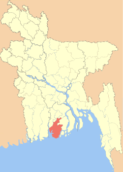 Location of Barguna in Bangladesh | |
| Coordinates: BD 22°09′03″N 90°07′35″E / 22.1508°N 90.1264°ECoordinates: BD 22°09′03″N 90°07′35″E / 22.1508°N 90.1264°E | |
| Country |
|
| Division | Barisal Division |
| Government | |
| • District Commissioner | Qazi Obaidur Rahman |
| Area | |
| • Total | 1,831.31 km2 (707.07 sq mi) |
| Population (2011 census) | |
| • Total | 892,781 |
| • Density | 490/km2 (1,300/sq mi) |
| Literacy rate | |
| • Total | 86.14% |
| Time zone | BST (UTC+6) |
| Website | www.dcbarguna.gov.bd |
Barguna (Bengali: বরগুনা Borguna) is a district in the division of Barisal, Bangladesh. [1]
Geography
The Barguna District has a total area of 1831.31 km². It is bounded on the north by the districts of Jhalkathi, Barisal, Pirojpur and Patuakhali. In the east, it borders the Patuakhali district. On the south, Barguna is bounded by the Patuakhali district, and the Bay of Bengal. On the western side, it borders Pirojpur and Bagerhat districts. Important rivers of Barguna district include the Paira River, Bishkhali River, khakdon river and the Baleshwar River.
Administration
- Administrator of Zila Porishod: Mohammad Jahangir Kabir[2]
- Deputy Commissioner (DC): Md. Mujibur Rahman[3]
Subdivisions
Barguna district has six upazilas. Taltali is the newest:
- Amtali Upazila
- Bamna Upazila
- Barguna Sadar Upazila
- Betagi Upazila
- Patharghata Upazila
- Taltali Upazila
Economy
Barguna's economy is primarily dependent on agriculture. Principal crops include rice and pulses. Jute cultivation was once important, but it gradually lost popularity as a cash crop. Being a coastal district, Barguna has a thriving fishing industry. Produce of the district includes betel leaf, pulses, bananas, betel nut, molasses, marine fish, and shrimp.
A small manufacturing industry comprises mostly rice mills, saw mill, soap factory, flour mill, ice factory and pen factory. Traditional cottage industries such as weaving, bamboo and cane art work, goldsmithing, blacksmithing, pottery, wood work, and tailoring also thrive in rural areas.
Demographics
As of 2007, Barguna District had an overall population of 902,465 with a population density of 492 persons/km². Females constitute a majority of the population with 50.12% while males constitute 49.88%.
Religion
The district of Barguna has 3485 mosques, 43 temples, five churches and a Buddhist temple.
See also
References
- ↑ Md Monir Hossain Kamal (2012). "Barguna District". In Sirajul Islam and Ahmed A. Jamal. Banglapedia: National Encyclopedia of Bangladesh (Second ed.). Asiatic Society of Bangladesh.
- ↑ "AL men appointed administrators" The Daily Star, December 16, 2011
- ↑ Archived December 22, 2011, at the Wayback Machine.
External links
| Wikimedia Commons has media related to Barguna District. |
| Barisal Division | 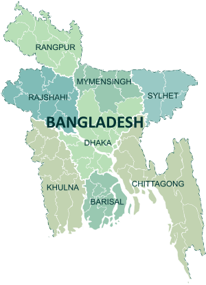 | |
|---|---|---|
| Chittagong Division | ||
| Dhaka Division | ||
| Khulna Division | ||
| Mymensingh Division | ||
| Rajshahi Division | ||
| Rangpur Division | ||
| Sylhet Division | ||