Patuakhali District
| Patuakhali পটুয়াখালী | |
|---|---|
| District | |
 Location of Patuakhali in Bangladesh | |
| Coordinates: BD 22°21′15″N 90°19′05″E / 22.3542°N 90.3181°ECoordinates: BD 22°21′15″N 90°19′05″E / 22.3542°N 90.3181°E | |
| Country |
|
| Division | Barisal Division |
| Patuakhali | 1969 |
| Area | |
| • Total | 3,220.15 km2 (1,243.31 sq mi) |
| Population (2011 census) | |
| • Total | 1,535,854 |
| • Density | 480/km2 (1,200/sq mi) |
| Time zone | BST (UTC+6) |
| Postal code | 8600 |
Patuakhali (Bengali: পটুয়াখালী) is a district in South-central Bangladesh. It is a part of the Barisal Division.
This is the main entrance for the beach of Kuakata. Famous for watching both the sun rise and sun set, it is called"সাগরকন্যা" The Daughter of Sea.
Geography
It is adjacent to the Bay of Bengal. The area of the district is 3220.15 km2.[1]
Patuakhali city is surrounded on three sides by rivers. The two major rivers are Laukathi and Lohalia, which are directly connected with the Bay of Bengal. The city has an inland airport used for transport and private travel across the country.
A number of different tribal peoples live in the district.
re 8 upazilas in this district. They are:
- Bauphal Upazila
- Galachipa Upazila
- Dashmina Upazila
- Kalapara Upazila
- Mirzaganj Upazila
- Patuakhali Sadar Upazila
- Dumki Upazila
- Rangabali Upazila
Administration
- Deputy Commissioner (DC): A.K.M Shamimul Haq Siddique
- Superintendent of Police (SP): Mr. Moshfiqur Rahman.
- Administrator of Zila Porishod: Mr. Khan Mosharraf Hossain
Economy
Agriculture is the profession of the most of the people. Fishing is also a prominent profession of this district. Thousands of boats go into the deep sea to fish and come back with tons of fish. Paddy, Jute, and different types of vegetables are the main product of agriculture sector.
Religion
The district of Patuakhali consists 3892 mosques, 187 temples, three Buddhist temples and two churches.
Places of interest
- Kuakata, a sea beach offering good views of the Bay of Bengal.
- Mirzaganj
- Kalaia Bandar (Rice's Hut)
- Mohipur (Fishing Boat).
- Patuakhali Science and Technology University
- Patuakhali Medical College
- Patuakhali Polytechnic Institute
- Patuakhali Govt College
Patuakhali city
The city of Patuakhali is situated beside two local rivers: Laukathi River and Lohalia River. During high tides some of the regions of Patuakhali get flooded. The Bay of Bengal is not far from the region.
At the entrance of the city there is a bridge that connects Barisal (the divisional city) with Patuakhali and Kuakata beach.
As Patuakhali is a coastal area, it is affected almost every year by natural disasters like cyclones, floods and tornadoes. To help the disaster-affected people, many NGO's are active in the area. They play a vital role in developing the life style of poor people.
Fruits
The fruit trees indigenous to Patuakhali district areas as follows:[2]
- Mango
- Banana
- Guava
- Jamun
- Custard-apple
- Tamarind
- Grapefruit
- Lime
- Jackfruit
- Papaya
- Pineapple
- Bengal almond
- Banana
- Lichi
- Pomegranate
- Palm or Tal
- Common fig
- Haritaki
- Date - scarce
- Coconut - scarce
Payra seaport
The Payra seaport is planned to become the third sea port of Bangladesh (after Chittagong and Mongla). The Indian Minister of Shipping Mr. Nitin Gadkari announced in April 2016 that a proposal and detailed report for a port at Payra in Bangladesh have been completed. India and Bangladesh will set up a high-level committee to work out details, including investment details. However this is still in the speculative stage. While initially Indian involvement in the development of this port was still not clear,[3] India is interested in this port to counter China's influence in the Bay of Bengal.[4]
See also
References
| Wikimedia Commons has media related to Patuakhali District. |
- ↑ Jerin, Iffat (2012). "Patuakhali District". In Islam, Sirajul; Jamal, Ahmed A. Banglapedia: National Encyclopedia of Bangladesh (Second ed.). Asiatic Society of Bangladesh.
- ↑ Bangladesh District Gazetteers:Bogra. Government of Bangladesh. 1979, pp. 16-16
- ↑ "India keen to set up a port in Bangladesh: Nitin Gadkari". The Economic Times. Mumbai. 11 April 2016.
- ↑ Hassan, Zia (17 June 2016). "Deep politics of deep sea ports". Dhaka Tribune. Retrieved 5 October 2016.
External links
| Upazila/Thana: | ||
|---|---|---|
| Barisal Division | 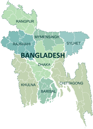 | |
|---|---|---|
| Chittagong Division | ||
| Dhaka Division | ||
| Khulna Division | ||
| Mymensingh Division | ||
| Rajshahi Division | ||
| Rangpur Division | ||
| Sylhet Division | ||