Lalmonirhat District
| Lalmonirhat লালমনিরহাট | |
|---|---|
| District | |
 Location of Lalmonirhat in Bangladesh | |
| Coordinates: BD 26°00′N 89°15′E / 26.00°N 89.25°ECoordinates: BD 26°00′N 89°15′E / 26.00°N 89.25°E | |
| Country |
|
| Division | Rangpur Division |
| Area | |
| • Total | 1,247.37 km2 (481.61 sq mi) |
| Population (2011 census) | |
| • Total | 1,256,099 |
| • Density | 1,000/km2 (2,600/sq mi) |
| Time zone | BST (UTC+6) |
Lalmonirhat (Bengali: লালমনিরহাট জেলা, Lalmonirhat Jela also Lalmonirhat Zila) is a district, situated at the north side border of Bangladesh. It is a part of the Rangpur Division.[1]
References
- ↑ Tanzimul Nayan (2012). "Lalmonirhat District". In Sirajul Islam and Ahmed A. Jamal. Banglapedia: National Encyclopedia of Bangladesh (Second ed.). Asiatic Society of Bangladesh.
External links
| Wikimedia Commons has media related to Lalmonirhat District. |
| Barisal Division | 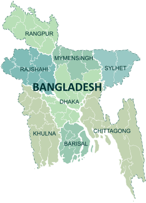 | |
|---|---|---|
| Chittagong Division | ||
| Dhaka Division | ||
| Khulna Division | ||
| Mymensingh Division | ||
| Rajshahi Division | ||
| Rangpur Division | ||
| Sylhet Division | ||
This article is issued from Wikipedia - version of the 10/7/2016. The text is available under the Creative Commons Attribution/Share Alike but additional terms may apply for the media files.