Marlboro County, South Carolina
| Marlboro County, South Carolina | ||
|---|---|---|
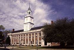 Marlboro County Courthouse, Bennettsville | ||
| ||
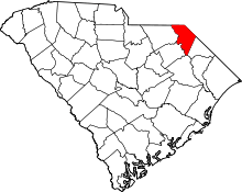 Location in the U.S. state of South Carolina | ||
 South Carolina's location in the U.S. | ||
| Founded | 1785 | |
| Named for | John Churchill, 1st Duke of Marlborough | |
| Seat | Bennettsville | |
| Largest city | Bennettsville | |
| Area | ||
| • Total | 485 sq mi (1,256 km2) | |
| • Land | 480 sq mi (1,243 km2) | |
| • Water | 5.6 sq mi (15 km2), 1.2% | |
| Population (est.) | ||
| • (2015) | 27,494 | |
| • Density | 60/sq mi (23/km²) | |
| Congressional district | 7th | |
| Time zone | Eastern: UTC-5/-4 | |
| Website |
www | |

Marlboro County is a county located in the U.S. state of South Carolina. As of the 2010 census recorded its population to be 28,933.[1] Its county seat is Bennettsville.[2] The Great Pee Dee River runs through it.
Marlboro County comprises the Bennettsville, SC Micropolitan Statistical Area.
Among its residents are the state-recognized Pee Dee Tribe of South Carolina (2006) and the Pee Dee Indian Nation of Upper South Carolina (2005). The first is based in McColl as is the Marlboro, Chesterfield, Darlington County Pee Dee Indian Tribe, which separated from the second listed Pee Dee tribe.[3] Nearly 5% of the county population identify as Pee Dee people.
History
Succeeding indigenous peoples occupied this area for thousands of years. At the time of European encounter, the inhabitants of the area were the historic Pee Dee. Some had moved into this area from the Lowcountry as a result of colonial pressures along the coast. They are believed to have spoken either a Siouan language, as did tribes in the Piedmont, or one of the Algonquian languages family, which were common among coastal peoples. Descendants identifying as Pee Dee still live in the county and region.[4] More recent research suggests they were based in this area, as part of a group called the South Appalachian Mississippian culture.
The first European colonists to arrive in the area were Welsh settlers, part of the British Isles colonists, migrating south from Pennsylvania. In 1737, they established the first European-American settlement, called Welsh Neck.;[5] these original settlers organized a Baptist church in January 1738.[6]
On 12 March 1785, Marlboro County was established by law. It was named for the Duke of Marlborough.[7] The first courthouse was near the Great Pee Dee River, just North of Crooked Creek, in a village called Carlisle, named for Richard Carlisle. In an effort to provide a more central location for the courthouse, the state legislature created the new county seat of Bennettsville, founded in 1819. A Robert Mills-designed courthouse was selected to be built. Construction began in 1820 and was completed in 1824.[5] It was replaced in the later 19th century, and the second courthouse was expanded and renovated in 1953-1954.
Geography
According to the U.S. Census Bureau, the county has a total area of 485 square miles (1,260 km2), of which 480 square miles (1,200 km2) is land and 5.6 square miles (15 km2) (1.2%) is water.[8]
Adjacent counties
- Richmond County, North Carolina - north
- Scotland County, North Carolina - northeast
- Robeson County, North Carolina - east
- Dillon County - east
- Florence County - south
- Darlington County - southwest
- Chesterfield County - west
- Anson County, North Carolina - northwest
Demographics
| Historical population | |||
|---|---|---|---|
| Census | Pop. | %± | |
| 1790 | 10,706 | — | |
| 1800 | 5,452 | −49.1% | |
| 1810 | 4,966 | −8.9% | |
| 1820 | 6,425 | 29.4% | |
| 1830 | 8,582 | 33.6% | |
| 1840 | 8,408 | −2.0% | |
| 1850 | 10,789 | 28.3% | |
| 1860 | 12,434 | 15.2% | |
| 1870 | 11,814 | −5.0% | |
| 1880 | 20,598 | 74.4% | |
| 1890 | 23,500 | 14.1% | |
| 1900 | 27,639 | 17.6% | |
| 1910 | 31,189 | 12.8% | |
| 1920 | 33,180 | 6.4% | |
| 1930 | 31,634 | −4.7% | |
| 1940 | 33,281 | 5.2% | |
| 1950 | 31,766 | −4.6% | |
| 1960 | 28,529 | −10.2% | |
| 1970 | 27,151 | −4.8% | |
| 1980 | 31,624 | 16.5% | |
| 1990 | 29,361 | −7.2% | |
| 2000 | 28,818 | −1.8% | |
| 2010 | 28,933 | 0.4% | |
| Est. 2015 | 27,494 | [9] | −5.0% |
| U.S. Decennial Census[10] 1790-1960[11] 1900-1990[12] 1990-2000[13] 2010-2013[1] | |||
2000 census
As of the census[14] of 2000, there were 28,818 people, 10,478 households, and 7,334 families residing in the county. The population density was 60 people per square mile (23/km²). There were 11,894 housing units at an average density of 25 per square mile (10/km²). The racial makeup of the county was 44.49% White, 50.73% Black or African American, 3.36% Native American, 0.24% Asian, 0.24% from other races, and 0.95% from two or more races. 0.71% of the population were Hispanic or Latino of any race.
There were 10,478 households out of which 32.00% had children under the age of 18 living with them, 42.60% were married couples living together, 22.20% had a female householder with no husband present, and 30.00% were non-families. 26.90% of all households were made up of individuals and 11.00% had someone living alone who was 65 years of age or older. The average household size was 2.59 and the average family size was 3.14.
In the county, the population was spread out with 26.20% under the age of 18, 9.30% from 18 to 24, 29.40% from 25 to 44, 22.80% from 45 to 64, and 12.30% who were 65 years of age or older. The median age was 35 years. For every 100 females there were 96.30 males. For every 100 females age 18 and over, there were 93.10 males.
The median income for a household in the county was $26,598, and the median income for a family was $32,019. Males had a median income of $25,896 versus $20,590 for females. The per capita income for the county was $13,385. About 17.70% of families and 21.70% of the population were below the poverty line, including 29.20% of those under age 18 and 22.70% of those age 65 or over.
2010 census
As of the 2010 United States Census, there were 28,933 people, 10,383 households, and 6,903 families residing in the county.[15] The population density was 60.3 inhabitants per square mile (23.3/km2). There were 12,072 housing units at an average density of 25.2 per square mile (9.7/km2).[16] The racial makeup of the county was 50.9% black or African American, 41.4% white, 4.5% American Indian, 0.3% Asian, 1.1% from other races, and 1.8% from two or more races. Those of Hispanic or Latino origin made up 2.8% of the population.[15] In terms of ancestry, and 9.7% were American.[17]
Of the 10,383 households, 33.5% had children under the age of 18 living with them, 36.8% were married couples living together, 24.3% had a female householder with no husband present, 33.5% were non-families, and 30.0% of all households were made up of individuals. The average household size was 2.47 and the average family size was 3.06. The median age was 38.8 years.[15]
The median income for a household in the county was $27,688 and the median income for a family was $32,485. Males had a median income of $31,170 versus $24,885 for females. The per capita income for the county was $13,817. About 23.3% of families and 27.5% of the population were below the poverty line, including 40.4% of those under age 18 and 17.6% of those age 65 or over.[18]
Politics
After Democrats regained power in the state in the late nineteenth century, the legislature passed a new constitution and laws to disfranchise black voters, who comprised a majority of the population in the state. They also imposed legal racial segregation and laws for Jim Crow and white supremacy. This situation of disfranchisement lasted largely into the 1960s, until Congress passed the federal Voting Rights Act of 1965, to give the government oversight and power to enforce constitutional rights for all citizens as a result of the civil rights movement. As part of the Solid South, the whites of the county and state used to vote overwhelmingly Democratic, giving 100% of its vote to the party in 1924.[19] White South Carolina residents (and throughout the South) had outsize power in Congress, as they controlled seats apportioned on the basis of total population of the state.
The county has continued to vote mostly Democratic but political alignments have changed since the 20th-century civil rights movement. African Americans have mostly left the Republican Party, which they had supported in the 19th century after the Civil War, to support the national Democratic Party, which achieved gains in Congress to restore constitutional rights for all citizens. In the 1972 election, Republican Richard Nixon won every county in the state including Marlboro.[20] In state and local voting, many whites have voted for Republican candidates, and African Americans have tended to continue to support the Democrats.
More recently the county went strongly for Barack Obama, who received 62.4% of the vote in the 2008 U.S. presidential election. The Democratic presidential candidate has received more than 58% of the county vote in all elections from 1992 to 2004.[21]
Transportation
Airports
- Marlboro County Jetport
- Myrtle Beach International Airport (MYR) 76.8 Miles South - South - East of Bennettsville
- Charlotte International Airport (CLT) 81.3 Miles West - North - West of Bennettsville
- Clio Crop Care Airport (9W9)
Communities
Cities
- Bennettsville (county seat)
Towns
Census-designated places
See also
References
- 1 2 "State & County QuickFacts". United States Census Bureau. Retrieved November 25, 2013.
- ↑ "Find a County". National Association of Counties. Retrieved 2011-06-07.
- ↑ Native Americans: The Pee Dee People, South Carolina Information Highway, accessed 22 April 2014
- ↑ Hudson, Charles M. (1970). The Catawba Nation. University of Georgia Press. pp. 16–17.
- 1 2 Marlboro County "It’s Good to be Home". Bennettsville, SC: Marlboro Herald-Advocate. January 2009. p. 60.
- ↑ J.A.W. Thomas. A History of Marlboro County: With Traditions and Sketches of Numerous Families. Atlanta: The Foote & Davies Company, 1897.
- ↑ Gannett, Henry (1905). The Origin of Certain Place Names in the United States. U.S. Government Printing Office. p. 200.
- ↑ "2010 Census Gazetteer Files". United States Census Bureau. August 22, 2012. Retrieved March 18, 2015.
- ↑ "County Totals Dataset: Population, Population Change and Estimated Components of Population Change: April 1, 2010 to July 1, 2015". Retrieved July 2, 2016.
- ↑ "U.S. Decennial Census". United States Census Bureau. Retrieved March 18, 2015.
- ↑ "Historical Census Browser". University of Virginia Library. Retrieved March 18, 2015.
- ↑ Forstall, Richard L., ed. (March 27, 1995). "Population of Counties by Decennial Census: 1900 to 1990". United States Census Bureau. Retrieved March 18, 2015.
- ↑ "Census 2000 PHC-T-4. Ranking Tables for Counties: 1990 and 2000" (PDF). United States Census Bureau. April 2, 2001. Retrieved March 18, 2015.
- ↑ "American FactFinder". United States Census Bureau. Retrieved 2011-05-14.
- 1 2 3 "DP-1 Profile of General Population and Housing Characteristics: 2010 Demographic Profile Data". United States Census Bureau. Retrieved 2016-03-11.
- ↑ "Population, Housing Units, Area, and Density: 2010 - County". United States Census Bureau. Retrieved 2016-03-11.
- ↑ "DP02 SELECTED SOCIAL CHARACTERISTICS IN THE UNITED STATES – 2006-2010 American Community Survey 5-Year Estimates". United States Census Bureau. Retrieved 2016-03-11.
- ↑ "DP03 SELECTED ECONOMIC CHARACTERISTICS – 2006-2010 American Community Survey 5-Year Estimates". United States Census Bureau. Retrieved 2016-03-11.
- ↑ 1924 Presidential Election Statistics
- ↑ David Leip Presidential Atlas (Election maps for South Carolina)
- ↑ New York Times Electoral Map (Zoom in on South Carolina)
External links
- 1905 Reprint of Bishop Gregg's History of the Old Cheraws with additional material as an appendix. (Google Book pdf)

Municipalities and communities of Marlboro County, South Carolina, United States | ||
|---|---|---|
| City | | |
| Towns | ||
| CDP | ||
| Unincorporated communities | ||
| Footnotes | ‡This populated place also has portions in an adjacent county or counties | |
Columbia (capital) | |
| Regions | |
| Larger cities | |
| Smaller cities |
|
| Towns |
|
| CDPs | |
| Counties |
|
| Topics |
|
| Society | |
Coordinates: 34°36′N 79°41′W / 34.60°N 79.68°W