Bronaugh, Missouri
| Bronaugh, Missouri | |
|---|---|
| City | |
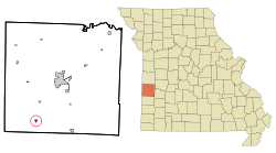 Location of Bronaugh, Missouri | |
| Coordinates: 37°41′36″N 94°28′2″W / 37.69333°N 94.46722°WCoordinates: 37°41′36″N 94°28′2″W / 37.69333°N 94.46722°W | |
| Country | United States |
| State | Missouri |
| County | Vernon |
| Area[1] | |
| • Total | 0.29 sq mi (0.75 km2) |
| • Land | 0.29 sq mi (0.75 km2) |
| • Water | 0 sq mi (0 km2) |
| Elevation | 889 ft (271 m) |
| Population (2010)[2] | |
| • Total | 249 |
| • Estimate (2012[3]) | 246 |
| • Density | 858.6/sq mi (331.5/km2) |
| Time zone | Central (CST) (UTC-6) |
| • Summer (DST) | CDT (UTC-5) |
| ZIP code | 64728 |
| Area code(s) | 417 |
| FIPS code | 29-08614[4] |
| GNIS feature ID | 0714737[5] |
Bronaugh is a city in Vernon County, Missouri, United States. The population was 249 at the 2010 census.
History
Bronaugh was platted in 1886 when the railroad was extended to that point.[6] It was named for W. C. Bronaugh, the original owner of the town site.[7] The city was incorporated in 1897.[8]
Geography
Bronaugh is located at 37°41′36″N 94°28′2″W / 37.69333°N 94.46722°W (37.693313, -94.467188).[9]
According to the United States Census Bureau, the city has a total area of 0.29 square miles (0.75 km2), all land.[1]
Demographics
| Historical population | |||
|---|---|---|---|
| Census | Pop. | %± | |
| 1890 | 148 | — | |
| 1900 | 190 | 28.4% | |
| 1910 | 263 | 38.4% | |
| 1920 | 285 | 8.4% | |
| 1930 | 192 | −32.6% | |
| 1940 | 265 | 38.0% | |
| 1950 | 214 | −19.2% | |
| 1960 | 173 | −19.2% | |
| 1970 | 203 | 17.3% | |
| 1980 | 209 | 3.0% | |
| 1990 | 211 | 1.0% | |
| 2000 | 245 | 16.1% | |
| 2010 | 249 | 1.6% | |
| Est. 2015 | 247 | [10] | −0.8% |
2010 census
As of the census[2] of 2010, there were 249 people, 83 households, and 64 families residing in the city. The population density was 858.6 inhabitants per square mile (331.5/km2). There were 107 housing units at an average density of 369.0 per square mile (142.5/km2). The racial makeup of the city was 96.0% White, 0.4% African American, 0.4% Asian, and 3.2% from two or more races. Hispanic or Latino of any race were 1.6% of the population.
There were 83 households of which 39.8% had children under the age of 18 living with them, 59.0% were married couples living together, 10.8% had a female householder with no husband present, 7.2% had a male householder with no wife present, and 22.9% were non-families. 15.7% of all households were made up of individuals and 4.8% had someone living alone who was 65 years of age or older. The average household size was 3.00 and the average family size was 3.38.
The median age in the city was 31.3 years. 33.7% of residents were under the age of 18; 6.7% were between the ages of 18 and 24; 28.4% were from 25 to 44; 21.6% were from 45 to 64; and 9.2% were 65 years of age or older. The gender makeup of the city was 49.0% male and 51.0% female.
2000 census
As of the census[4] of 2000, there were 245 people, 93 households, and 65 families residing in the city. The population density was 863.1 people per square mile (337.8/km²). There were 103 housing units at an average density of 362.9 per square mile (142.0/km²). The racial makeup of the city was 97.96% White, 0.41% Native American, and 1.63% from two or more races.
There were 93 households out of which 40.9% had children under the age of 18 living with them, 59.1% were married couples living together, 9.7% had a female householder with no husband present, and 30.1% were non-families. 29.0% of all households were made up of individuals and 17.2% had someone living alone who was 65 years of age or older. The average household size was 2.63 and the average family size was 3.28.
In the city the population was spread out with 31.0% under the age of 18, 6.9% from 18 to 24, 31.0% from 25 to 44, 17.6% from 45 to 64, and 13.5% who were 65 years of age or older. The median age was 31 years. For every 100 females there were 102.5 males. For every 100 females age 18 and over, there were 79.8 males.
The median income for a household in the city was $26,786, and the median income for a family was $40,625. Males had a median income of $23,542 versus $18,750 for females. The per capita income for the city was $13,073. About 2.7% of families and 7.2% of the population were below the poverty line, including 2.7% of those under the age of eighteen and 24.2% of those sixty five or over.
References
- 1 2 "US Gazetteer files 2010". United States Census Bureau. Archived from the original on 2012-01-24. Retrieved 2012-07-08.
- 1 2 "American FactFinder". United States Census Bureau. Retrieved 2012-07-08.
- ↑ "Population Estimates". United States Census Bureau. Archived from the original on 2013-06-17. Retrieved 2013-05-30.
- 1 2 "American FactFinder". United States Census Bureau. Archived from the original on 2013-09-11. Retrieved 2008-01-31.
- ↑ "US Board on Geographic Names". United States Geological Survey. 2007-10-25. Retrieved 2008-01-31.
- ↑ Combs, Joe D. (August 5, 1985). "Bronaugh: The village origin is explained". The Nevada Daily Mail. pp. 7A. Retrieved 28 April 2015.
- ↑ Eaton, David Wolfe (1918). How Missouri Counties, Towns and Streams Were Named. The State Historical Society of Missouri. p. 368.
- ↑ "Area towns approaching 100". The Nevada Daily Mail. Aug 14, 1970. p. 10. Retrieved 28 October 2015.
- ↑ "US Gazetteer files: 2010, 2000, and 1990". United States Census Bureau. 2011-02-12. Retrieved 2011-04-23.
- ↑ "Annual Estimates of the Resident Population for Incorporated Places: April 1, 2010 to July 1, 2015". Retrieved July 2, 2016.
- ↑ "Census of Population and Housing". Census.gov. Archived from the original on May 11, 2015. Retrieved June 4, 2015.
Municipalities and communities of Vernon County, Missouri, United States | ||
|---|---|---|
| Cities |  | |
| Villages | ||
| Townships | ||
| Unincorporated communities |
| |
| Footnotes | ‡This populated place also has portions in an adjacent county or counties | |