Nevada, Missouri
| Nevada, Missouri | |
|---|---|
| City | |
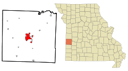 Location within Vernon County and Missouri | |
| Coordinates: 37°50′27″N 94°21′20″W / 37.84083°N 94.35556°WCoordinates: 37°50′27″N 94°21′20″W / 37.84083°N 94.35556°W | |
| Country | United States |
| State | Missouri |
| County | Vernon |
| Area[1] | |
| • Total | 9.06 sq mi (23.47 km2) |
| • Land | 8.98 sq mi (23.26 km2) |
| • Water | 0.08 sq mi (0.21 km2) |
| Elevation | 873 ft (266 m) |
| Population (2010)[2] | |
| • Total | 8,386 |
| • Estimate (2012[3]) | 8,171 |
| • Density | 930/sq mi (360/km2) |
| Time zone | Central (CST) (UTC-6) |
| • Summer (DST) | CDT (UTC-5) |
| ZIP code | 64772 |
| Area code(s) | 417 |
| FIPS code | 29-51644 [4] |
| GNIS feature ID | 0729934 [5] |
| Website | http://nevadamo.gov/ |
Nevada /nəˈveɪdə/ (local pronunciation is NevAYda) is a city and a county seat of Vernon County, Missouri, United States.[6] The population was 8,386 at the 2010 census, and 8,171 in the 2012 estimate.[3] Nevada is the home of Cottey College.
History
Before its incorporation in 1855, the small community was known as both Fair View and Hog-Eye. The second name was considered to be degrading, and the first name had already been used for the name of a post office in Fairview, Missouri. The town's name was changed to Nevada after Nevada City, California by circuit and county clerk DeWitt C. Hunter, for the city where he had been a miner.[7]
Vernon County suffered greatly during the Civil War. The entire town of Nevada was burned to the ground on May 23, 1863, by pro-Union militiamen from nearby Cedar County. A few days before that, a small force of Union militia from Cedar County had attacked the Nevada Courthouse. They were beaten back and all of them killed. When they failed to return home, a much larger force of militia marched on Nevada. They told the villagers that they had fifteen minutes to save anything they wanted; then their homes would be burned. The jail and several houses were all that escaped destruction.
Nevada was home for many years to Moore's Opera House, built by Colonel Harry Moore and located on the corner of Cherry and Washington Streets.[8] It opened in May 1882, but it was destroyed by an accidental fire just five days later. Rebuilt and reopened within ten months, it hosted plays, moving pictures and traveling shows, until it too was destroyed by fire in April 1907.
Nevada was home of the Weltmer Institute of Suggestive Therapeutics from 1897−1933. During the early 20th century, the business this healing institution generated was a driving force in the growing prosperity of the town.[9]
Geography
Nevada is located at 37°50′27″N 94°21′20″W / 37.84083°N 94.35556°W (37.840930, -94.355576).[10] According to the United States Census Bureau, the city has a total area of 9.06 square miles (23.47 km2), of which 8.98 square miles (23.26 km2) is land and 0.08 square miles (0.21 km2) is water.[1]
Climate
| Climate data for Nevada, Missouri | |||||||||||||
|---|---|---|---|---|---|---|---|---|---|---|---|---|---|
| Month | Jan | Feb | Mar | Apr | May | Jun | Jul | Aug | Sep | Oct | Nov | Dec | Year |
| Average high °F (°C) | 40 (4) |
46 (8) |
57 (14) |
67 (19) |
76 (24) |
85 (29) |
90 (32) |
89 (32) |
81 (27) |
71 (22) |
55 (13) |
44 (7) |
66.8 (19.3) |
| Average low °F (°C) | 19 (−7) |
25 (−4) |
35 (2) |
44 (7) |
54 (12) |
64 (18) |
68 (20) |
66 (19) |
58 (14) |
47 (8) |
35 (2) |
25 (−4) |
45 (7.3) |
| Average precipitation inches (mm) | 1.65 (41.9) |
2.01 (51.1) |
3.66 (93) |
4.29 (109) |
5.28 (134.1) |
5.63 (143) |
3.98 (101.1) |
3.98 (101.1) |
4.21 (106.9) |
4.17 (105.9) |
3.58 (90.9) |
2.32 (58.9) |
44.76 (1,136.9) |
| Source: [11] | |||||||||||||
Demographics
| Historical population | |||
|---|---|---|---|
| Census | Pop. | %± | |
| 1880 | 1,913 | — | |
| 1890 | 7,262 | 279.6% | |
| 1900 | 7,461 | 2.7% | |
| 1910 | 7,176 | −3.8% | |
| 1920 | 7,139 | −0.5% | |
| 1930 | 7,448 | 4.3% | |
| 1940 | 8,181 | 9.8% | |
| 1950 | 8,009 | −2.1% | |
| 1960 | 8,416 | 5.1% | |
| 1970 | 9,736 | 15.7% | |
| 1980 | 9,044 | −7.1% | |
| 1990 | 8,597 | −4.9% | |
| 2000 | 8,607 | 0.1% | |
| 2010 | 8,386 | −2.6% | |
| Est. 2015 | 8,253 | [12] | −1.6% |
2010 census
As of the census[2] of 2010, there were 8,386 people, 3,491 households, and 1,908 families residing in the city. The population density was 933.9 inhabitants per square mile (360.6/km2). There were 4,018 housing units at an average density of 447.4 per square mile (172.7/km2). The racial makeup of the city was 95.1% White, 1.1% African American, 0.8% Native American, 0.8% Asian, 0.6% from other races, and 1.6% from two or more races. Hispanic or Latino of any race were 2.0% of the population.
There were 3,491 households of which 28.2% had children under the age of 18 living with them, 35.9% were married couples living together, 14.1% had a female householder with no husband present, 4.6% had a male householder with no wife present, and 45.3% were non-families. 40.3% of all households were made up of individuals and 17.1% had someone living alone who was 65 years of age or older. The average household size was 2.16 and the average family size was 2.88.
The median age in the city was 38.3 years. 23.3% of residents were under the age of 18; 11.5% were between the ages of 18 and 24; 22.6% were from 25 to 44; 24.4% were from 45 to 64; and 18.2% were 65 years of age or older. The gender makeup of the city was 45.3% male and 54.7% female.
2000 census
As of the census[4] of 2000, there were 8,607 people, 3,463 households, and 1,973 families residing in the city. The population density was 964.1 people per square mile (372.1/km²). There were 3,857 housing units at an average density of 432.0 per square mile (166.8/km²). The racial makeup of the city was 95.79% White, 1.03% African American, 0.94% Native American, 0.44% Asian, 0.05% Pacific Islander, 0.49% from other races, and 1.25% from two or more races. Hispanic or Latino of any race were 1.29% of the population.
There were 3,463 households out of which 29.9% had children under the age of 18 living with them, 40.1% were married couples living together, 13.3% had a female householder with no husband present, and 43.0% were non-families. 38.5% of all households were made up of individuals and 17.8% had someone living alone who was 65 years of age or older. The average household size was 2.22 and the average family size was 2.95.
In the city the population was spread out, with 25.8% under the age of 18, 11.8% from 18 to 24, 24.7% from 25 to 44, 18.8% from 45 to 64, and 18.9% who were 65 years of age or older. The median age was 35 years. For every 100 females there were 82.1 males. For every 100 females age 18 and over, there were 74.3 males.
The median income for a household in the city was $25,774, and the median income for a family was $36,639. Males had a median income of $28,939 versus $17,424 for females. The per capita income for the city was $15,118. About 13.7% of families and 20.0% of the population were below the poverty line, including 28.7% of those under age 18 and 16.4% of those age 65 or over.
Notable people
- Russell Alexander — circus band composer, performer and entertainer
- Eva Bowring − United States Senator for Nebraska
- Patricia Breckenridge − current Associate Justice of Supreme Court of Missouri
- Frank Buckles − America's last surviving World War I veteran when he died in 2011. Buckles attended elementary and high school in Nevada.
- Forrest DeBernardi − member of the Basketball Hall of Fame
- Ed Emery — state senator and former state representative
- John Huston − actor, director, screenwriter and producer (born there)
- Frank James − guerrilla and outlaw, brother of Jesse James
- Steve Brule − famous Doctor and host of Check it Out
- Bill Phelps − former lieutenant governor of Missouri
- Sue Thompson − country and pop singer, born Eva Sue McKee
- Sidney Weltmer - founder of the Weltmer Institute of Suggestive Therapeutics
References
- 1 2 "US Gazetteer files 2010". United States Census Bureau. Retrieved 2012-07-08.
- 1 2 "American FactFinder". United States Census Bureau. Retrieved 2012-07-08.
- 1 2 "Population Estimates". United States Census Bureau. Retrieved May 30, 2014.
- 1 2 "American FactFinder". United States Census Bureau. Retrieved 2008-01-31.
- ↑ "US Board on Geographic Names". United States Geological Survey. 2007-10-25. Retrieved 2008-01-31.
- ↑ "Find a County". National Association of Counties. Retrieved 2011-06-07.
- ↑ Eaton, David Wolfe (1918). How Missouri Counties, Towns and Streams Were Named. The State Historical Society of Missouri. p. 368.
- ↑ Moore's Opera House
- ↑ Thornton, Carolyn Gray (19 November 2004). "Short history of a longtime landmark". The Nevada Daily Mail. Retrieved February 2013. Check date values in:
|access-date=(help) - ↑ "US Gazetteer files: 2010, 2000, and 1990". United States Census Bureau. 2011-02-12. Retrieved 2011-04-23.
- ↑ "Climate - Nevada - Missouri". usclimatedata.com. Retrieved February 16, 2013.
- ↑ "Annual Estimates of the Resident Population for Incorporated Places: April 1, 2010 to July 1, 2015". Retrieved July 2, 2016.
- ↑ "Census of Population and Housing". Census.gov. Retrieved June 4, 2015.
External links
| Wikisource has the text of a 1911 Encyclopædia Britannica article about Nevada, Missouri. |
- City of Nevada
- Nevada Chamber of Commerce
- Nevada Daily Mail
- Nevada Public Library
- Nevada R-5 School District
- Historic maps of Nevada in the Sanborn Maps of Missouri Collection at the University of Missouri
-
 "Nevada, a city of Missouri". Collier's New Encyclopedia. 1921.
 - "Nevada. A city and the county-seat of Vernon County, Mo". New International Encyclopedia. 1905.
Municipalities and communities of Vernon County, Missouri, United States | ||
|---|---|---|
| Cities | 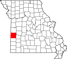 | |
| Villages | ||
| Townships | ||
| Unincorporated communities |
| |
| Footnotes | ‡This populated place also has portions in an adjacent county or counties | |