Caledonia, Missouri
| Caledonia, Missouri | |
|---|---|
| Village | |
| Nickname(s): Caley | |
 Location of Caledonia, Missouri | |
| Coordinates: 37°45′48″N 90°46′20″W / 37.76333°N 90.77222°WCoordinates: 37°45′48″N 90°46′20″W / 37.76333°N 90.77222°W | |
| Country | United States |
| State | Missouri |
| County | Washington |
| Area[1] | |
| • Total | 0.16 sq mi (0.41 km2) |
| • Land | 0.16 sq mi (0.41 km2) |
| • Water | 0 sq mi (0 km2) |
| Elevation | 915 ft (279 m) |
| Population (2010)[2] | |
| • Total | 130 |
| • Estimate (2012[3]) | 134 |
| • Density | 812.5/sq mi (313.7/km2) |
| Time zone | Central (CST) (UTC-6) |
| • Summer (DST) | CDT (UTC-5) |
| ZIP code | 63631 |
| Area code(s) | 573 |
| FIPS code | 29-10432[4] |
| GNIS feature ID | 0749157[5] |
Caledonia is a village in Washington County, Missouri, United States. The population was 130 at the 2010 census. The village was founded in 1819 and is named after the Roman Empire's Latin name for Scotland.[6] It is 4 miles east of Belgrade, Missouri.
Geography
Caledonia is located at 37°45′48″N 90°46′20″W / 37.76333°N 90.77222°W (37.763368, -90.772212).[7]
According to the United States Census Bureau, the village has a total area of 0.16 square miles (0.41 km2), all of it land.[1]
Demographics
| Historical population | |||
|---|---|---|---|
| Census | Pop. | %± | |
| 1880 | 236 | — | |
| 1900 | 166 | — | |
| 1910 | 128 | −22.9% | |
| 1920 | 133 | 3.9% | |
| 1930 | 143 | 7.5% | |
| 1940 | 139 | −2.8% | |
| 1950 | 143 | 2.9% | |
| 1960 | 119 | −16.8% | |
| 1970 | 113 | −5.0% | |
| 1980 | 162 | 43.4% | |
| 1990 | 142 | −12.3% | |
| 2000 | 158 | 11.3% | |
| 2010 | 130 | −17.7% | |
| Est. 2015 | 130 | [8] | 0.0% |
2010 census
As of the census[2] of 2010, there were 130 people, 58 households, and 39 families residing in the village. The population density was 812.5 inhabitants per square mile (313.7/km2). There were 76 housing units at an average density of 475.0 per square mile (183.4/km2). The racial makeup of the village was 100.0% White. Hispanic or Latino of any race were 0.8% of the population.
There were 58 households of which 25.9% had children under the age of 18 living with them, 55.2% were married couples living together, 3.4% had a female householder with no husband present, 8.6% had a male householder with no wife present, and 32.8% were non-families. 31.0% of all households were made up of individuals and 17.2% had someone living alone who was 65 years of age or older. The average household size was 2.24 and the average family size was 2.72.
The median age in the village was 46 years. 17.7% of residents were under the age of 18; 6.1% were between the ages of 18 and 24; 24.6% were from 25 to 44; 30% were from 45 to 64; and 21.5% were 65 years of age or older. The gender makeup of the village was 53.1% male and 46.9% female.
2000 census
As of the census[4] of 2000, there were 158 people, 66 households, and 40 families residing in the village. The population density was 1,133.9 people per square mile (435.7/km²). There were 79 housing units at an average density of 567.0 per square mile (217.9/km²). The racial makeup of the village was 100.00% White.
There were 66 households out of which 31.8% had children under the age of 18 living with them, 50.0% were married couples living together, 12.1% had a female householder with no husband present, and 37.9% were non-families. 30.3% of all households were made up of individuals and 16.7% had someone living alone who was 65 years of age or older. The average household size was 2.39 and the average family size was 3.00.
In the village the population was spread out with 25.3% under the age of 18, 13.9% from 18 to 24, 27.2% from 25 to 44, 20.3% from 45 to 64, and 13.3% who were 65 years of age or older. The median age was 29 years. For every 100 females there were 100.0 males. For every 100 females age 18 and over, there were 87.3 males.
The median income for a household in the village was $24,833, and the median income for a family was $28,125. Males had a median income of $20,179 versus $15,625 for females. The per capita income for the village was $10,685. About 19.1% of families and 29.3% of the population were below the poverty line, including 40.0% of those under the age of eighteen and 6.7% of those sixty five or over.
School Teams
Valley R-VI is the local school. There are three schools: An elementary school, which is located in Belgrade, Missouri; an intermediate school, located in Caledonia; and the high school/junior high, which are in the same building in Caledonia next to the intermediate school. Later, an elementary building was added on to the existing building in Caledonia, and students from Belgrade Elementary School were transferred to it.
Nearest Airport
Washington County Airport, Airport Road, Mineral Point, Missouri 63660
References
- 1 2 "US Gazetteer files 2010". United States Census Bureau. Archived from the original on 2012-07-14. Retrieved 2012-07-08.
- 1 2 "American FactFinder". United States Census Bureau. Retrieved 2012-07-08.
- ↑ "Population Estimates". United States Census Bureau. Archived from the original on 2013-06-17. Retrieved 2013-05-30.
- 1 2 "American FactFinder". United States Census Bureau. Archived from the original on 2013-09-11. Retrieved 2008-01-31.
- ↑ "US Board on Geographic Names". United States Geological Survey. 2007-10-25. Retrieved 2008-01-31.
- ↑ Eaton, David Wolfe (1918). How Missouri Counties, Towns and Streams Were Named. The State Historical Society of Missouri. p. 370.
- ↑ "US Gazetteer files: 2010, 2000, and 1990". United States Census Bureau. 2011-02-12. Retrieved 2011-04-23.
- ↑ "Annual Estimates of the Resident Population for Incorporated Places: April 1, 2010 to July 1, 2015". Retrieved July 2, 2016.
- ↑ "Census of Population and Housing". Census.gov. Archived from the original on May 11, 2015. Retrieved June 4, 2015.
Municipalities and communities of Washington County, Missouri, United States | ||
|---|---|---|
| Cities | 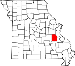 | |
| Villages | ||
| Townships |
| |
| Unincorporated communities | ||