Washington County, Missouri
| Washington County, Missouri | |
|---|---|
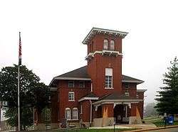 Washington County Courthouse | |
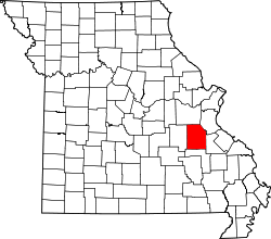 Location in the U.S. state of Missouri | |
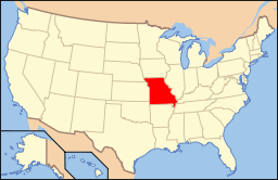 Missouri's location in the U.S. | |
| Founded | August 21, 1813 |
| Named for | George Washington |
| Seat | Potosi |
| Largest city | Potosi |
| Area | |
| • Total | 762 sq mi (1,974 km2) |
| • Land | 760 sq mi (1,968 km2) |
| • Water | 2.6 sq mi (7 km2), 0.3% |
| Population (est.) | |
| • (2015) | 24,788 |
| • Density | 33/sq mi (13/km²) |
| Congressional district | 8th |
| Time zone | Central: UTC-6/-5 |
| Website |
www |
Washington County is a county located in the eastern portion of the U.S. state of Missouri. As of the 2010 census, the population was 25,195.[1] The largest city and county seat is Potosi.[2] The county was officially organized on August 21, 1813, and was named in honor of George Washington, the first President of the United States.[3]
History
The French explorers Renault and La Motte entered the area of present-day Potosi in 1722-23. However, no permanent settlements were made until 1763, when François Breton settled near Potosi and began to operate a mine bearing his name. The Bellview Valley, near Caledonia and Belgrade, was settled in 1802 by the families of Annanias McCoy, Benjamin Crow, and Robert Reed. Washington County was officially organized on August 21, 1813, out of Ste. Genevieve County.
Geography
According to the U.S. Census Bureau, the county has a total area of 762 square miles (1,970 km2), of which 760 square miles (2,000 km2) is land and 2.6 square miles (6.7 km2) (0.3%) is water.[4]
Adjacent counties
- Franklin County (north)
- Jefferson County (northeast)
- St. Francois County (east)
- Iron County (south)
- Crawford County (west)
National protected area
- Mark Twain National Forest (part)
Demographics
| Historical population | |||
|---|---|---|---|
| Census | Pop. | %± | |
| 1820 | 2,769 | — | |
| 1830 | 6,784 | 145.0% | |
| 1840 | 7,213 | 6.3% | |
| 1850 | 8,811 | 22.2% | |
| 1860 | 9,723 | 10.4% | |
| 1870 | 11,719 | 20.5% | |
| 1880 | 12,896 | 10.0% | |
| 1890 | 13,153 | 2.0% | |
| 1900 | 14,263 | 8.4% | |
| 1910 | 13,378 | −6.2% | |
| 1920 | 13,803 | 3.2% | |
| 1930 | 14,450 | 4.7% | |
| 1940 | 17,492 | 21.1% | |
| 1950 | 14,689 | −16.0% | |
| 1960 | 14,346 | −2.3% | |
| 1970 | 15,086 | 5.2% | |
| 1980 | 17,983 | 19.2% | |
| 1990 | 20,380 | 13.3% | |
| 2000 | 23,344 | 14.5% | |
| 2010 | 25,195 | 7.9% | |
| Est. 2015 | 24,788 | [5] | −1.6% |
| U.S. Decennial Census[6] 1790-1960[7] 1900-1990[8] 1990-2000[9] 2010-2015[1] | |||
| Largest ancestries (2000) | Percent |
|---|---|
| American | 19.8% |
| French | 15.6% |
| German | 10.4% |
| Irish | 9.6% |
| English | 5.9% |
As of the census[10] of 2000, there were 23,344 people, 8,406 households, and 6,237 families residing in the county. The population density was 31 people per square mile (12/km²). There were 9,894 housing units at an average density of 13 per square mile (5/km²). The racial makeup of the county was 95.47% White, 2.48% Black or African American, 0.66% Native American, 0.15% Asian, 0.01% Pacific Islander, 0.15% from other races, and 1.08% from two or more races. Approximately 0.73% of the population were Hispanic or Latino of any race.
There were 8,406 households out of which 36.40% had children under the age of 18 living with them, 58.60% were married couples living together, 10.60% had a female householder with no husband present, and 25.80% were non-families. 22.00% of all households were made up of individuals and 9.40% had someone living alone who was 65 years of age or older. The average household size was 2.64 and the average family size was 3.05.
In the county the population was spread out with 26.60% under the age of 18, 9.80% from 18 to 24, 29.20% from 25 to 44, 22.70% from 45 to 64, and 11.70% who were 65 years of age or older. The median age was 35 years. For every 100 females there were 106.40 males. For every 100 females age 18 and over, there were 106.40 males.
The median income for a household in the county was $32,001, and the median income for a family was $38,193. Males had a median income of $27,871 versus $18,206 for females. The per capita income for the county was $16,095. About 17.10% of families and 20.80% of the population were below the poverty line, including 25.40% of those under age 18 and 12.90% of those age 65 or older.
Religion
According to the Association of Religion Data Archives County Membership Report (2000), Washington County is a part of the Bible Belt with evangelical Protestantism being the majority religion. The most predominant denominations among residents in Washington County who adhere to a religion are Roman Catholics (36.73%), Southern Baptists (21.74%), and Baptist Missionary Association of America (16.86%).
Politics
Local
The Democratic Party predominantly controls politics at the local level in Washington County. Democrats hold all but five of the elected positions in the county.
| Washington County, Missouri | ||||
|---|---|---|---|---|
| Elected countywide officials | ||||
| Assessor | Charlotte Boyer | Republican | ||
| Circuit Clerk | Patti Coleman Boyer | Democratic | ||
| County Clerk | Jeannette Allen | Republican | ||
| Collector | Michael P. McGirl | Republican | ||
| Commissioner (Presiding) |
Marvin Wright | Republican | ||
| Commissioner (District 1) |
Todd Moyers | Democratic | ||
| Commissioner (District 2) |
Randy O'Neail | Democratic | ||
| Coroner | Brian Declue | Democratic | ||
| Prosecuting Attorney | John D. Rupp, Jr. | Democratic | ||
| Public Administrator | Janet Drummond | Democratic | ||
| Recorder | Judy Cresswell Moyers | Democratic | ||
| Sheriff | Andy Skiles | Democratic | ||
| Surveyor | R. Timothy Daugherty | Democratic | ||
| Treasurer | Phyllis Long | Republican | ||
State
Washington County is divided into two legislative districts in the Missouri House of Representatives.
- District 110 - Currently represented by Ben Harris (D-Hillsboro) and consists of the northern parts of the county and includes Potosi and Mineral Point.
| Party | Candidate | Votes | % | ± | |
|---|---|---|---|---|---|
| Democratic | Ben Harris | 2,259 | 57.07 | -42.93 | |
| Republican | Carrie Cabral | 1,699 | 42.93 | +42.93 | |
- District 152 - Currently represented by Paul Fitzwater (R-Potosi) and consists of the southern parts of the county and includes Caledonia and Irondale.
| Party | Candidate | Votes | % | ± | |
|---|---|---|---|---|---|
| Republican | Paul Fitzwater | 2,003 | 73.45 | +40.72 | |
| Democratic | Shane Van Steenis | 724 | 26.55 | -38.48 | |
All of Washington County is a part of Missouri's 3rd District in the Missouri Senate and is currently represented by State Senator Kevin Engler (R-Farmington). In 2008, Engler defeated Democrat Dennis Riche 58.72-41.28 percent in the district. The 3rd Senatorial District consists of Carter, Iron, Reynolds, St. Francois, Ste. Genevieve, and Washington counties, and parts of Jefferson County.
| Party | Candidate | Votes | % | ± | |
|---|---|---|---|---|---|
| Republican | Kevin Engler | 5,490 | 58.10 | ||
| Democratic | Dennis Riche | 3,959 | 41.90 | ||
| Year | Republican | Democratic | Third Parties |
|---|---|---|---|
| 2012 | 42.25% 3,697 | 55.12% 4,823 | 2.63% 230 |
| 2008 | 31.08% 2,993 | 67.05% 6,456 | 1.87% 180 |
| 2004 | 50.37% 4,622 | 47.87% 4,393 | 1.76% 162 |
| 2000 | 42.93% 3,536 | 49.90% 4,110 | 7.17% 591 |
| 1996 | 39.69% 3,097 | 57.77% 4,508 | 2.54% 198 |
| 1992 | 39.60% 3,049 | 60.40% 4,851 | 0.00% 0 |
| 1988 | 57.19% 3,978 | 42.64% 2,966 | 0.17% 12 |
| 1984 | 51.46% 3,460 | 48.54% 3,264 | 0.00% 0 |
| 1980 | 50.52% 3,278 | 49.35% 3,202 | 0.12% 8 |
| 1976 | 47.00% 2,855 | 52.84% 3,210 | 0.16% 10 |
Federal
Washington County is included in Missouri’s 8th Congressional District and is currently represented by Jason T. Smith (R-Salem) in the U.S. House of Representatives. Smith won a special election on Tuesday, June 4, 2013, to finish out the remaining term of U.S. Representative Jo Ann Emerson (R-Cape Girardeau). Emerson announced her resignation a month after being reelected with over 70 percent of the vote in the district. She resigned to become CEO of the National Rural Electric Cooperative.
| Party | Candidate | Votes | % | ± | |
|---|---|---|---|---|---|
| Republican | Jo Ann Emerson | 5,868 | 68.09 | +11.00 | |
| Democratic | Jack Rushin | 2,510 | 29.13 | -9.93 | |
| Libertarian | Rick Vandeven | 240 | 2.78 | +0.80 | |
| Party | Candidate | Votes | % | ± | |
|---|---|---|---|---|---|
| Republican | Jason T. Smith | 732 | 65.36 | ||
| Democratic | Steve Hodges | 356 | 31.79 | ||
| Constitution | Doug Enyart | 17 | 1.52 | ||
| Libertarian | Bill Slantz | 12 | 1.07 | ||
| Write-in | Wayne L. Byington | 3 | 0.27 | ||
Political culture
| Year | Republican | Democratic | Third parties |
|---|---|---|---|
| 2012 | 58.32% 5,071 | 39.30% 3,417 | 1.49% 207 |
| 2008 | 48.95% 4,706 | 49.00% 4,711 | 2.05% 197 |
| 2004 | 50.57% 4,641 | 48.58% 4,459 | 0.85% 78 |
| 2000 | 48.64% 4,020 | 48.97% 4,047 | 2.39% 198 |
| 1996 | 28.78% 2,259 | 54.97% 4,315 | 16.25% 1,276 |
| 1992 | 26.93% 2,157 | 52.57% 4,211 | 20.20% 1,618 |
| 1988 | 46.29% 3,240 | 53.49% 3,744 | 0.23% 16 |
| 1984 | 55.70% 3,755 | 44.30% 2,987 | 0.00% 0 |
| 1980 | 53.19% 3,439 | 44.44% 2,873 | 2.37% 153 |
| 1976 | 41.36% 2,526 | 58.01% 3,543 | 0.64% 39 |
At the presidential level, Washington County is a fairly independent-leaning or battleground county although it does have a tendency to often lean Democratic. While George W. Bush carried Washington County in 2004, he narrowly lost the county to Al Gore in 2000, and both times the margins of victory were significantly closer than in many of the other rural areas. Bill Clinton also carried Washington County both times in 1992 and 1996 by convincing double-digit margins, and unlike most of the other rural counties in Missouri, Washington County was one of only nine counties in Missouri that favored Barack Obama over John McCain. Obama won Washington County by just five votes in the 2008 election.
Like most rural areas throughout Missouri, voters in Washington County generally adhere to socially and culturally conservative principles but are more moderate or populist on economic issues, typical of the Dixiecrat philosophy. In 2004, Missourians voted on a constitutional amendment to define marriage as the union between a man and a woman—it overwhelmingly passed Washington County with 81.37 percent of the vote. The initiative passed the state with 71 percent of support from voters as Missouri became the first state to ban same-sex marriage. In 2006, Missourians voted on a constitutional amendment to fund and legalize embryonic stem cell research in the state—it failed in Washington County with 56.48 percent voting against the measure. The initiative narrowly passed the state with 51 percent of support from voters as Missouri became one of the first states in the nation to approve embryonic stem cell research. Despite Washington County’s longstanding tradition of supporting socially conservative platforms, voters in the county have a penchant for advancing populist causes like increasing the minimum wage. In 2006, Missourians voted on a proposition (Proposition B) to increase the minimum wage in the state to $6.50 an hour—it passed Washington County with 81.47 percent of the vote. The proposition strongly passed every single county in Missouri with 75.94 percent voting in favor as the minimum wage was increased to $6.50 an hour in the state. During the same election, voters in five other states also strongly approved increases in the minimum wage.
Missouri Presidential Preference Primary (2008)
In the 2008 Missouri Presidential Preference Primary, voters in Washington County from both political parties supported candidates who finished in second place in the state at large and nationally.
- Former U.S. Senator Hillary Clinton (D-New York) received more votes, a total of 2,345, than any candidate from either party in Washington County during the 2008 Missouri Presidential Preference Primary. She also received more votes, almost double, than the total number of votes cast in the entire Republican Primary in Washington County. Washington County was Clinton’s fifth strongest county in Missouri; she only did better in Dunklin, Wayne, Carter and Ripley counties.
| Washington County, Missouri | ||
|---|---|---|
| 2008 Republican primary in Missouri | ||
| John McCain | 616 (38.36%) | |
| Mike Huckabee | 622 (38.73%) | |
| Mitt Romney | 297 (18.49%) | |
| Ron Paul | 50 (3.11%) | |
| Washington County, Missouri | ||
|---|---|---|
| 2008 Democratic primary in Missouri | ||
| Hillary Clinton | 2,345 (74.63%) | |
| Barack Obama | 670 (21.32%) | |
| John Edwards (withdrawn) | 100 (3.18%) | |
Education
Of adults 25 years of age and older in Washington County, 62.5% possesses a high school diploma or higher while 7.5% holds a bachelor's degree or higher as their highest educational attainment.
Public schools
- Kingston K-XIV School District - Cadet
- Kingston Elementary School (PK-05)
- Kingston Middle School (06-08)
- Kingston High School (09-12)
- Potosi R-III School District - Potosi
- Potosi Pre-School (PK)
- Potosi Elementary School (PK-03)
- Trojan Intermediate School (04-06)
- John A. Evans Middle School (07-08)
- Potosi High School (09-12)
- Richwoods R-VII School District - Richwoods
- Richwoods Elementary School (PK-08)
- Valley R-VI School District - Caledonia/ Belgrade
Private schools
- St. Joachim Elementary School - Cadet - (PK-08) - Roman Catholic
Colleges and universities
- Mineral Area College Annex - Potosi - A satellite campus of Mineral Area College-Park Hills.
Government and infrastructure
The Potosi Correctional Center of the Missouri Department of Corrections is located in an unincorporated area in the county.[11] The prison houses male death row inmates.[12]
911
- Washington County Central Dispatch 911. Brad Barton-Director
- Dispatchers - 10
Fire Departments
- Potosi Fire Protection District. Chief- Richard Knight
- Firemen- 25-30
- Junior Firemen- 3-7
- Potosi House#1. 313 E Jefferson St. Downtown/South County Station
- Potosi House#2 State Highway AA Sunnen Lake Station
- Potosi House#3. State Highway E. Tiff Station
- Potosi House#4. State Highway 21. Northeast County/Washington State Park Station
- Potosi House#5. State Highway 185 North County/Indian Creek Station
- Richwoods Fire Protection District. Chief- David Hoffmann Jr
- Firemen - 36
- Junior Firemen - 1
- No. Of Stations - 1
- No. Of Trucks - 6
- Area District - Town Of Richwoods, Parts of Blackwell, Fletcher, Lonedell, and Sullivan.
- District Highway Coverage
- State Hwy 47
- State Hwy A
- State Hwy H
- State Hwy T
- State Hwy WW
- Irondale Fire Protection District. Chief- Bill Byers
- Firemen- 15-20
- Junior Firemen- 3-5
- No. Of Stations- 1
- No. Of Trucks- 5
- Area District- City Of Irondale
- District Highway Coverage
- State Hwy M
- State Hwy 8
- State Hwy U
- Belgrade Fire Protection District. Chief- Vacant
- Firemen- 5-7
- Junior Firemen- 0
- Number Of Stations 2
- Number Of Trucks 8
- Area District- City Of Belgrade- Village Of Caledonia- Palmer- Quaker- Delbridge
- District Highway Coverage-
- State Hwy C
- State Hwy 21 Bootleg Park @ Gildea Rd
- State Hwy 32 Iron County
- State Hwy DD
- State Hwy P
- State Hwy Y
- State Hwy BB
- State Hwy JJ
- State Hwy Z
- Council Bluff Beach-Camping Area
- Caledonia Fire Department. Chief- Charles Hampton
- Firemen- 15-20
- Junior Firemen- 1
- No. Of Stations- 1
- No. Of Trucks- 6
- Area District- Village Of Caledonia- City Of Belgrade
- District Highway Coverage
- State Hwy 21
- State Hwy 32
- State Hwy M
Ambulance District
Washington County Ambulance District. Administrator - Mal Gum
- Paramedics - 12
- EMT-B - 10
- No. of Stations - 2
- No. of Ambulances - 5
- No. of Support Vehicles - 2
- Area District - All of Washington County
Law Enforcement
Washington County Sheriff's Office
- Sheriff - Andy Skiles
- Captain - Zach Jacobsen
- Lieutenant - Doug Tuning
- Lieutenant - Mike Gum
- Sergeant - Nick Todd
- Corporal - Jeff Jarvis
- Jurisdiction - All of Washington County
Potosi Police Department
- Chief - Roy Logsden
- Captain - Mal Gum
- Lieutenant - Mike Gum
- Lieutenant - Mike King
- Sergeant - Jonie Boyer
- Corporal - Scott LaHay
- Corporal - Matthew Coffman
Missouri Department of Conservation
- Conservation Agent - Lucas McClamroch
United States Forestry Service
- Forestry Ranger - <VACANT>
Attractions
- Big River Access - Belgrade
- Council Bluff Lake - Belgrade
- Berryman Camp & Trail National Forest - Berryman
- Bootleg Park - Caledonia
- Buford Mountain - Caledonia
- Hughes Mountain Natural Area - Irondale
- Bismarck Conservation Area - Bismarck
- Little Indian Creek Conservation Area - Sullivan
- Pea Ridge Conservation Area - Sullivan
- YMCA of the Ozarks - Shirley
Transportation
Primary state highways
- Route 8. Hopewell-Potosi
- Route 21. Cadet-Potosi-Caledonia
- Route 32. Caledonia-Bismarck
- Route 47. Lonedell-Richwoods-Blackwell
- Route 104. Blackwell
- Route 185. Sullivan-Ebo-Potosi
Secondary state highways
- State Route A. Richwoods-Sullivan
- State Route AA. Shirley
- State Route BB. Belgrade
- State Route C. Belgrade-Viburnum
- State Route CC. Blackwell
- State Route DD. Belgrade
- State Route E. Potosi-Cadet-Blackwell
- State Route EE. Sullivan
- State Route F. Potosi
- State Route H. Richwoods-Fletcher
- State Route JJ. Belgrade
- State Route M. Irondale
- State Route N. Sullivan
- State Route o. Mineral Point
- State Route P. Belgrade-Potosi
- State Route T. Richwoods
- State Route U. Irondale-Mineral Point
- State Route W. Bourbon
- State Route WW. Fletcher
- State Route N. Bourbon
- State Route Y. Viburnum-Belgrade-Berryman
- State Route Z. Belgrade
Airports
Railroads
- Union Pacific Railroad
Communities
Cities
Villages
Unincorporated communities
Townships
- Baughertown
- Belgrade
- Bellview
- Blackwell
- Breton
- Concord
- Fletcher
- Harmony
- Johnson
- Kingston
- Liberty
- Richwoods
- Union
- Walton
See also
References
- 1 2 "State & County QuickFacts". United States Census Bureau. Retrieved September 14, 2013.
- ↑ "Find a County". National Association of Counties. Retrieved 2011-06-07.
- ↑ Eaton, David Wolfe (1918). How Missouri Counties, Towns and Streams Were Named. The State Historical Society of Missouri. p. 370.
- ↑ "2010 Census Gazetteer Files". United States Census Bureau. August 22, 2012. Retrieved November 22, 2014.
- ↑ "County Totals Dataset: Population, Population Change and Estimated Components of Population Change: April 1, 2010 to July 1, 2015". Retrieved July 2, 2016.
- ↑ "U.S. Decennial Census". United States Census Bureau. Retrieved November 22, 2014.
- ↑ "Historical Census Browser". University of Virginia Library. Retrieved November 22, 2014.
- ↑ "Population of Counties by Decennial Census: 1900 to 1990". United States Census Bureau. Retrieved November 22, 2014.
- ↑ "Census 2000 PHC-T-4. Ranking Tables for Counties: 1990 and 2000" (PDF). United States Census Bureau. Retrieved November 22, 2014.
- ↑ "American FactFinder". United States Census Bureau. Retrieved 2008-01-31.
- ↑ "Institutional Facilities." Missouri Department of Corrections. Retrieved on September 18, 2010. "Potosi Correctional Center (C-5)" "11593 State Highway O Mineral Point, MO 63660"
- ↑ Lombardi, George, Richard D. Sluder, and Donald Wallace. "The Management of Death-Sentenced Inmates: Issues, Realities, and Innovative Strategies." Missouri Department of Corrections. 8-9. Retrieved on September 18, 2010.
External links
- Digitized 1930 Plat Book of Washington County from University of Missouri Division of Special Collections, Archives, and Rare Books
 |
Franklin County | Jefferson County | | |
| Crawford County | |
St. Francois County | ||
| ||||
| | ||||
| Dent County | Iron County | Madison County |
Municipalities and communities of Washington County, Missouri, United States | ||
|---|---|---|
| Cities | | |
| Villages | ||
| Townships |
| |
| Unincorporated communities | ||
| Topics |  | |
|---|---|---|
| Central city | ||
| Largest cities (over 50,000 in 2010) | ||
| Medium-sized cities (over 20,000 in 2010) | ||
| Largest towns and villages (over 10,000 in 2010) |
| |
| Missouri Counties | ||
| Illinois Counties | ||
| Subregions | ||
Coordinates: 37°58′N 90°53′W / 37.97°N 90.88°W