Campagne-sur-Arize
| Campagne-sur-Arize | |
|---|---|
|
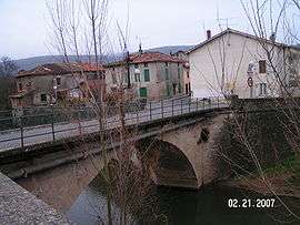
The bridge in Campagne-sur-Arize | |
 Campagne-sur-Arize | |
|
Location within Occitanie region  Campagne-sur-Arize | |
| Coordinates: 43°07′43″N 1°20′20″E / 43.1286°N 1.3389°ECoordinates: 43°07′43″N 1°20′20″E / 43.1286°N 1.3389°E | |
| Country | France |
| Region | Occitanie |
| Department | Ariège |
| Arrondissement | Pamiers |
| Canton | Le Mas-d'Azil |
| Intercommunality | l'Arize |
| Government | |
| • Mayor (2008–2014) | Jean-Claude Commenge |
| Area1 | 13.34 km2 (5.15 sq mi) |
| Population (2008)2 | 265 |
| • Density | 20/km2 (51/sq mi) |
| Time zone | CET (UTC+1) |
| • Summer (DST) | CEST (UTC+2) |
| INSEE/Postal code | 09075 / 09350 |
| Elevation |
251–482 m (823–1,581 ft) (avg. 250 m or 820 ft) |
|
1 French Land Register data, which excludes lakes, ponds, glaciers > 1 km² (0.386 sq mi or 247 acres) and river estuaries. 2 Population without double counting: residents of multiple communes (e.g., students and military personnel) only counted once. | |
Campagne-sur-Arize is a commune in the Ariège department in southwestern France.
Population
| Historical population | ||
|---|---|---|
| Year | Pop. | ±% |
| 1806 | 365 | — |
| 1851 | 866 | +137.3% |
| 1856 | 800 | −7.6% |
| 1901 | 618 | −22.8% |
| 1921 | 525 | −15.0% |
| 1946 | 430 | −18.1% |
| 1968 | 326 | −24.2% |
| 1982 | 257 | −21.2% |
| 1999 | 281 | +9.3% |
| 2008 | 265 | −5.7% |
See also
References
| Wikimedia Commons has media related to Campagne-sur-Arize. |
This article is issued from Wikipedia - version of the 3/21/2015. The text is available under the Creative Commons Attribution/Share Alike but additional terms may apply for the media files.