Fabas, Ariège
| Fabas | |
|---|---|
|
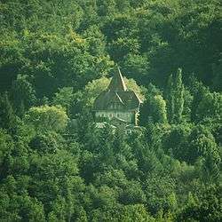
The Chateau of Poudelay, in Fabas | |
 Fabas | |
|
Location within Occitanie region  Fabas | |
| Coordinates: 43°06′32″N 1°06′24″E / 43.1089°N 1.1067°ECoordinates: 43°06′32″N 1°06′24″E / 43.1089°N 1.1067°E | |
| Country | France |
| Region | Occitanie |
| Department | Ariège |
| Arrondissement | Saint-Girons |
| Canton | Sainte-Croix-Volvestre |
| Intercommunality | Volvestre ariégeois |
| Government | |
| • Mayor (2008–2014) | Simon Bavard |
| Area1 | 23.04 km2 (8.90 sq mi) |
| Population (2008)2 | 319 |
| • Density | 14/km2 (36/sq mi) |
| Time zone | CET (UTC+1) |
| • Summer (DST) | CEST (UTC+2) |
| INSEE/Postal code | 09120 / 09230 |
| Elevation |
288–560 m (945–1,837 ft) (avg. 400 m or 1,300 ft) |
|
1 French Land Register data, which excludes lakes, ponds, glaciers > 1 km² (0.386 sq mi or 247 acres) and river estuaries. 2 Population without double counting: residents of multiple communes (e.g., students and military personnel) only counted once. | |
Fabas is a commune in the Ariège department in southwestern France.
Population
| Historical population | ||
|---|---|---|
| Year | Pop. | ±% |
| 1962 | 215 | — |
| 1968 | 268 | +24.7% |
| 1975 | 310 | +15.7% |
| 1982 | 336 | +8.4% |
| 1990 | 327 | −2.7% |
| 1999 | 306 | −6.4% |
| 2008 | 319 | +4.2% |
See also
References
| Wikimedia Commons has media related to Fabas (Ariège). |
This article is issued from Wikipedia - version of the 3/15/2016. The text is available under the Creative Commons Attribution/Share Alike but additional terms may apply for the media files.