Lesparrou
| Lesparrou | ||
|---|---|---|
|
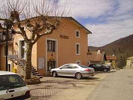
The town hall in Lasparrou | ||
| ||
 Lesparrou | ||
|
Location within Occitanie region  Lesparrou | ||
| Coordinates: 42°55′53″N 1°54′19″E / 42.9314°N 1.9053°ECoordinates: 42°55′53″N 1°54′19″E / 42.9314°N 1.9053°E | ||
| Country | France | |
| Region | Occitanie | |
| Department | Ariège | |
| Arrondissement | Foix | |
| Canton | Lavelanet | |
| Intercommunality | Pays d'Olmes | |
| Government | ||
| • Mayor (2008–2014) | Maryse Ripoll | |
| Area1 | 16.09 km2 (6.21 sq mi) | |
| Population (2008)2 | 243 | |
| • Density | 15/km2 (39/sq mi) | |
| Time zone | CET (UTC+1) | |
| • Summer (DST) | CEST (UTC+2) | |
| INSEE/Postal code | 09165 / 09300 | |
| Elevation |
440–761 m (1,444–2,497 ft) (avg. 450 m or 1,480 ft) | |
|
1 French Land Register data, which excludes lakes, ponds, glaciers > 1 km² (0.386 sq mi or 247 acres) and river estuaries. 2 Population without double counting: residents of multiple communes (e.g., students and military personnel) only counted once. | ||
.svg.png)
Lesparrou is a commune in the Ariège department in southwestern France.
Population
| Historical population | ||
|---|---|---|
| Year | Pop. | ±% |
| 1962 | 316 | — |
| 1968 | 387 | +22.5% |
| 1975 | 366 | −5.4% |
| 1982 | 291 | −20.5% |
| 1990 | 290 | −0.3% |
| 1999 | 265 | −8.6% |
| 2008 | 243 | −8.3% |
See also
References
| Wikimedia Commons has media related to Lesparrou. |
This article is issued from Wikipedia - version of the 7/20/2016. The text is available under the Creative Commons Attribution/Share Alike but additional terms may apply for the media files.