Choussy
| Choussy | ||
|---|---|---|
 | ||
| ||
 Choussy | ||
|
Location within Centre-Val de Loire region  Choussy | ||
| Coordinates: 47°22′27″N 1°20′51″E / 47.3742°N 1.3475°ECoordinates: 47°22′27″N 1°20′51″E / 47.3742°N 1.3475°E | ||
| Country | France | |
| Region | Centre-Val de Loire | |
| Department | Loir-et-Cher | |
| Arrondissement | Romorantin-Lanthenay | |
| Canton | Saint-Aignan | |
| Intercommunality | Controis | |
| Government | ||
| • Mayor (2014–2020) | Thierry Gosseaume | |
| Area1 | 15.45 km2 (5.97 sq mi) | |
| Population (2013)2 | 336 | |
| • Density | 22/km2 (56/sq mi) | |
| Time zone | CET (UTC+1) | |
| • Summer (DST) | CEST (UTC+2) | |
| INSEE/Postal code | 41054 / 41700 | |
| Elevation |
80–117 m (262–384 ft) (avg. 69 m or 226 ft) | |
|
1 French Land Register data, which excludes lakes, ponds, glaciers > 1 km² (0.386 sq mi or 247 acres) and river estuaries. 2 Population without double counting: residents of multiple communes (e.g., students and military personnel) only counted once. | ||
.svg.png)
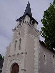
Choussy is a commune in the Loir-et-Cher department of central France.
Population
| Historical population | ||
|---|---|---|
| Year | Pop. | ±% |
| 1793 | 184 | — |
| 1806 | 192 | +4.3% |
| 1821 | 224 | +16.7% |
| 1831 | 214 | −4.5% |
| 1841 | 237 | +10.7% |
| 1851 | 279 | +17.7% |
| 1861 | 297 | +6.5% |
| 1872 | 294 | −1.0% |
| 1881 | 297 | +1.0% |
| 1891 | 343 | +15.5% |
| 1901 | 366 | +6.7% |
| 1911 | 323 | −11.7% |
| 1921 | 329 | +1.9% |
| 1931 | 290 | −11.9% |
| 1946 | 273 | −5.9% |
| 1954 | 260 | −4.8% |
| 1962 | 272 | +4.6% |
| 1968 | 232 | −14.7% |
| 1975 | 206 | −11.2% |
| 1982 | 228 | +10.7% |
| 1990 | 240 | +5.3% |
| 1999 | 234 | −2.5% |
| 2008 | 320 | +36.8% |
| 2013 | 336 | +5.0% |
See also
References
| Wikimedia Commons has media related to Choussy. |
This article is issued from Wikipedia - version of the 11/12/2016. The text is available under the Creative Commons Attribution/Share Alike but additional terms may apply for the media files.